Philippine President Enacts New Laws to Strengthen National Protection
Imagine a bustling market in Manila, where merchants bargain over the price of fresh fish and exotic fruits. Amid the gossip and color, a news broadcast blares from a nearby stall. The headline? China has just formalized maritime baselines around Scarborough Shoal, a move that sends shockwaves through the Philippines. Traders and shoppers alike pause, their faces reflecting a mix of concern and defiance. This isn’t just about distant waters and political posturing—it’s about national pride and sovereignty, deeply felt even in the daily rhythms of city life.
China and the Philippines are once again embroiled in a heated diplomatic row over competing maritime claims in the South China Sea, spurred by China’s recent decision to establish official baselines around Scarborough Shoal. This disputed territory, which China seized in 2012, has remained a flashpoint as both nations assert sovereignty. By defining these baselines, China is now positioning the area as part of its territorial waters, a move that could intensify confrontations and further strain regional stability.
On Sunday, China’s Foreign Ministry published geographic coordinates establishing baselines around Scarborough Shoal, integrating it within China’s maritime boundaries. These baselines are crucial as they serve as a starting point to measure a nation’s territorial sea and exclusive economic zone (EEZ), which can stretch 200 nautical miles outward and grant sovereign rights over resources in those waters.
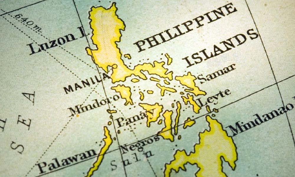
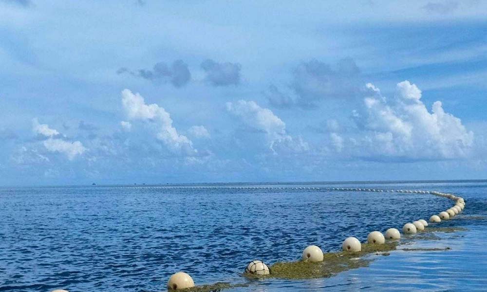
Scarborough Shoal, situated off the western coast of Luzon, the Philippines’ main island, has been a contentious area since China’s takeover over a decade ago. Filipino fishermen, historically reliant on the shoal’s waters, have increasingly faced access restrictions from Chinese authorities, fuelling discontent and escalating tensions between the two countries.
Adding to the challenge is a 2016 international arbitration tribunal ruling, which deemed most of China’s claims in the South China Sea legally invalid. Despite this, China has consistently refused to acknowledge or comply with the ruling, and numerous encounters between Chinese and Philippine vessels have highlighted the escalating risk of a maritime crisis.
Imagine a tense morning in a small coastal town in Luzon. Fisherman Juan is preparing his boat, just like his father and grandfather did before him. The sea has always been his family’s livelihood, but today, there’s a palpable tension in the air. As he sets out, he recalls the growing number of encounters with Chinese coast guard ships that have forced many of his fellow fishermen to stay ashore, their nets empty.
Just as Juan reaches the edge of the shoal, he spots a Chinese vessel on the horizon. Memories of past altercations flood his mind. Suddenly, his radio crackles to life—it’s a warning in Chinese. The familiar waters of Scarborough Shoal, once a symbol of sustenance and freedom, now feel like a battleground.
Just before China’s latest move, Philippine President Ferdinand Marcos Jr. signed two laws—the Philippine Maritime Zones Act and the Philippine Archipelagic Sea Lanes Act. These laws delineate the Philippines’ maritime zones and affirm its rights over its EEZ, an assertion intended to protect the country’s sovereignty in the South China Sea and increase its authority over these critical resources.
The Philippine Maritime Zones Act specifically outlines the archipelagic baselines and maritime zones, thereby strengthening Manila’s jurisdiction over contested waters. Marcos stressed the significance of these measures for safeguarding the Philippines’ marine resources and highlighted the laws as symbols of Manila’s dedication to international law and the well-being of coastal communities.
China responded with a strong rebuke, condemning the Philippines’ actions as an effort to “enforce the illegal ruling” of the 2016 tribunal. Chinese Foreign Ministry spokesperson Mao Ning argued that the Philippines’ recent moves violate China’s sovereignty, warning against any challenges to China’s authority over the South China Sea.
China claims nearly the entire South China Sea, which is an essential global shipping route, based on its controversial “nine-dash line” map, now expanded to ten dashes. This vast claim has drawn fierce opposition from several Southeast Asian nations, including Vietnam, Malaysia, and the Philippines, which regard it as unsupported by international law.
Incidents of conflict between China and the Philippines have been frequent, with coast guard vessels from both nations repeatedly clashing. In some encounters, China’s coast guard has reportedly employed water cannons and even military-grade lasers against Philippine vessels, raising fears of an escalation that could draw in the United States, a longstanding Philippine ally.
In Manila, the Philippine government remains resolute in its sovereignty under international law, especially the 1982 United Nations Convention on the Law of the Sea (UNCLOS). Officials argue that the newly enacted laws are essential for preserving the Philippines’ territorial integrity and ensuring resource access vital to the nation’s economy and food security.
China, however, maintains that its actions are lawful under its territorial claims and aligned with international standards. By marking baselines around Scarborough Shoal, Beijing asserts that it is merely following protocol in delineating its maritime territory—a stance the Philippines disputes, contending that these baselines violate its EEZ.
The Philippines’ Archipelagic Sea Lanes Act designates specific air and sea routes through the archipelago, allowing foreign passage under UNCLOS oversight to ensure national security. Chinese officials have expressed dissatisfaction, alleging that these regulations encroach on areas they consider part of Chinese jurisdiction.
Analysts warn that China may disregard the Philippines’ new laws, increasing the likelihood of direct confrontations between Chinese and Philippine vessels. One notable realist political analyst who has expressed similar views on the South China Sea dispute is M. Taylor Fravel. He has extensively analyzed China’s strategic behavior in the region, emphasizing China’s use of delaying tactics and its focus on consolidating control over contested areas. Despite limited naval capabilities, the Philippines insists that the new regulations, aligned with UNCLOS, will be implemented after formal publication.
The Philippines has prepared an updated map including the West Philippine Sea (WPS) within its jurisdiction. National Mapping and Resource Information Authority (Namria) Administrator Peter Tiangco announced that the maps are ready, pending the implementing rules for the new Maritime Zones Act. This map, based on legal grounds, contrasts with China’s revised map, which many regard as unfounded.
Alongside the Maritime Zones Act, Marcos also signed the Archipelagic Sea Lanes Act, which mandates designated sea lanes and air routes for foreign vessels and aircraft. Emphasizing Manila’s commitment to its marine resources, sovereignty, and biodiversity, Marcos highlighted that the laws serve as national security measures amid the heightened tension with China.
A recent near-collision between Philippine and Chinese coast guard ships near Second Thomas Shoal exemplifies the ongoing conflict. During a patrol, a Chinese vessel blocked the Philippine BRP Malapascua, forcing it to retreat. Philippine officials described the maneuver as reckless and in violation of international navigation norms.
The patrol, conducted with journalists onboard, was a strategic move by the Philippine Coast Guard to showcase China’s increasingly assertive actions in contested waters. Chinese authorities reportedly ordered the Philippine vessels to leave the “undisputable territories,” escalating when a Chinese vessel used water cannons against a Philippine boat, injuring crew members.
President Marcos responded by condemning China’s actions, hinting at “proportionate” responses to what he described as illegal harassment. The Chinese Foreign Ministry, in turn, summoned the Philippine ambassador and cautioned Manila against provoking conflict, accusing the Philippines of disseminating misinformation to sway global opinion.
The Philippines’ new maritime laws and the forthcoming map reflect its staunch refusal to accept China’s expansive territorial claims. While these actions highlight Manila’s determination, questions remain about the Philippines’ ability to enforce its laws, given China’s military dominance in the disputed waters, which includes fortified artificial islands within the Philippine EEZ.
Amid China’s actions, the U.S. has reiterated its commitment to defending the Philippines under their 1951 Mutual Defense Treaty. Condemning China’s actions as intimidation, U.S. officials emphasized the importance of freedom of navigation and reaffirmed their defense obligations to the Philippines.
China’s expanded map has not only sparked tensions with the Philippines but has drawn criticism across Asia. Many argue that Beijing’s dashed lines lack historical or legal basis and represent its broader regional ambitions.
The Philippines’ newly defined maritime boundaries signal a strategic push to consolidate its claims. Philippine officials hope that international exposure to China’s aggression will rally global support. Commodore Jay Tarriela of the Philippine Coast Guard described the Philippines’ resilience as similar to David’s stand against Goliath, reflecting the nation’s resolve in facing a mammoth opponent.
China’s new ten-dash line map has intensified regional diplomatic opposition, claiming disputed territories from the South China Sea to India’s borders. Released by China’s Ministry of Natural Resources, the map marks Taiwan, portions of India’s Arunachal Pradesh, and Russia’s Bolshoy Ussuriysky Island as Chinese territory, igniting fresh tensions across Asia.
India, embroiled in its own border conflicts with China, quickly condemned the map, calling it “baseless.” Malaysia, Taiwan, and Indonesia echoed India’s objections, with Taiwan rejecting the map’s validity regarding its sovereignty.
China defended the map release as routine, with Foreign Ministry spokesperson Wang Wenbin encouraging “objective” views. Officials sidestepped questions on the map’s new dash, framing the update as a public education effort. However, its timing suggests that Beijing is reasserting its territorial claims.
Vice President Han Zheng supported the map, portraying it as a reflection of China’s established stance. But as opposition mounts across Asia, the affected countries appear determined to resist China’s reach.
Though not directly involved, the United States has conducted freedom-of-navigation patrols in the region, supporting Southeast Asian allies. Officials condemned China’s harassment of Philippine vessels and reaffirmed the U.S.’s commitment to uphold defense treaties.
The new map has complicated already intricate regional dynamics, highlighting China’s unwillingness to retreat from its claims despite the objections of neighboring states. China’s assertiveness continues to stir fears of destabilizing a region crucial to global trade and security.