China Rejects Philippines’ New South China Sea Chart — Manila Just Drew a Line
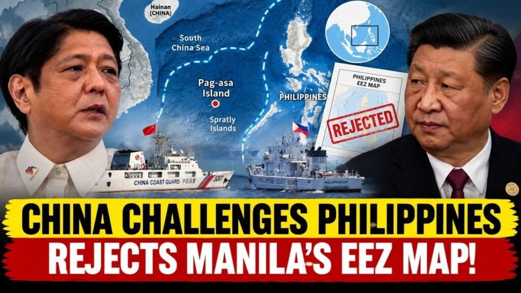
China’s rejection of the Philippines’ new nautical chart has turned what might initially appear to be a technical mapping issue into another important development in the long-running South China Sea dispute. The Philippine National Maritime Council unveiled an updated maritime chart covering Pag-asa Island and surrounding maritime features on September 25. Four days later, China publicly rejected the Philippine depiction of the disputed features and argued that they fall within what Beijing calls the Nansha Islands and Chinese territory. The Chinese response specifically referred to Zhongye Dao, known in the Philippines as Pag-asa Island or Thitu Island, and Mahuan Dao, commonly known internationally as Nanshan Island. Beijing said the Philippine designation of the Kalayaan Island Group and the publication of the chart were illegal and null and void under China’s stated position.
At first glance, a dispute over a nautical chart may seem far removed from the more familiar scenes of coast guard ships, military vessels and confrontations at sea. But maps can play an important role in territorial and maritime disputes because they create an official record of how a government identifies geographic features and describes the areas it considers relevant to its national interests. The Philippine chart therefore matters not because it can physically change the location of an island or reef, but because it forms part of a wider process through which Manila is standardizing names, updating government records and strengthening consistency in its official maritime documentation.
The latest Chinese response also shows that Beijing does not view the issue as merely a question of cartographic terminology. China challenged the underlying Philippine framework that places the disputed features within the Kalayaan Island Group. This makes the episode part of a much broader contest over geography, administration, international law and diplomatic positioning in the South China Sea.
What Happened When China Rejected the Philippine Map?
The immediate dispute began with the Philippines unveiling an updated maritime chart on September 25. The chart was associated with Pag-asa Island and surrounding maritime features and was presented as part of the country’s continuing effort to update its official maritime documentation. Philippine reporting indicated that the chart was intended for further official use and potential submission to the United Nations. That detail is significant because it places the chart within a wider diplomatic and institutional context rather than treating it as a simple navigation document. On September 29, Chinese Foreign Ministry spokesperson Guo Jiakun responded to the Philippine action. Beijing stated that Zhongye Dao and Mahuan Dao are part of China’s Nansha Islands and Chinese territory. China also argued that the territorial scope of the Philippines is determined by international treaties and rejected Manila’s designation of the Kalayaan Island Group. Chinese officials said the Philippine chart seriously violated what Beijing considers Chinese territorial sovereignty and relevant international law.
The wording of China’s response was direct. Beijing described the Philippine actions as illegal and null and void and said it would continue taking necessary measures to defend what it calls its territorial sovereignty and maritime rights and interests. That language is important, but it should not automatically be interpreted as an announcement of imminent military action. The statement does not specify a military operation, a particular deadline or a new deployment. What it clearly demonstrates is that China considers the Philippine mapping initiative connected to its broader sovereignty and maritime-rights claims.
This is why the story is bigger than a disagreement over names. If China were objecting only to a spelling choice or a technical coordinate, the dispute would have a much narrower meaning. Instead, Beijing directly challenged the Philippine geographic framework itself. Manila is effectively documenting the same maritime geography according to its own administrative terminology, while Beijing continues to document and describe those same features according to its own national framework.
What Is Actually on the Philippine Nautical Chart?
The first thing to understand is that an official national map does not automatically settle an international sovereignty dispute. A government can produce a map showing the geographic features and maritime areas according to its own official position, but that does not mean another country is legally required to recognize the map. Nor does the appearance of an island or reef on a national chart by itself create sovereignty over that feature. The Philippine chart is important because it identifies disputed maritime features within Manila’s own geographic and administrative framework. Pag-asa Island, for example, is one of the most significant Philippine-held features in the Kalayaan Island Group. The Philippines uses the name Pag-asa, while Thitu Island is the name commonly used internationally and Zhongye Dao is the Chinese name. Mahuan Island is another disputed feature that Beijing specifically mentioned in its response.
The different names are important because they reflect different national approaches to the same geography. Manila places the features within the Kalayaan Island Group, while Beijing places them within the Nansha Islands. The physical locations of the islands do not change when the names change. Their coordinates remain the same. What changes is the official terminology and administrative framework through which each government describes those locations.
This is why the new chart should be understood as one part of a much larger process. Manila has been working to create standardized Philippine names for features in the Kalayaan Island Group and to incorporate those names into official government records. The chart represents the cartographic side of that effort. In practical terms, the Philippines is attempting to ensure that its agencies are using the same names, the same geographic framework and the same official terminology when referring to these disputed features.
That process can have long-term importance even though it does not itself resolve sovereignty. Official maps can be reused in government documents, research, educational materials, maritime planning and diplomatic communications. Over time, repeated use can make a particular terminology a stable part of a country’s institutional record. This is one reason Beijing has treated the Philippine chart as politically significant.
Philippines Pushes Its Defense Line 200 Nautical Miles Offshore — China Is Watching!
Why Executive Order 111 Matters More Than the Map Itself
The September chart did not appear in isolation. One of the most important developments came earlier in March, when Philippine President Ferdinand Marcos Jr. issued Executive Order No. 111. The order adopted standardized Philippine names for 131 features in the Kalayaan Island Group and instructed relevant government institutions to incorporate those names into their official work. The order directed the National Mapping and Resource Information Authority, or NAMRIA, to produce and publish updated charts and maps reflecting the standardized names. It also directed national government agencies to use the standardized names in official communications, messages and documents. Educational institutions and other relevant bodies were also instructed to use the standardized terminology and updated charts in appropriate research and instructional materials.
That means the Philippines was not simply announcing a new list of names. It was creating an institutional mechanism through which those names could become part of the country’s official geographic record. This distinction is crucial. A statement made by a government official can disappear from the news cycle within days, but a standardized geographic name incorporated into official charts, databases and documents can remain in use for years.
The September maritime chart is therefore best understood as a continuation of this policy. First, Manila standardized the names. Then it instructed government institutions to use them. NAMRIA was tasked with incorporating them into maps and charts. The new maritime chart provides another official representation of that terminology.
This is where cartography becomes a form of statecraft. The map itself does not move territory, but it helps create a consistent documentary record of how a government understands and administers the geography it claims. In a territorial dispute that can last for decades, that continuity can be politically and administratively significant.
Why the 2016 Arbitration Does Not Simply “Settle the Map”
Any discussion of the Philippine chart has to address the 2016 South China Sea arbitration because it is frequently misunderstood. The case, brought by the Philippines against China under the United Nations Convention on the Law of the Sea, dealt with several important questions concerning historic rights, maritime entitlements, the legal status of certain maritime features and the legality of certain Chinese actions. However, the arbitration did not decide sovereignty over all of the disputed islands and reefs in the South China Sea. The tribunal expressly stated that it was not deciding sovereignty over land territory and that it was not delimiting a maritime boundary between China and the Philippines. Those limitations are essential when discussing the significance of the new Philippine chart. The tribunal did make important findings concerning maritime entitlements and the legal status of certain features. It examined whether particular geographic features could generate maritime zones under UNCLOS and considered the legal implications of activities conducted in disputed areas. But these findings should not be transformed into a claim that the tribunal simply awarded every disputed island and reef to the Philippines.
This distinction helps explain what the new map can and cannot accomplish. The Philippines can use the arbitration award as part of its legal and diplomatic position on particular maritime questions, while continuing to maintain its own geographic and administrative framework. At the same time, China continues to reject the tribunal’s conclusions and maintains its own interpretation of sovereignty and maritime rights. The result is a complicated legal environment in which several questions have to be considered separately. Sovereignty over land features, maritime entitlements under UNCLOS, historic-rights claims, the status of individual reefs and islands, and the delimitation of maritime boundaries are not identical questions. A map cannot answer all of them at once.
Two Countries Are Building Competing Versions of the Same Geography
One of the most important features of the current dispute is that China and the Philippines are increasingly using different official systems to describe the same maritime space. Manila uses the Kalayaan Island Group and West Philippine Sea terminology in its own official framework. Beijing uses the Nansha Islands terminology and maintains that the relevant features fall within Chinese sovereignty and maritime rights. The physical geography is not changing. Pag-asa Island remains in the same location. The surrounding reefs remain in the same locations. Their geographic coordinates do not shift because one government publishes a new map. What changes is the official record attached to those geographic points.
This distinction may appear technical, but it has practical consequences. Government agencies depend on common terminology when producing documents, conducting research, creating maps, planning maritime activities and communicating with other institutions. If one government consistently uses one name while another consistently uses a different name, both countries are effectively maintaining parallel documentary systems.
The same process can occur with maps and databases. A Philippine agency may use a particular name and coordinate framework, while a Chinese agency may use another name and a different administrative description. Neither document automatically becomes an internationally binding settlement simply because it exists. Instead, each becomes evidence of how that government officially describes the area. Over time, this can create what might be called a contest over the record. The question becomes not only who is physically present at a particular location today, but also how that location is identified in official documents that may be used by future governments, researchers, diplomats and international institutions.
The New Chart Does Not Change Sovereignty — So Why Does It Matter?
The answer lies in institutional continuity. A national map does not have the legal power to unilaterally transfer sovereignty. It does not remove another state’s claim, and it does not compel international recognition. But it can reinforce the consistency of a government’s own position.
For Manila, the value of the chart is therefore partly administrative. Government agencies need standardized names and geographic references. If those names are incorporated into maps, official correspondence, educational materials and maritime records, they create a common national terminology. That can make the government’s position clearer and more consistent internally. There is also a diplomatic dimension. If an official chart is later used in international communications or submitted to an international organization, it becomes part of the documentary record through which the Philippines presents its position. Again, that does not mean an international organization automatically accepts the claims represented on the map. It means the Philippine government has formally documented its position.
This is particularly relevant because territorial and maritime disputes often continue for decades. Governments change, officials change and individual incidents at sea eventually leave the headlines. Official records, however, can remain. A geographic name standardized today may still appear on government maps many years from now.
That is why describing the chart as “just a map” misses part of the story. It is a map, but it is also an official government document produced within a broader policy framework. Its significance comes from that institutional context.
Why China’s Reaction Is So Direct
China’s response makes sense when viewed through Beijing’s stated position on the Nansha Islands. Chinese officials consider the disputed features to be part of Chinese territory and reject Philippine efforts to place them within the Kalayaan Island Group framework.
From Beijing’s perspective, a Philippine government chart showing those features within a Philippine administrative and maritime framework conflicts directly with China’s own official geographic and territorial position. This explains why the Chinese Foreign Ministry responded at the diplomatic level rather than treating the matter as a routine technical disagreement between mapping agencies. The phrase “illegal and null and void” reflects China’s established diplomatic language for actions it considers contrary to its territorial claims. Beijing also said it would take necessary measures to defend its territorial sovereignty and maritime rights and interests. That statement communicates China’s intention to continue resisting actions it views as challenging its claims, although the wording alone does not establish what specific future action China will take.
It is also important to separate diplomatic language from predictions about future military developments. The statement should not automatically be interpreted as evidence that a military confrontation is about to occur. There are many possible forms of state response, including diplomatic protests, administrative measures, competing official publications and maritime activity.
What is clear is that Beijing considers the Philippine cartographic initiative part of the wider territorial and maritime dispute. The map has therefore become another arena in which the two governments are expressing incompatible positions.
The Map Dispute Is Happening While Tensions Continue at Sea
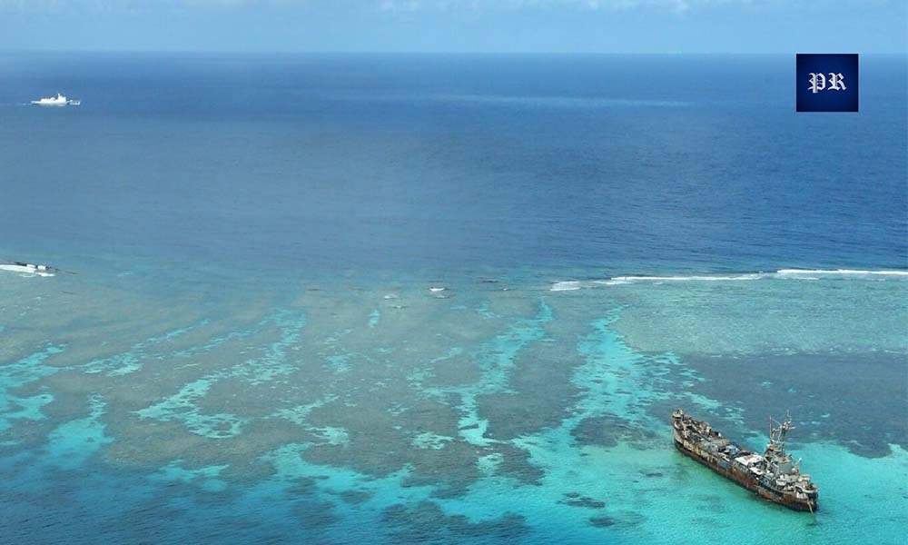
The documentary dispute is unfolding alongside continuing physical confrontations in the West Philippine Sea. On September 24, Philippine authorities reported another confrontation involving Chinese vessels during a Philippine rotation and resupply mission to Ayungin Shoal, where the grounded BRP Sierra Madre serves as a Philippine military outpost.
Philippine officials said Chinese vessels interfered with the mission and put Filipino personnel at risk. Reuters also reported the Philippine Coast Guard’s account concerning the obstruction of the resupply operation. China has its own account of maritime incidents and consistently rejects Philippine descriptions that it considers inconsistent with Chinese sovereignty and maritime rights.
The important point is that the maritime confrontation and the new chart should not be presented as cause and effect. There is no basis for saying that the September 24 encounter occurred because the Philippines released its chart on September 25. The two developments should be treated as separate events occurring within the same wider dispute.
Nevertheless, their proximity highlights how the South China Sea contest operates on multiple levels. At sea, coast guard and other vessels interact around disputed areas. In government offices, officials prepare charts, legal documents and administrative records. In diplomatic forums, governments issue statements defending their respective positions.
The physical and documentary sides of the dispute therefore reinforce the same broader reality: China and the Philippines continue to disagree over how disputed maritime spaces should be understood, administered and described.
Will the Philippines Continue Updating Its Maritime Maps?
One of the most important questions after the latest dispute is whether the Philippine government will continue expanding and updating its cartographic record. Executive Order 111 provides a policy foundation for continued use of standardized names and updated maps, so the September chart should not necessarily be viewed as a one-time event.
Future NAMRIA charts, maritime publications and government documents could show how extensively the standardized names are incorporated into the Philippines’ official geographic system. If the terminology becomes routine across multiple agencies, it could become a durable part of the country’s institutional record.
Another issue is whether additional Philippine charts will be prepared for international use. Reports surrounding the September chart indicated that it was intended for further official use and possible submission to the United Nations. If such a submission takes place, it would provide another formal channel through which Manila communicates its position.
But it is important not to overstate what an international submission would mean. Submitting a map to an international organization would document a national position; it would not automatically settle a sovereignty dispute or establish a mutually accepted maritime boundary. The more immediate significance is therefore the continuation of the process. The Philippine government appears to be moving toward greater consistency in the way it names and documents disputed maritime features.
What Could China Do in Response?
China is likely to continue defending its established position that the disputed features form part of the Nansha Islands and fall within Chinese sovereignty and maritime rights. The September 29 Foreign Ministry statement already provides a clear indication that Beijing rejects the Philippine cartographic framework.
Future Chinese responses could take several forms. Beijing could issue additional diplomatic protests, publish competing geographic information, reinforce its own administrative terminology or continue maritime activities around disputed areas. Which specific actions will occur cannot be established from the current statement alone.
The important point is that the dispute over maps is likely to remain connected to the wider disagreement over maritime rights. When one government publishes an official map that another government considers to depict its territory incorrectly, the map becomes another source of diplomatic friction.
This is not unique to the South China Sea. Governments involved in territorial disputes have historically used maps, names and official geographic records to communicate their claims. What makes the current situation particularly important is the combination of cartographic activity with continuing maritime encounters and competing interpretations of international law.
For that reason, observers should watch both the documentary record and activity at sea. A change in official terminology may not produce an immediate physical confrontation, while a maritime incident may occur without changing either country’s official map. The two tracks can develop separately while still forming part of the same strategic dispute.
The Real Contest Is Over Who Defines the Record of the South China Sea
The deeper meaning of the Philippine chart becomes clearer when the dispute is viewed over a longer period. Territorial disputes are not fought only through physical presence. They are also fought through the accumulation of official records. Names are standardized. Coordinates are published. Maps are revised. Government agencies adopt terminology. Diplomatic notes preserve legal arguments. International submissions document national positions. None of these actions alone determines sovereignty. But together they create a historical and institutional record of how each state understands the disputed geography.
This is why Manila’s decision to standardize 131 names matters. The government is not simply selecting alternative names for convenience. It is integrating those names into an administrative system that includes government agencies, mapping authorities and educational institutions. The new nautical chart is another product of that system.
China is doing the same thing from its own perspective. Beijing maintains its own names, maps and official descriptions of the Nansha Islands and rejects the Philippine framework. The result is an increasingly visible competition between two official geographic narratives.
The most important takeaway is therefore simple: the Philippine map does not move the islands, settle sovereignty or erase China’s claims. But it does strengthen the Philippines’ own documentary and administrative record. China’s rejection does not erase the Philippine map either. It adds another official Chinese response to the record.
That is why this story matters. The South China Sea dispute is taking place simultaneously on the water, in diplomatic statements, through international law and inside government mapping systems. The islands and reefs remain physically unchanged, but the official record surrounding them continues to evolve. And as that record becomes more detailed and more institutionalized, maps and names are becoming an increasingly important part of how both countries communicate and defend their positions.
About Indo-Pacific Report
For more geopolitical analysis, strategy coverage, and Indo-Pacific security reporting, visit Indo-Pacific Report:
Website
Facebook
YouTube
China Rejects Philippines’ New South China Sea Chart — Manila Just Drew a Line