Philippines Pushes Its Defense Line 200 Nautical Miles Offshore — China Is Watching!
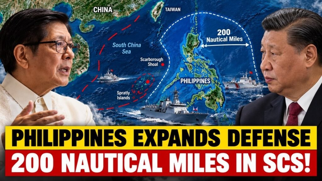
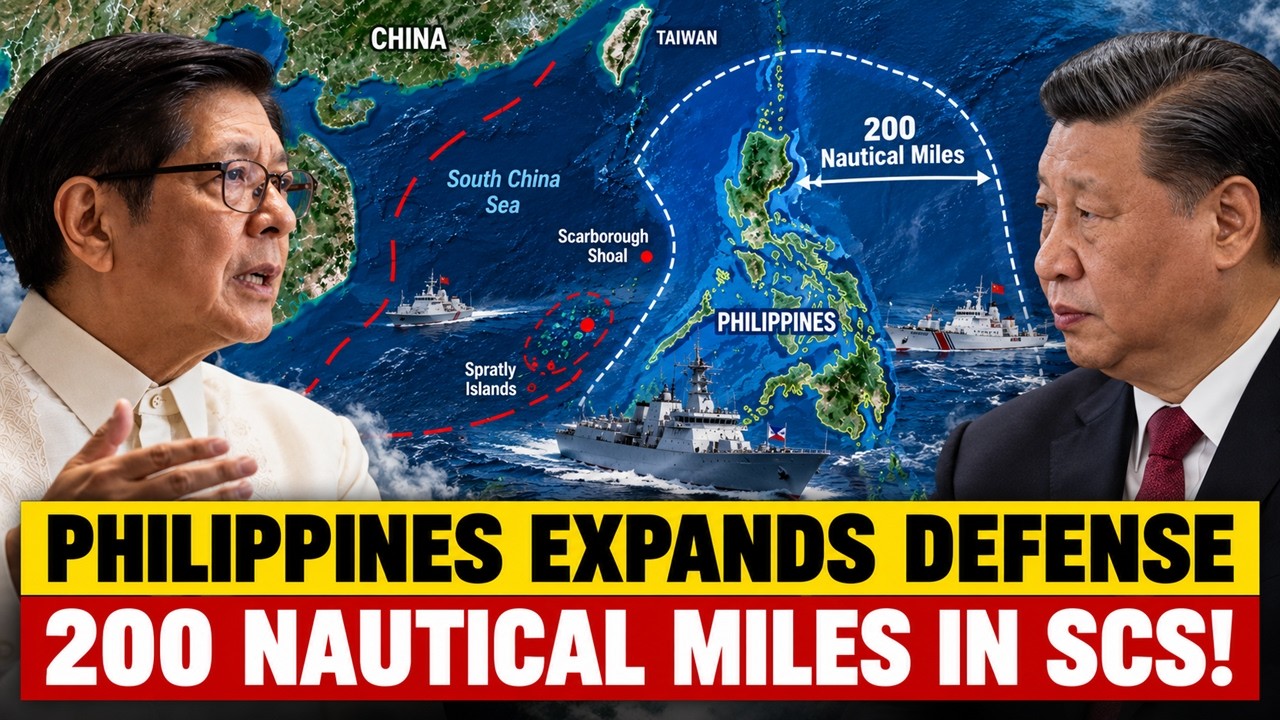
Something is changing in the way the Philippines thinks about maritime defense. On September 28, Defense Secretary Gilberto Teodoro said the Armed Forces of the Philippines needs the capability to project its defense presence at least 200 nautical miles from the country’s shores, while also pointing to the need for additional bases and infrastructure. The figure is important because 200 nautical miles is roughly 370 kilometers and corresponds to the breadth of the Philippines’ Exclusive Economic Zone, or EEZ. The announcement therefore goes beyond simply defending the islands themselves. It points toward the ability to monitor, reach, support and respond across a much larger maritime space.
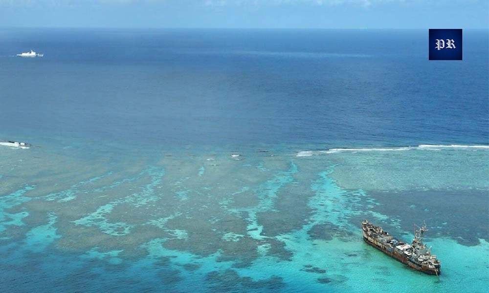
The timing also provides useful context. On September 27, the Philippine Coast Guard sent an aircraft and the BRP Teresa Magbanua to locate and challenge China Coast Guard vessel CCG-3303, which was reported operating about 36.61 nautical miles northwest of Cabra Island in Occidental Mindoro. The Coast Guard said the vessel did not respond to repeated radio challenges. Later that day, the Teresa Magbanua monitored three Chinese Navy warships operating about 31 nautical miles northwest of the island. The incident does not by itself establish a direct cause-and-effect relationship with Teodoro’s September 28 statement, but it illustrates the wider maritime-awareness and presence challenge facing Manila.
The bigger question is therefore not simply whether a Philippine ship or aircraft can physically travel 200 nautical miles from shore. The more important question is whether the Philippines can maintain a reliable and sustainable defense presence at that distance. A vessel can travel far, but a modern maritime defense system also needs fuel, communications, surveillance, maintenance, logistics, trained personnel and supporting infrastructure. That is where the significance of the 200-nautical-mile objective becomes much clearer.
The 200-Mile Line Is Already There — The Military System Is Not
The first point to understand is that the Philippines is not suddenly claiming another 200 nautical miles of ocean. Under the Philippine Maritime Zones Act, the country’s Exclusive Economic Zone extends up to 200 nautical miles from its baselines. Within the EEZ, the Philippines has sovereign rights relating to the exploration, exploitation, conservation and management of natural resources, as well as jurisdiction over areas including artificial islands and installations, marine scientific research and environmental protection.
An EEZ is not the same as territorial waters. The Philippines does not exercise the same form of sovereignty over the entire 200-nautical-mile zone that it exercises in its territorial sea. Other states retain rights under international law, including navigation freedoms. The key distinction is that the EEZ provides specific sovereign rights and jurisdiction recognized under the UN Convention on the Law of the Sea, or UNCLOS.
That means Teodoro’s reference to projecting defense presence 200 nautical miles from shore is fundamentally about capability. Manila is looking for the ability to protect maritime interests, maintain awareness, support government and civilian vessels, and respond to threats across a large area where Philippine sovereign rights and interests apply. The geographical zone already exists. The challenge is building a defense and security network capable of operating across it.
This distinction is particularly important because a headline suggesting that the Philippines wants to “defend 200 nautical miles” could easily be misunderstood as a claim that every part of the EEZ is equivalent to Philippine sovereign territory. That is not what the concept means. Instead, the emphasis is on maintaining enough awareness, presence and response capability to protect Philippine interests within the maritime space. The strategic issue is therefore less about drawing a line on a map and more about turning that line into an operational reality. The Philippines already has maritime zones established by law. The difficult part is creating the systems required to monitor and operate across such a large area.
This Is Not a New Idea — It Is the Next Stage of CADC
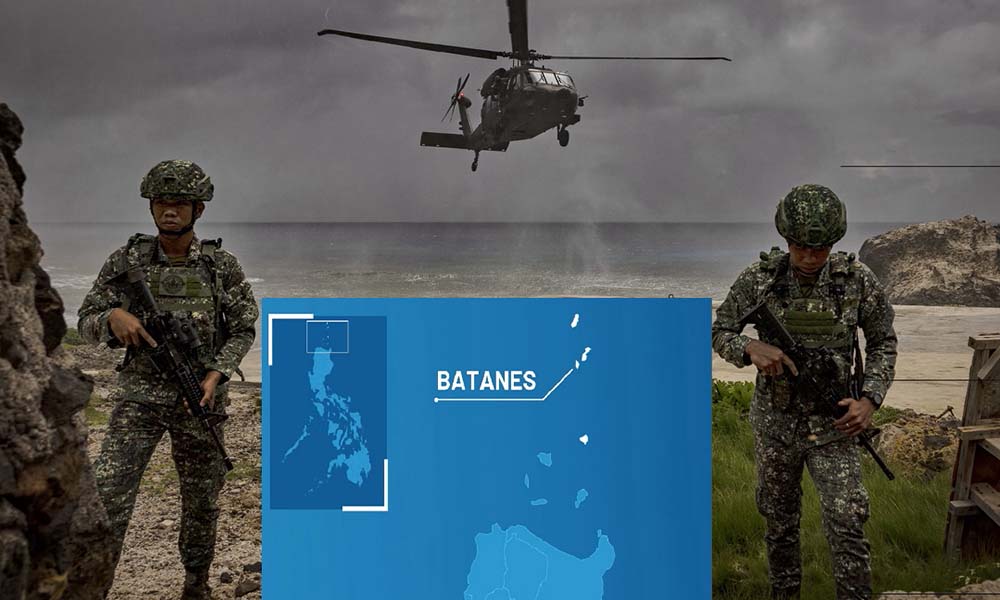
The September 28 announcement becomes clearer when viewed alongside the Philippines’ broader military transformation. For decades, the Armed Forces of the Philippines were heavily focused on internal security and counterinsurgency. The strategic environment now requires greater attention to external and archipelagic defense, including remote islands, maritime approaches, offshore resources, sea lanes, airspace and foreign military activity. The Comprehensive Archipelagic Defense Concept, or CADC, brings many of these ideas together. As discussed in the supplied source material, CADC is part of the effort to strengthen deterrence and protect Philippine interests across the country’s maritime entitlements. It reflects a shift toward projecting defense capabilities outward instead of waiting for a threat to reach Philippine territory.
For that reason, the 200-nautical-mile objective should be viewed as part of a longer transformation rather than as an isolated announcement. The Philippines is moving toward a defense model that has to operate across the archipelago and its surrounding maritime spaces. The central difficulty is distance, because every additional kilometre creates new requirements for surveillance, mobility, communications, maintenance and supply. This is a significant change in military thinking. An archipelagic country cannot rely only on defending major population centers or traditional military bases. Its geography means that important maritime areas can be located far from the country’s main infrastructure. Remote islands, fishing grounds, offshore resources and sea lanes can all become strategically important.
CADC therefore represents more than a military doctrine. It reflects a broader attempt to connect Philippine geography with military planning. If the country’s strategic interests extend across a large maritime area, then the armed forces need the ability to operate across that same geography. The 200-nautical-mile requirement can consequently be understood as a practical expression of this broader defense concept. It asks how far Philippine forces need to see, travel, communicate, operate and sustain themselves in order to protect national interests.
The First Problem Is Distance
A naval vessel can travel 200 nautical miles. The harder question is what happens after it arrives. How does it refuel, communicate with headquarters, obtain spare parts, conduct repairs, evacuate a sick or injured crew member, receive ammunition or remain on station for an extended period? Those practical questions determine whether a country has a sustainable forward defense capability or simply owns platforms that can physically reach distant waters. This is why the call for additional bases and infrastructure is significant. A 200-mile defense concept requires more than ships. It requires forward facilities, fuel storage, maintenance capacity, communications, ammunition storage, medical support, transport links, radar sites, airfields and ports. It also requires redundancy so that the overall system does not depend on one major facility that could become a single point of failure.
The Philippines faces a distinctive geographic challenge. Its large number of islands provides many possible operating locations, but the same geography makes logistics difficult. A force deployed on a remote island may be hundreds of kilometres from a major maintenance center. An aircraft needs fuel and technicians, a radar installation needs resupply and a ship deployed away from its home port needs continuous support. This means the infrastructure behind a defense strategy can be just as important as the platforms themselves. A modern frigate may have considerable range, but its operational usefulness depends on how long it can remain at sea. An aircraft may have the range to reach a distant patrol area, but it also needs fuel, maintenance and trained crews. A radar system may detect activity at long range, but the information is useful only if it can be transmitted and acted upon.
There is another issue: redundancy. If a defense network depends heavily on one port, one airfield or one communications center, disruption at that location can affect the wider system. A dispersed geography can therefore be both an advantage and a challenge. The Philippines has many potential locations for military and security infrastructure, but connecting those locations into one reliable network requires investment and planning. In this context, the real measure of modernization may not simply be how many platforms Manila acquires, but how far those platforms can operate sustainably.
The Philippine Navy Has to Become a Different Kind of Navy
Teodoro’s September 17 comments about the need for an “expeditionary” navy add another layer to the picture. He described a navy capable of protecting Filipino merchant vessels and crews on the high seas, including alongside like-minded countries, and capable of operating well away from its home shores for sustained periods. That concept fits closely with the 200-nautical-mile requirement. A navy focused mainly on nearby patrols can respond to local incidents, but a more expeditionary force must remain at sea longer, operate farther from its principal bases, protect Philippine vessels, coordinate with aircraft and receive supplies without constantly returning home.
The change is important because maritime security is not limited to the immediate coastline. Philippine commercial activity depends heavily on shipping and sea lanes. Filipino seafarers operate around the world, while Philippine merchant vessels connect the country to international markets. Protecting those interests requires a navy that can think beyond coastal patrols. It requires long-range planning, endurance, communications and cooperation with other countries. When vessels operate far from Philippine territory, Manila cannot necessarily depend on a nearby domestic port for every requirement. This is where expeditionary capability becomes relevant. It does not necessarily mean that the Philippines needs to build a navy comparable to the largest maritime powers. It means developing the ability to operate away from home for meaningful periods and to support Philippine interests when they are located far from the main islands.
It also means improving coordination between the Navy, Coast Guard, Air Force and other government agencies. Maritime security often begins with information from one organization and ends with action by another. The more effectively these institutions can share information and coordinate operations, the more useful the overall defense network becomes. The economic dimension is equally important. The supplied source connects the expeditionary-navy discussion with the Philippines’ merchant shipping fleet and the protection of Filipino seafarers and vessels on the high seas. Maritime defense is therefore not limited to military confrontation. It is also connected to commerce, shipping and the wider economic importance of sea lanes.
You Cannot Defend 200 Miles If You Cannot See 200 Miles
Surveillance may be one of the most important parts of the entire strategy. Before a military or coast guard force can respond to an activity, it needs to know that the activity is there. Monitoring a maritime area that stretches hundreds of thousands of square kilometres requires a layered system involving coastal radar, maritime patrol aircraft, unmanned systems, shipborne sensors, satellites, communications networks and intelligence fusion. The basic sequence is straightforward: detect, identify, track, decide and respond. Most of this work happens before weapons are involved. A surveillance system that can find a vessel but cannot reliably transmit the information to decision-makers is incomplete. Likewise, a response force that cannot reach the location in time cannot fully convert information into presence.
Maritime domain awareness is therefore central to the 200-mile concept. The Philippines does not need to physically place a ship everywhere to maintain awareness. It needs a network capable of combining information from different sources and creating a reliable picture of what is happening at sea. Aircraft can cover large areas relatively quickly. Unmanned systems can provide persistent observation in certain circumstances. Surface vessels can conduct identification and patrol missions. Coastal radar can monitor approaches, while satellite information can contribute to broader situational awareness. Communications networks then allow information from these systems to reach the people responsible for making decisions.
The September 27 activity around Cabra Island provides a practical example. According to the supplied source, Philippine Coast Guard aircraft PCG-2081 conducted a Maritime Domain Awareness flight after CCG-3303 was monitored in the area. The aircraft visually confirmed the vessel at approximately 36.61 nautical miles northwest of the island and issued radio challenges. The BRP Teresa Magbanua later monitored three PLA Navy vessels nearby. The episode demonstrates why maritime defense begins with information and coordination long before it reaches the question of weapons. The aircraft provided awareness. The information supported a response. A surface vessel then maintained monitoring capability. Other naval activity was also observed. Scaling that process to 200 nautical miles is the difficult part. The farther away an area is, the more demanding the surveillance and communication requirements become. A system designed only for relatively close waters cannot automatically provide persistent awareness hundreds of kilometres away.
The West Philippine Sea Is Where This Strategy Gets Real
The Philippines’ maritime interests extend far beyond the beaches of its major islands. They include fishing grounds, energy resources, sea lanes, offshore activity, remote maritime features, commercial vessels and government operations. The Philippine Maritime Zones Act establishes the legal framework for the country’s maritime zones and the sovereign rights and jurisdiction exercised within its EEZ. This creates an important practical distinction: having a legal right and having the operational ability to maintain a meaningful presence are not the same thing. A government can state its position, publish maps and invoke international law, but maritime spaces are managed through a combination of presence, surveillance, law enforcement, diplomacy and defense capability.
The West Philippine Sea is therefore one of the areas where this broader defense strategy becomes especially relevant. The Philippines has to balance legal rights, maritime law enforcement, civilian activity, resource protection and national security. A Coast Guard vessel operating in an area is performing a different function from a naval vessel conducting a defense mission. An aircraft conducting surveillance is performing a different role from a combat aircraft. Yet these capabilities can form part of the same wider maritime security network.
That is where CADC becomes relevant. The concept attempts to translate Philippine geography and maritime interests into an operational defense framework. The challenge for Manila is therefore not simply to assert maritime rights, but to develop enough capacity to monitor and maintain a presence in the areas where those rights and interests matter.This also explains why infrastructure matters so much. A maritime security system cannot rely exclusively on ships at sea. It needs bases and support facilities on land, aircraft in the air, sensors across different locations and communication systems connecting them. The larger the area Manila wants to monitor and protect, the more important this network becomes.
China Is Part of the Equation — But the Strategy Is Bigger Than China
China is an important factor in Philippine defense planning, particularly because Chinese maritime and naval activity is a major security concern for Manila in the West Philippine Sea. However, a 200-mile defense capability has applications beyond a single bilateral confrontation. A broader maritime defense network can support protection of Philippine vessels, monitoring of maritime activity, offshore resource security, law-enforcement operations, disaster response, reinforcement of remote areas and humanitarian missions.
This broader perspective matters because military capability can have multiple functions. Surveillance systems can support law enforcement as well as defense. Maritime aircraft can assist in search-and-rescue operations as well as monitoring. Ports and airfields can support both military missions and disaster response. Communications infrastructure can serve different government agencies. The supplied source material also emphasizes that deterrence depends on more than weapons. The National Defense College of the Philippines’ analysis of CADC discusses factors such as capability, commitment, communication, will and presence. In practical terms, this means that the ability to detect activity, maintain forces forward, reinforce threatened areas and operate from dispersed locations can affect the credibility of a country’s defense posture.
That does not guarantee deterrence or determine how another country would respond in a crisis. It simply highlights the purpose behind the capability being discussed. Manila is seeking a defense posture that can function across a wider maritime area rather than one concentrated only around the main population centers and established bases. The same capabilities could also support more routine maritime security. Fishing protection, monitoring of shipping, environmental enforcement and emergency response all require awareness of what is happening at sea. The 200-mile objective should therefore be understood as part of a larger national maritime capability rather than only as a military response to China.
The Philippines Does Not Have to Do This Alone
Another major part of the emerging defense architecture is cooperation with partner countries. The supplied source notes that in September, Manila and Tokyo co-hosted the ADMM-Plus Experts’ Working Group on Maritime Security Joint Cooperative Activity and Future Leaders’ Program. The activity involved personnel, naval assets, ships and aircraft from eight participating ADMM-Plus countries, while other ASEAN members and dialogue partners participated as observers. Such cooperation is not only about putting ships next to each other. Joint activities can build familiarity with procedures, improve coordination and develop professional networks. For a country with limited resources compared with major military powers, interoperability can help expand practical capability without requiring every capability to be developed independently.
Modern maritime security increasingly depends on networks. A country can combine its own surveillance assets with information-sharing arrangements, exercises, training and operational cooperation with partners. These relationships can help improve coordination during maritime incidents and humanitarian emergencies. For the Philippines, geography makes this especially relevant. Its maritime interests extend across a large area, while the country’s defense resources are finite. Partnerships can therefore help expand the practical reach of national capabilities. The broader idea is a networked defense model in which Philippine forces operate with partners and connect ships, aircraft, sensors, bases and communications.
The relevant question is therefore not simply how many ships the Philippines owns. It is how effectively its national capabilities can operate together and how well they can connect with regional partners when required. Interoperability also requires practice. Forces need to understand procedures, communications protocols and operational expectations before a crisis occurs. Exercises and cooperative activities can help develop that familiarity. This makes international defense cooperation a supporting element of the 200-mile concept rather than a separate issue.
The Most Important Word Is Sustainment
Defense modernization often focuses on visible equipment such as frigates, missiles, aircraft, drones, radars and new bases. Yet a 200-mile defense strategy will also depend heavily on less visible requirements: fuel, spare parts, maintenance crews, ammunition, communications, training, runways, ports, repair facilities, logistics and funding. A ship capable of traveling 200 nautical miles is not the same as a ship that can remain operational hundreds of kilometres from home for an extended period. A radar that detects a vessel but cannot reliably pass that information to commanders is not a complete surveillance architecture. An airfield without fuel and maintenance support cannot function as a sustainable forward operating location.
This is the difference between reach and endurance. Reach describes whether a platform can physically get somewhere. Endurance describes whether the wider system can keep it there and keep it functioning. For example, a patrol vessel may reach a distant maritime area, but if it must return frequently for fuel or maintenance, the effective coverage of that area becomes limited. Similarly, an aircraft can conduct a long-range mission, but its operational tempo depends on maintenance cycles, crew availability, fuel and the ability of its supporting base to sustain repeated flights.
Communications are another part of sustainment. A force operating hundreds of kilometres away needs secure and reliable connections with commanders and supporting units. Information must move quickly between aircraft, ships, coastal facilities and headquarters. Redundancy is equally important. A defense facility can become a vulnerability if the wider network depends too heavily on one location. This is why infrastructure may ultimately matter as much as the 200-mile figure itself. The distance describes the intended reach. Sustainment determines whether that reach can be maintained.
The Real Test Is Whether the Map Becomes Operational
The Philippines now has a clear geographical and strategic framework. Its EEZ extends up to 200 nautical miles from its baselines under Philippine law. CADC forms part of the country’s shift toward comprehensive archipelagic defense. The defense secretary has called for the capability to project defense presence at least 200 nautical miles from shore, while the Philippine Navy is being encouraged toward a more expeditionary operating model. But these policy objectives do not automatically create a 200-mile defense network. The network has to be built and sustained. It needs bases, sensors, ships, aircraft, communications, logistics, maintenance and trained personnel. More importantly, all of these elements have to function together.
The real test is whether the Philippines can maintain a reliable operational picture and sustain an appropriate presence across a large maritime area. The activity around Cabra Island shows why the challenge is substantial. A Chinese Coast Guard vessel was monitored roughly 36.61 nautical miles from the island, while Philippine aircraft and a surface vessel were involved in detection and monitoring. That distance is already operationally significant. Extending the same kind of awareness and response architecture toward 200 nautical miles requires a much larger and more resilient system.
It also requires planning for different levels of maritime activity. Not every unidentified vessel represents a military threat, and not every maritime incident requires a military response. A capable system must be able to distinguish between routine shipping, fishing activity, law-enforcement situations, foreign government vessels and potential security threats. That means the quality of information can be just as important as the quantity of information. The ultimate objective is therefore not simply to put more platforms into the water. It is to create a system in which information, decision-making, mobility and sustainment work together.
The Next Phase of Philippine Defense Will Be About Distance
The most important implication of the September 28 announcement is the way it defines defense. The Philippines is increasingly thinking not only about the territory it physically occupies, but also about the distance across which it can maintain meaningful maritime awareness and defense presence. That requires a different kind of military system. The navy needs the ability to remain at sea and operate farther from home. The air force needs surveillance and support reach. The Coast Guard needs persistent maritime awareness and law-enforcement capacity. Sensors need to see farther. Bases need to support dispersed forces. Communications need to connect information to decision-makers. Logistics needs to keep ships, aircraft and personnel supplied.
The key distinction is simple: the Philippines is not trying to move the legal 200-nautical-mile line outward. That maritime zone already exists. What Manila is trying to extend outward is its ability to operate effectively within the space. The success of that effort will depend less on the announcement itself and more on what happens when aircraft need to stay on station, ships need fuel, remote facilities need resupply, radar systems detect unfamiliar vessels and commanders need to reinforce an area quickly.
If the Philippines can build that sustainable network, the result would be more than a larger patrol radius. It would be a maritime defense architecture designed to see farther, reach farther, remain active longer and coordinate across the maritime space the country considers strategically important. The central challenge is therefore not the 200-mile line on the map. The line is already there. The challenge is building the ships, aircraft, sensors, bases, communications and logistics required to make that distance operationally meaningful. For the Philippines, the next phase of defense modernization will ultimately be measured not only by what the country buys, but by how effectively those capabilities can work together across one of Asia’s most geographically complex maritime environments.
About Indo-Pacific Report
For more geopolitical analysis, strategy coverage, and Indo-Pacific security reporting, visit Indo-Pacific Report:
Website
Facebook
YouTube
Philippines Pushes Its Defense Line 200 Nautical Miles Offshore — China Is Watching!