Philippines Transforms Thitu Island in the South China Sea — China Is Watching!
A U.S. HIMARS launcher recently appeared on Balabac, a remote Philippine island at the southern edge of the South China Sea. It was not deployed to a permanent American base. Instead, during Balikatan 2026, U.S., Philippine and Australian forces moved onto the island, secured an airfield, brought a HIMARS system ashore, conducted a live-fire demonstration against simulated maritime targets and then withdrew. U.S. Marine Corps reporting said MV-22B Ospreys flew more than 200 miles to move personnel and equipment, while U.S. Army watercraft demonstrated the rapid movement of HIMARS into austere maritime terrain.
That distinction is important. The central story is not that the United States has suddenly built a giant military base on Balabac. The more significant development is that a remote Philippine location is becoming capable of supporting temporary allied operations. Forces can arrive, equipment can be moved in, an airfield can be secured, missions can be conducted and units can leave again. That model fits a broader trend in Indo-Pacific defense planning: creating a network of access points rather than relying on a small number of large, permanent bases. Balabac was designated as one of four additional Enhanced Defense Cooperation Agreement, or EDCA, locations in 2023, bringing the total number of EDCA sites in the Philippines to nine. The arrangement allows rotational U.S. access and supports combined training, infrastructure development, logistics and interoperability while Philippine sovereignty remains in place. Philippine officials have also emphasized that EDCA sites are not conventional American military bases.
Balabac’s Strategic Geography in the Southern Philippines
Balabac sits in southern Palawan near the Balabac Strait and the Palawan Passage, with the Sulu Sea and northern Borneo to the south and the South China Sea to the west. Its position gives it a different strategic role from Philippine facilities farther north. Northern Philippine locations are particularly relevant to the approaches toward Taiwan and the Bashi Channel. Balabac provides another geographic axis farther south. From there, Philippine and allied forces are positioned closer to the southern approaches of the West Philippine Sea and the wider Spratly region. That does not mean Balabac controls the South China Sea, and it would be misleading to describe one island as capable of controlling surrounding waters. Its value is more practical: distance matters.
A military aircraft, surveillance platform, ship or mobile missile unit needs time and logistics to travel from a distant base to an area of concern. A forward location can reduce that distance. It can also create more options for where forces stage, refuel, resupply, communicate and operate. In a crisis, those options can matter because military operations are shaped not only by weapons but also by geography, transportation and time. The geography is also important for the Philippines itself. The country has a vast maritime area and many remote communities and islands. Its western and southern approaches are far from the largest population centers and established military facilities. A better-supported location in Balabac can therefore contribute to Philippine surveillance, maritime security, logistics, disaster response and territorial defense even when no U.S. forces are present.
EDCA: Access Without a Permanent U.S. Base
The Enhanced Defense Cooperation Agreement is central to the Balabac story. In April 2023, the United States and the Philippines announced four additional EDCA locations: Balabac Island in Palawan, Naval Base Camilo Osias in Cagayan, Camp Melchor Dela Cruz in Isabela and Lal-lo Airport in Cagayan. Together with five existing locations, these brought the total to nine.EDCA is designed to support combined training, interoperability, infrastructure improvements and the pre-positioning of equipment and supplies. Philippine officials have repeatedly clarified that EDCA locations are not American military bases and that U.S. access is not unlimited. Activities are planned and agreed by the two countries, while Philippine sovereignty remains in place.
That distinction is important because it changes how Balabac should be described. Calling it an American base can obscure the actual arrangement. A more accurate description is a Philippine-controlled location that can support rotational American and allied access under an existing defense agreement. The model also creates flexibility. The United States does not need to permanently station thousands of troops on Balabac for the location to have operational value. Equipment can be pre-positioned or brought in for exercises. Temporary forces can use improved facilities. Philippine and allied units can practice operating together and then redeploy elsewhere.
The U.S. Department of Defense has said EDCA investments are intended to strengthen interoperability and enable more seamless responses to shared challenges, including humanitarian and disaster-response missions. That dual-use purpose is relevant in the Philippines, a country regularly affected by typhoons, earthquakes and other natural hazards. In practical terms, EDCA turns geography into usable access. Balabac was strategically located before EDCA. The agreement gives the Philippines and the United States a framework for making that location more operationally useful.
The Airfield and Infrastructure Are the Real Foundation
A runway alone does not create a powerful military position. An airfield becomes useful when it is connected to fuel, maintenance, communications, accommodation, storage, transportation and reliable logistics. That is why infrastructure development on Balabac matters as much as the runway itself. The development of Catagupan Airport and supporting infrastructure is intended to make the remote location more usable. A longer and improved runway can increase the types of aircraft that can operate there, but aircraft still need fuel, spare parts, ground crews and protection. Communications must work. Supplies must arrive. Damaged infrastructure must be repairable. Personnel need places to work and rest.
This is the difference between access and endurance. It may be possible to move a force onto an island for an exercise, but sustaining that force during a prolonged crisis is much harder. The real measure of Balabac’s military utility will therefore be how well the island can support operations over time and how resilient its infrastructure is under pressure.nInfrastructure also has a humanitarian dimension. Philippine officials have said EDCA sites can support humanitarian assistance and disaster relief by allowing supplies and equipment to be positioned closer to areas that need them. For a geographically dispersed country, reducing the distance between stored equipment and affected communities can be valuable during emergencies.n The strategic effect is therefore broader than military aviation. Better roads, airfield facilities, communications, logistics and storage can strengthen both military mobility and disaster response. The same infrastructure that allows a transport aircraft to reach Balabac can also help move emergency personnel and supplies after a typhoon or other disaster.
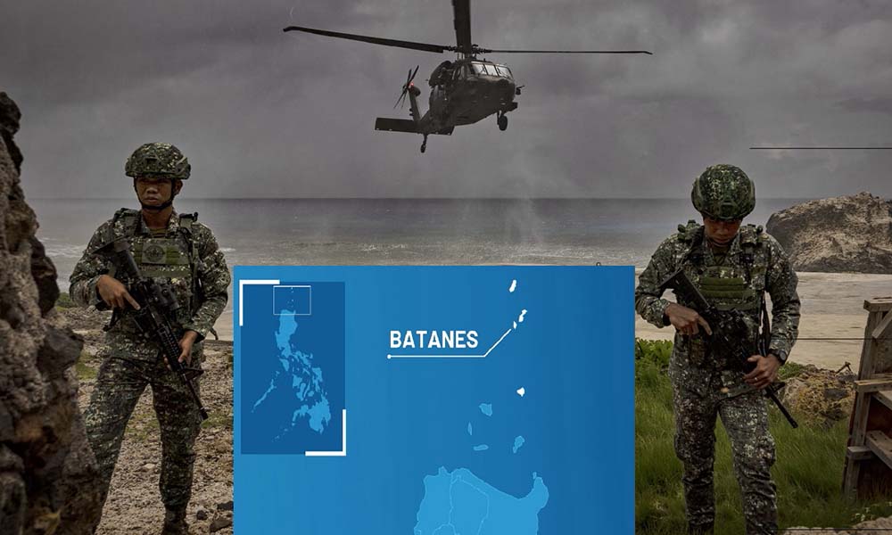
For years, Balabac could be described as strategically important largely because of its location. Balikatan 2026 provided a more concrete demonstration of what that location can actually support. According to U.S. Marine Corps reporting, Marines from Marine Medium Tiltrotor Squadron 268 flew more than 200 miles from Antonio Bautista Air Base to Balabac Airfield on May 2, carrying key personnel and equipment. U.S. Army watercraft simultaneously demonstrated HIMARS rapid infiltration into the island’s austere maritime environment.
The following day, U.S., Philippine and Australian forces conducted an operation to secure the airfield. With the HIMARS system already ashore, the exercise moved into a live-fire demonstration against simulated maritime targets. The multinational force then conducted an exfiltration. The significance is not simply that a HIMARS launcher was photographed on Balabac. The more important lesson is the sequence: move personnel, move equipment, secure the airfield, position long-range fires, conduct an operation and withdraw. That sequence demonstrates the practical value of a temporary forward node.
It also shows why the term “gateway” needs to be used carefully. Balabac is not a permanent U.S. missile base, and the exercise did not establish permanent American control of the island. What it demonstrated was the ability of U.S. and partner forces to use a Philippine location for a short-duration operation. nThat capability can become more important as infrastructure improves and military units become more familiar with the terrain. Exercises build procedures, communications, logistics experience and interoperability. In a crisis, those factors can reduce the amount of time needed to organize a response.
Why the Southern Node Matter to the Wider Philippine Network
Balabac makes more sense when viewed as one part of a larger network. The Philippines stretches across a huge maritime area, and different EDCA locations provide access to different geographic directions. Northern sites are relevant to the approaches toward Taiwan and the northern Philippine maritime environment. Palawan sites provide access to the western side of the archipelago and the West Philippine Sea. Balabac adds another southern node. The value is not that every location performs the same mission. The value is that the network creates alternatives. A distributed network can allow forces to move between locations, stage equipment in different areas and conduct exercises across multiple environments. It can also reduce reliance on a single facility. That does not make any individual location immune from attack or disruption. Fixed infrastructure remains vulnerable, and the more important a site becomes, the more attention it may receive.
China Philippines Ships Collide AGAIN Near Sabina Shoal at Escoda Shoal
But from an operational-planning perspective, additional access points can complicate an opponent’s assumptions about where forces might be concentrated. The network can provide more routes for movement and more locations for temporary operations. For the Philippines, this can support a broader effort to improve territorial defense and maritime awareness. For the United States, it creates additional access in a strategically important part of the Indo-Pacific. For Australia and other partners, it provides another location where multinational forces can practice operating together.
What Balabac Could Mean for China
Balabac is also significant because of the broader strategic competition involving the United States, the Philippines and China. The island does not by itself change the balance of power in the South China Sea, nor does it give the United States or the Philippines control of the surrounding waters. Its significance is that it adds another usable location to a wider defense network. Surveillance assets, logistics units, transport aircraft or temporary missile systems do not necessarily have to operate from a small number of established bases. A remote location such as Balabac can provide another option, provided the infrastructure and supply chain are capable of supporting the mission.
This is especially relevant to the West Philippine Sea and the wider South China Sea because geography determines how quickly forces can reach areas of interest. A forward location can reduce transit distances and create additional opportunities for maritime surveillance and response. China has closely watched the expansion of U.S.-Philippine military cooperation. Beijing has generally viewed growing U.S. access in the Philippines through the broader lens of strategic competition and the First Island Chain. At the same time, the Philippine government has publicly framed EDCA as part of its own defense, modernization, disaster-response and security requirements. The most rational way to interpret Balabac is therefore not as a single facility that suddenly transforms the region. Its importance comes from the network effect. One location can host a temporary force. Another can provide logistics. Another can receive aircraft. Another can support surveillance. When those locations are connected, their combined utility can be greater than the value of any one site by itself.
Balabac Is Not an Invulnerable Fortress
The development of Balabac also has clear limitations. A longer runway does not make an island invulnerable. Communications can be disrupted. Fuel storage and logistics facilities require protection. Aircraft require maintenance. Ammunition and spare parts must be transported. Weather can affect operations. Ports, roads and airfields can all become bottlenecks. In a high-intensity conflict, air and missile defense would also become important. A remote island may be useful because of its location, but that same isolation can make resupply difficult. The more dependent an operation is on a small number of transport routes, the more important those routes become.
There is also a political and legal dimension. Balabac remains Philippine territory, and EDCA does not transfer sovereignty to the United States. U.S. access is based on cooperation and mutual agreement rather than permanent American ownership. That means the availability of the location in a hypothetical future crisis cannot simply be assumed without considering Philippine decisions, operational requirements and the circumstances of the crisis. These limitations do not make Balabac irrelevant. They define what it can realistically do. It is better understood as a potentially useful forward operating node than as an impenetrable fortress. The distinction matters for public discussion because dramatic images of missile launchers and military aircraft can make an infrastructure project appear more powerful than it actually is. The harder questions are logistical: How long can forces stay? How quickly can damaged facilities be repaired? Can supplies continue to arrive? Can communications remain reliable? Those factors will ultimately determine the island’s wartime value.
The Real Transformation Is the Network
When the major pieces are placed together, Balabac’s transformation becomes easier to understand. The first piece is geography: the island sits near important maritime approaches in the southern Philippines. The second is Philippine sovereignty: the island remains part of the country’s own defense and security architecture. The third is infrastructure: airfield and supporting improvements make the location more usable. The fourth piece is EDCA, which provides a framework for rotational U.S. access, combined training and infrastructure cooperation. The fifth is operational experience. Balikatan 2026 showed that multinational forces can move onto Balabac, secure an airfield, bring in long-range fires and conduct a mission before withdrawing.
None of those elements is decisive by itself. Together, they create a military node. That is why describing Balabac simply as an American military base misses the larger development. The United States does not need to own the island for it to matter. The Philippines does not need a permanent American garrison for Balabac to contribute to deterrence, mobility or disaster response. The important change is that a remote location is becoming more connected to a wider network.The network can support training in peacetime, humanitarian operations during disasters and potentially defensive missions during a crisis. It can also improve familiarity with the geography of the southern Philippines. The same principle is visible elsewhere in the Indo-Pacific: access, mobility and dispersal can be as important as permanent basing. Balabac fits that model particularly well because its geography gives the network a southern dimension.
Balabac’s Future: A New Southern Gateway?
So, is Balabac becoming America’s new military gateway to the South China Sea? The evidence supports a more precise answer. It is becoming an important Philippine-controlled access point that can support U.S. and allied operations, rather than becoming a conventional permanent American base. The island’s strategic value comes from the combination of location, infrastructure, EDCA access and real-world exercises. Balikatan 2026 showed that forces can move to Balabac, secure the airfield, bring in long-range fires, conduct an operation and withdraw. That is a meaningful demonstration of military mobility in a remote maritime environment.

For Manila, the island can strengthen the southern part of the country’s defense and disaster-response network. For Washington, it creates another point of access into a strategically important maritime region. For Australia and other partners, it offers another location for multinational training. For China, it represents another element in the expanding U.S.-Philippine security network that must be considered in regional planning. But the long-term importance of Balabac will depend on what happens after the exercises end. Can the Philippines maintain the infrastructure? Can logistics remain reliable? Can the airfield and communications systems operate under pressure? Can the site be integrated effectively with other Philippine facilities? And can the Philippines and its partners maintain the political and operational arrangements required to use it? Those questions are more important than the headline of a missile launcher arriving on a remote island. Balabac is not important because it is already a major American base. It is important because geography, Philippine sovereignty, new infrastructure and U.S. access are turning a remote location into a usable strategic node. That is the real story of Balabac: not the creation of another giant overseas base, but the gradual construction of a more flexible southern gateway within the wider security network of the Philippines and the Indo-Pacific.
About Indo-Pacific Report
For more geopolitical analysis, strategy coverage, and Indo-Pacific security reporting, visit Indo-Pacific Report:
Website
Facebook
YouTube