Why These Philippines Islands Matter to China’s Military in the South China Sea
The South China Sea is often described as a dispute over reefs, shoals, fishing grounds, and maritime boundaries, but the deeper strategic reality is much larger. At the center of the competition is geography, and few countries possess a geographic position as important as the Philippines. Stretching from the northern approaches of the South China Sea toward Taiwan and down toward the waters surrounding Borneo, the Philippine archipelago sits directly across several routes that China would need to dominate if it wanted to turn its growing military presence into broader control of the region. This is why Philippine islands matter so much in the strategic calculations of Beijing, Manila, the United States, and other Indo-Pacific powers. The islands are not simply pieces of land on a map; they form a natural chain of observation points, maritime approaches, defensive positions, and potential military access routes. China can construct artificial islands, expand military facilities, deploy ships, and strengthen its presence across disputed waters, but it cannot relocate the Philippine archipelago. The location of these islands gives the Philippines a strategic importance that goes far beyond their individual size or population.
Why Philippine Geography Matters to China
China’s military and maritime strategy in the South China Sea is closely connected to its ability to operate beyond its immediate coastline. The country’s southern coast provides access to the South China Sea, but the waters farther east and southeast are surrounded by a network of islands belonging to other countries. The Philippines represents one of the most important parts of that geographic environment because its islands sit across several routes leading toward the Philippine Sea and the wider Pacific. If China seeks to push its naval and air power farther from the mainland, the position of the Philippines becomes increasingly difficult to ignore. The geography of the archipelago can create natural observation points and strategic barriers that influence how ships and aircraft move between the South China Sea and the Pacific. This does not mean that the Philippines can automatically block Chinese military power, but it does mean that China’s planners must account for Philippine territory whenever they consider long-range operations, maritime access, surveillance, or the possibility of military pressure spreading beyond the South China Sea.
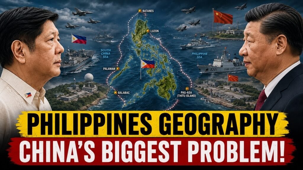
The importance of the Philippines also comes from the fact that its islands are spread across a very large maritime area. Luzon dominates the northern part of the country, Palawan extends along the western side toward the South China Sea, and smaller islands such as Batanes and Balabac occupy positions that become strategically significant because of their proximity to major waterways and neighboring countries. Together, these islands create a geographic network rather than a single defensive position. From a strategic perspective, this makes the Philippines difficult to treat as one isolated location. Different islands serve different purposes depending on their distance from China, Taiwan, the South China Sea, or the Philippine Sea. Some are important because they are close to disputed waters, while others matter because they sit near international maritime routes or potential military approaches. This geographic diversity is one reason why the Philippines remains central to wider Indo-Pacific security discussions.
China has responded to the geographic challenge in part by developing and expanding artificial islands and military facilities in the South China Sea. These installations can provide runways, radar systems, communications infrastructure, ports, and other capabilities that extend China’s operational reach. However, artificial islands do not erase the geography of the surrounding region. A military facility built on a reef can increase China’s ability to operate in a particular area, but it does not move the Philippine islands farther away or change their location relative to the South China Sea and Pacific Ocean. The fundamental geographic problem therefore remains. China’s growing military infrastructure may strengthen its presence, but the Philippines continues to occupy positions that naturally influence access between major maritime spaces. In strategic competition, geography often creates long-term advantages that technology and construction can modify but cannot completely eliminate.
Palawan: The Philippines’ Western Strategic Shield
Among the Philippine islands, Palawan is one of the most important because of its location along the western side of the country. Palawan stretches toward the South China Sea and lies comparatively close to several of the areas at the center of maritime disputes. Its geographic position gives the Philippines a natural platform from which it can monitor developments in nearby waters and maintain access to areas that are strategically important to its maritime interests. Palawan is therefore much more than a long and narrow island with beautiful coastlines and a major tourism industry. In the context of regional security, it forms part of the Philippines’ western strategic shield. Its location places Philippine territory relatively close to important disputed areas, making it relevant to surveillance, maritime operations, logistics, and national defense planning.
The strategic value of Palawan becomes clearer when its position is considered alongside the wider geography of the South China Sea. The island is located west of the Philippine mainland and provides access toward areas where China has established a substantial military and maritime presence. Philippine facilities on or near Palawan can therefore contribute to the country’s ability to observe maritime activity and respond to developments in its western waters. Palawan also has a role in supporting Philippine operations because of its relatively large land area and established population centers compared with many of the smaller islands farther west. Its geography means that it can serve as a bridge between the Philippine mainland and the country’s maritime interests in the South China Sea. For China, the continued presence of a large Philippine island in this location is strategically significant because it represents a permanent geographic factor that cannot be removed through the construction of artificial facilities.
Palawan also illustrates an important difference between natural and artificial geography. China can expand its presence on disputed reefs by constructing runways, radar stations, ports, and other infrastructure, but Palawan is a naturally existing and sovereign Philippine territory with a much broader geographic footprint. It provides depth, access, and a permanent physical presence that is not dependent on the continued construction or maintenance of a single artificial installation. The strategic importance of Palawan therefore comes not only from what facilities exist there today but from where the island is located. As tensions in the South China Sea continue, the island’s role is likely to remain important because it sits at the intersection of Philippine sovereignty, maritime security, and the broader competition over access and influence in the region.
Balabac: A Small Island With a Larger Strategic Meaning
Balabac is much smaller than Palawan, but its strategic importance comes from location rather than size. Positioned at the southern end of Palawan near the waters leading toward Sabah and the broader maritime environment around the Sulu and South China seas, Balabac occupies a position close to important regional routes. Its location gives it relevance in discussions about maritime surveillance, movement, and regional security. Small islands are often underestimated because they lack large populations or major cities, yet military geography does not measure importance by population alone. An island can become strategically significant simply because it sits close to a maritime passage, a neighboring country, or an area where military and commercial movement is concentrated.
Balabac’s position also matters because it connects the geographic picture of Palawan with the wider southern Indo-Pacific. The island sits close to the maritime environment surrounding the Philippines, Malaysia, and the South China Sea, making it part of a larger network of strategic locations. In a period when maritime surveillance and rapid movement are increasingly important, even relatively remote islands can gain significance. Surveillance systems, communications infrastructure, airstrips, ports, or other facilities can increase the usefulness of such locations. The strategic value of Balabac therefore lies in the fact that it occupies a fixed position that cannot be shifted. As regional competition expands, islands that were once considered peripheral can become increasingly important because modern military operations depend heavily on information, access, and awareness of movement across large maritime spaces.
The broader lesson from Balabac is that China’s challenge in the region is not simply about confronting one major Philippine military base. It is about operating in an environment filled with natural geographic positions that belong to other countries. The Philippines has islands distributed across routes that connect the South China Sea with neighboring maritime regions, and Balabac is one part of that network. China may have the resources to build advanced facilities on artificial islands, but it cannot recreate the exact geographic distribution of Philippine territory. That makes islands such as Balabac relevant to the long-term balance of power even when they receive less international attention than larger or more famous locations.
Pag-asa Island and the Spratly Islands
Pag-asa Island, known internationally as Thitu Island, is one of the most strategically sensitive Philippine-held features in the Spratly Islands. Its importance comes from its location inside the disputed South China Sea and its proximity to areas where several countries maintain competing territorial claims. Unlike the Philippine mainland, Pag-asa is directly situated within the contested maritime environment, which makes developments around the island particularly sensitive. The Philippines maintains a presence there, while China and other claimant states operate in the surrounding region. The island’s strategic significance therefore comes from both its physical position and its symbolic importance to Philippine sovereignty. Maintaining a presence on the island demonstrates that Manila continues to exercise a physical connection to one of the most contested areas of the South China Sea.
Pag-asa also matters because it provides the Philippines with a forward position in the Spratly Islands. From a military and surveillance perspective, forward positions can improve awareness of activity in surrounding waters and provide logistical advantages. The island has therefore become an important part of the Philippine government’s broader effort to maintain its presence in the West Philippine Sea. Its runway, facilities, and surrounding waters are closely watched because even small changes in military or maritime activity can have wider strategic implications. The island also highlights the complexity of the South China Sea dispute: the competition is not limited to large naval vessels or major military bases. It also involves the continuous maintenance of small outposts, patrols, resupply operations, fishing activity, and the ability of countries to demonstrate their presence over time.
For China, Pag-asa represents another example of geography that cannot simply be removed from the strategic equation. Beijing has built substantial facilities on several artificial islands, but Philippine-held islands such as Pag-asa remain physical positions occupied by another claimant. This creates a persistent layer of competition in the Spratlys. The importance of Pag-asa is therefore not determined by the island’s physical size. Its significance comes from where it sits, who controls it, and what its continued presence means for the broader dispute. As long as the Philippines maintains its presence there, Pag-asa will remain one of the locations where Chinese and Philippine strategic interests directly overlap.
Scarborough Shoal, Sabina Shoal and Second Thomas Shoal
The South China Sea dispute cannot be understood by looking only at islands because several of the most important flashpoints are reefs, shoals, and maritime features without the same geographic characteristics as major islands. Scarborough Shoal is one of the best-known examples. Located off the coast of Luzon, it occupies a strategically important position within the South China Sea and has become a major point of tension between China and the Philippines. Its proximity to Luzon gives it particular importance because developments there can directly affect Philippine maritime security and the waters surrounding the country’s largest island. Scarborough Shoal demonstrates how a relatively small geographic feature can become a major strategic issue when it sits in an area where territorial claims, fishing activity, maritime law enforcement, and military interests overlap.
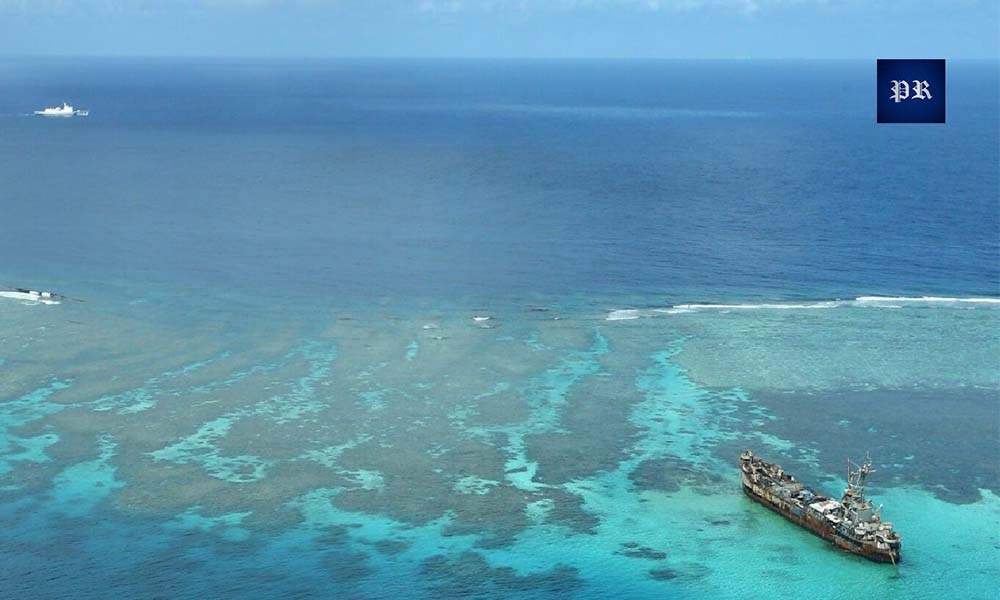
Sabina Shoal has also become increasingly important because of its location and its connection to Philippine maritime activity in the West Philippine Sea. Its proximity to other contested features and Philippine positions means that developments around the shoal can influence the wider operating environment. The same is true of Second Thomas Shoal, where the Philippines maintains the BRP Sierra Madre as a symbol and physical point of its position in the disputed area. The continued resupply of Philippine personnel at the outpost has repeatedly become a source of confrontation between Philippine and Chinese vessels. These incidents show that control and presence in the South China Sea can depend on something as basic as whether a country can safely reach and resupply its own position.
These locations demonstrate why the strategic contest is about more than conventional warfare. Maritime presence, coast guard operations, fishing fleets, supply missions, surveillance, diplomatic pressure, and legal claims all form part of the competition. China can use a large maritime presence to exert pressure around disputed features, while the Philippines relies on its own maritime forces, alliances, legal position, and physical presence to protect its interests. The geography of these shoals means that neither side can completely ignore the other. Their importance is amplified because they are located within the larger strategic environment created by Luzon, Palawan, and the Philippine archipelago. Together, these geographic positions create a complicated maritime landscape in which even routine patrols or resupply missions can carry significant strategic consequences.
Luzon: The Philippines’ Northern Strategic Anchor
Luzon is the largest and most populous island in the Philippines and serves as the country’s most important geographic and political anchor. Its strategic importance is enormous because of its location between the South China Sea, the Philippine Sea, and the waters approaching Taiwan. Unlike small outposts in the Spratlys, Luzon provides the Philippines with substantial territory, population, infrastructure, and military capacity. The island hosts Manila and many of the country’s most important economic and military facilities, giving it a role that extends far beyond the South China Sea dispute. From a regional security perspective, Luzon’s position allows the Philippines to influence developments across both western and eastern maritime approaches.
Luzon’s northern position is especially important in relation to Taiwan and the Bashi Channel. The waters between northern Luzon and Taiwan form an important passage between the South China Sea and the Philippine Sea. This means that the island occupies a geographic position that becomes increasingly significant whenever military planners consider scenarios involving Taiwan, the South China Sea, or the movement of naval forces into the western Pacific. Northern Luzon therefore has importance not only for Philippine national defense but also for broader Indo-Pacific strategy. Any major regional crisis involving China and Taiwan would inevitably increase attention on the geographic relationship between Taiwan, Luzon, and the surrounding maritime passages.
The strategic significance of Luzon also comes from its ability to support military and logistical infrastructure at a scale that smaller islands cannot. Large airfields, ports, roads, communications systems, and population centers provide strategic depth. The Philippines can therefore use Luzon as a foundation for operations, surveillance, disaster response, and defense planning across multiple directions. For China, this means that the Philippines is not simply a collection of small disputed territories in the South China Sea. It is a major neighboring archipelago with a large northern island positioned close to key regional routes. Luzon cannot be moved, bypassed geographically, or replaced by an artificial structure, making it one of the most enduring factors in China’s strategic calculations.
Batanes: The Northern Gateway
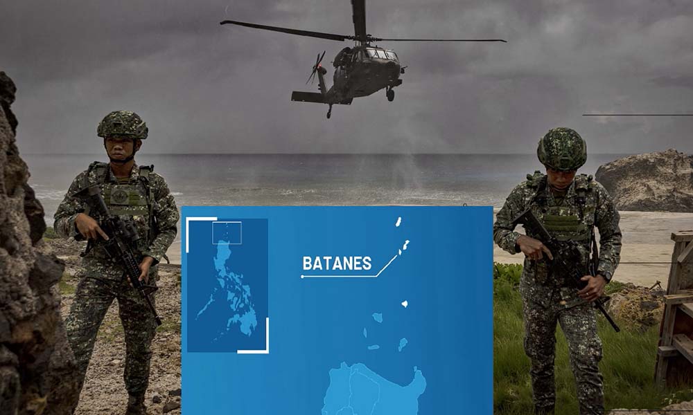
The Batanes Islands are small and remote compared with Luzon, but their location gives them exceptional strategic relevance. Situated in the northernmost part of the Philippines between Luzon and Taiwan, Batanes occupies a position close to the Bashi Channel and the wider waters of the western Pacific. The islands are geographically closer to Taiwan than most of the Philippine mainland, making them important whenever analysts examine the relationship between the Philippines, Taiwan, and China. Their significance does not come from their population or physical size but from their location at the northern edge of the Philippine archipelago. In strategic geography, such positions can become important because they provide awareness of maritime and air activity across a sensitive area.
Batanes also forms part of the geographic relationship between the South China Sea and the Philippine Sea. Any military movement between these maritime spaces must take into account the island geography of the region. The islands therefore have potential importance for surveillance, communications, logistics, and broader situational awareness. Their location means that they can provide the Philippines with an additional geographic position from which activity around the northern approaches can be observed. While Batanes does not represent a massive military base or a major population center, its strategic value is closely connected to the fact that it sits in a location where several important regional interests meet.
For China, the existence of Batanes highlights the difficulty of treating the South China Sea as an isolated strategic theater. China’s maritime and military interests increasingly extend into the Philippine Sea and the western Pacific, while the Philippines occupies territory across the routes connecting those areas. Batanes is therefore part of a larger geographic system that includes Taiwan, Luzon, the Bashi Channel, and the South China Sea. Its importance may become even more visible during periods of heightened regional tension. Again, the central point is simple: China can build facilities elsewhere, but it cannot change the location of Batanes or the surrounding Philippine geography.
China Warns Manila as Turkey Supplies the Philippines With ANKA & ATAK
China Can Build Bases, But It Cannot Move Philippine Geography
China’s artificial islands have significantly changed the military landscape of the South China Sea. Facilities built on features such as Fiery Cross Reef, Subi Reef, and Mischief Reef have allowed China to establish runways, radar systems, communications infrastructure, ports, and other military capabilities far from the mainland. These developments have increased Beijing’s ability to sustain operations and monitor activity across disputed waters. From a strategic perspective, this infrastructure matters because it extends China’s reach and creates permanent-looking positions in areas that were previously dominated by natural reefs and open water. The construction of these facilities has therefore become one of the defining developments of the South China Sea dispute.
However, artificial infrastructure has a fundamental limitation: it does not change the location of the natural islands surrounding the South China Sea. Palawan remains where it is. Luzon remains where it is. Batanes remains where it is. Balabac remains where it is. Pag-asa remains where it is. These islands continue to occupy geographic positions that shape access between the South China Sea and the Pacific. China can increase the number of ships and aircraft operating from artificial facilities, but it cannot physically relocate the Philippine archipelago farther away. This distinction is critical because military power is influenced not only by bases and weapons but also by distance, terrain, maritime passages, logistics, and the location of neighboring territory.
This is why the Philippine islands remain strategically important even as China’s military capabilities grow. The contest is not simply about who can build the largest base or deploy the most ships. It is also about who occupies the most advantageous geographic positions and who can maintain access to the surrounding maritime environment. The Philippines possesses a geography that naturally intersects with China’s strategic expansion. Its islands form a chain stretching across critical maritime approaches, while its alliance with the United States adds another dimension to that geography. The result is a strategic environment in which China’s military expansion can increase its capabilities without eliminating the geographic advantages possessed by the Philippines and its partners.
The U.S.-Philippines Alliance Adds Another Strategic Layer
The strategic importance of Philippine islands becomes even greater because of the country’s defense relationship with the United States. Geography alone gives the Philippines importance, but an alliance with a major military power can transform that geographic importance into a wider strategic factor. The United States has long considered the Philippines an important partner in the Indo-Pacific, and cooperation between the two countries includes military exercises, defense planning, logistics, and access arrangements. This means that the location of Philippine territory cannot be analyzed separately from the broader U.S. military presence in the region. Philippine geography can influence the movement, positioning, and support of allied forces during periods of crisis or heightened tension.
This relationship is particularly significant in northern Luzon and the areas facing the Philippine Sea and Taiwan. If tensions around Taiwan were to increase, the geographic position of the Philippines would become even more important because of its proximity to Taiwan and its access to the surrounding maritime environment. Similarly, developments in the South China Sea can bring the alliance into focus because the United States has repeatedly emphasized its defense commitments to the Philippines. This creates a strategic environment in which China’s actions toward Philippine maritime positions may have implications beyond the immediate bilateral relationship.
The alliance therefore adds another layer to the basic geographic reality. China’s competition is not occurring with an isolated country operating alone. The Philippines has its own military capabilities, maritime forces, diplomatic relationships, and geographic advantages, while its partnership with the United States provides an additional strategic dimension. This does not mean that geography automatically determines the outcome of any conflict. Modern warfare depends on many factors, including technology, logistics, political decisions, economic strength, intelligence, and military readiness. But geography establishes the starting conditions, and the Philippines occupies a position that makes it impossible to ignore in any serious assessment of China’s regional strategy.
Why These Islands Matter for the Future of the Indo-Pacific
The strategic importance of Philippine islands is likely to grow as competition between China and the United States intensifies across the Indo-Pacific. The South China Sea is connected to the Philippine Sea, the Taiwan Strait, the East China Sea, and the wider Pacific, meaning that developments in one area can quickly influence another. The Philippines sits directly within this interconnected geography. Its western islands face the South China Sea, its northern islands approach Taiwan, and its eastern coastline opens toward the Philippine Sea. Few countries occupy such a geographically consequential position. This makes Philippine territory relevant not only to the country’s own defense but also to the broader balance of power across the Indo-Pacific.
The future strategic role of these islands will depend on how the Philippines develops its military infrastructure, maritime surveillance, air defense, coast guard capabilities, and relationships with regional partners. Infrastructure improvements can make remote islands more useful for logistics and surveillance, while stronger maritime capabilities can help Manila maintain a more consistent presence across its large maritime domain. At the same time, diplomatic engagement remains important because military competition in the South China Sea is closely connected to international law, economic interests, fisheries, energy resources, and freedom of navigation. The Philippines therefore faces the difficult task of defending its interests while avoiding unnecessary escalation in an increasingly competitive regional environment.
Ultimately, the central strategic fact is that the Philippines cannot choose its geography, and China cannot change it. The islands of Palawan, Balabac, Luzon, Batanes, and Pag-asa occupy positions that naturally shape the strategic environment surrounding the South China Sea and the western Pacific. China’s artificial islands may expand its military reach, but they do not erase the physical presence of Philippine territory. This is why the Philippine archipelago will remain one of the most important geographic factors in the future of the Indo-Pacific. The competition between China and the Philippines, and the wider competition involving the United States and other regional powers, will continue to evolve, but the map itself will remain remarkably constant. In the end, technology can change the battlefield, military power can change the balance, and alliances can change the political environment, but geography remains the one strategic factor that neither side can simply move out of the way.
About Indo-Pacific Report
For more geopolitical analysis, strategy coverage, and Indo-Pacific security reporting, visit Indo-Pacific Report:
Website
Facebook
YouTube