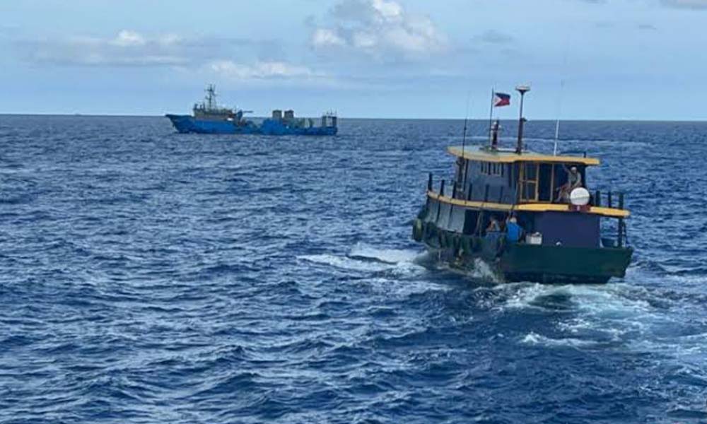
At dawn, local fishermen off the northern coast of Luzon scan the sky as they haul their nets, not just for weather, but for warplanes. Overhead, the thunder of Chinese jets patrolling Taiwan’s ADIZ has become part of the daily soundscape in 2025. Just beyond the horizon lies the Bashi Channel, a narrow maritime passage that looks peaceful on a map but feels increasingly like the eye of a geopolitical storm. It’s here, where internet cables snake silently beneath deep blue waters and ships carry billions in trade, that the world’s next crisis could surface.
Few outside military circles or cable-laying corporations had heard of the Bashi Channel a decade ago. Now, in 2025, it’s a name spoken in war rooms, shipping control centers, and cybersecurity briefings across the globe. This slim strait between Taiwan and the Philippines has quietly become one of the most strategically volatile locations on Earth. Why? Because if conflict ever erupts over Taiwan, Bashi won’t just be a battleground, it’ll be the switchboard for everything from drone swarms to internet outages. And everyone knows it.
The Bashi Channel is just a body of water. It has no armies, no borders, no capital. But in 2025, it represents the fragile seam stitching together global peace and potential catastrophe. It is where China’s ambitions, Taiwan’s defense, and America’s deterrence strategies meet in uneasy silence. A single miscalculation here, just one fighter jet straying too far, could tear through underwater cables, disrupt economies, and launch the Indo-Pacific into crisis. Geography has always shaped conflict, but few places now shape the possibility of it more than this.
Taiwan Invasion Scenario: The Bashi Channel as Lifeline and Chokepoint
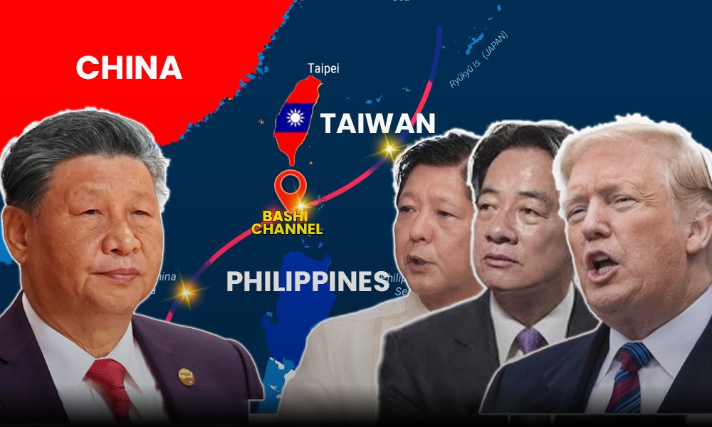
In the event of a Chinese invasion of Taiwan, the map of the Western Pacific transforms from geography into strategy, and nowhere is that more evident than the narrow band of water known as the Bashi Channel. While the Taiwan Strait often grabs headlines, it’s this southern passage, less than 90 miles wide between Taiwan’s tip and the Philippines, that could make or break both offense and defense in a future war.
Taiwan itself is no easy place to seize. Towering mountain ranges split the island down the middle, complicating any ground assault. That’s why control of the sea becomes everything. There are three main maritime corridors around Taiwan, each with its own strategic weight. To the north, the Yonaguni Channel brushes up against Japanese territory, Tokyo is already installing cruise missiles on Yonaguni Island. To the west lies the infamous Taiwan Strait, just 100 miles wide at its narrowest, and the most obvious invasion route. But in the south, the Bashi Channel holds special significance. This is where China must secure its own supply lines, and cut off Taiwan’s.
At the heart of this southern theater lies Kaohsiung, Taiwan’s largest and most vital port. It’s not just big, it’s the 15th largest container port in the world and handles over 60% of Taiwan’s cargo traffic. Think oil for tanks, diesel for generators, spare parts, and even fresh produce for civilians and soldiers alike. A 2002 U.S. Army study showed that a single brigade combat team burns through 500 tons of supplies daily. Ninety percent of that is just fuel and food. Without Kaohsiung, Taiwan’s ability to sustain itself under siege could rapidly crumble.
But resupplying Taiwan isn’t as simple as sending ships. Amphibious landings require massive, deep-draft vessels. They’re vulnerable, slow, and can only offload safely at proper berths, Kaohsiung provides that. Yet doing so under fire would be daunting. The Taiwan Strait is known for harsh currents, and during half the year, typhoons churn the region into chaos. Layer on the risk of sea mines, anti-ship missiles, and attacks on fuel-laden vessels, and you begin to understand why logistics, not just combat, may decide the war.
From China’s perspective, the strategy is crystal clear: capture Kaohsiung fast and lock down the Bashi Channel. Without those, Beijing can’t maintain its own military throughput, and it can’t stop others, particularly the U.S., from bringing aid to Taiwan. Recent data tells a clear story. In January 2025, PLA aircraft crossed the Taiwan Strait’s median line 248 times, nearly double the previous record. More flights are pushing past the Bashi Channel into the Pacific, while Chinese warships now swarm Taiwan’s waters at unprecedented levels. This isn’t mere intimidation anymore, it’s preparation.
It’s no accident that China held two live-fire drills in Taiwan’s southern waters in recent years, near Kaohsiung and inside the Bashi Channel, breaking a long-standing taboo. These aren’t just warnings; they’re rehearsals. Each drill, each incursion, sends a message: the south is no safe zone.
The U.S. sees it the same way. American planners increasingly view the Bashi Channel as a lifeline for Taiwan and a potential gateway for intervention. Bases in the Philippines and Japan are being repositioned to pre-stage supplies and support. If China can be denied control of this corridor, Taiwan may hold out. If not, the island could be cut off, and history shows what happens when defenders run out of fuel, food, and time.
Force Projection and Strategic Area Denial: The Bashi Channel as a Gate to War or Peace
In the chessboard of the Indo-Pacific, the Bashi Channel is no ordinary square. It’s a door, wide enough, deep enough, and strategically placed enough to let the world’s most powerful militaries move pieces across oceans. In fact, it’s one of only two maritime access points over 50 miles wide that connect the Pacific Ocean to the South China Sea. Whoever controls this narrow sea lane controls the tempo of movement between open waters and one of the most contested regions on Earth.
For the United States and its allies, this makes the Bashi Channel more than a maritime passage. It becomes a launchpad, a vital artery for force projection and supply lines in any Taiwan conflict. Its position offers a perfect geographic advantage: U.S. forces can now feed Taiwan from two directions, like a pincer, north from Japan, and south from the Philippines. This complicates Chinese invasion planning by reducing its options and making its landing zones more predictable.
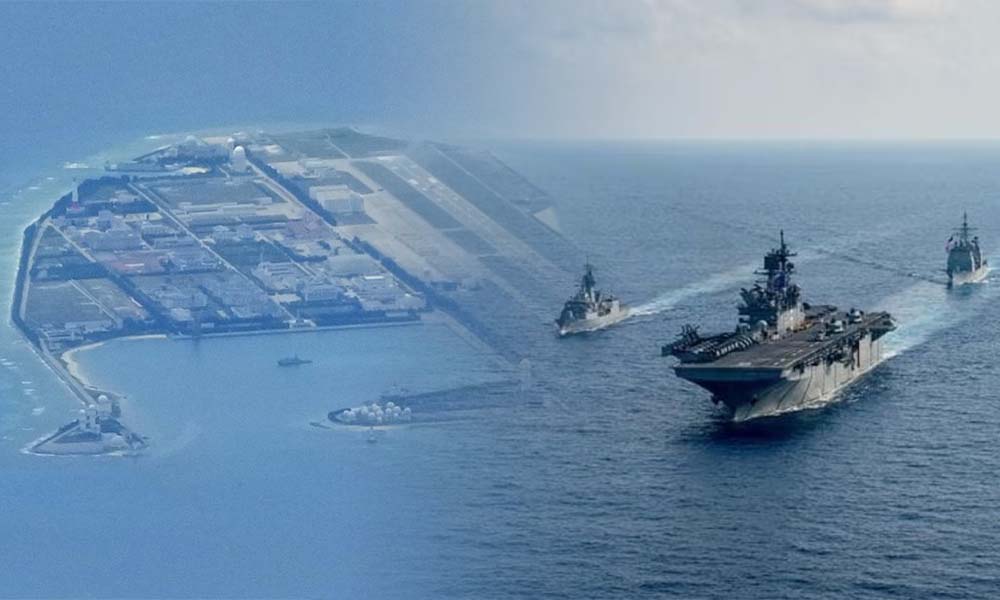
The U.S. has wasted no time adjusting its posture. Between 2023 and 2025, Washington secured access to four new military sites on northern Luzon, just a short flight from the Bashi Channel. In March 2023, F-22 Raptors touched down in the Philippines for the first time, signaling a dramatic leap in airpower coverage over the South China Sea. These bases weren’t just symbolic, they are now a cornerstone of American deterrence architecture in Southeast Asia.
But airbases aren’t the only tools in play. The Philippines itself is stepping up. By acquiring BRAHMOS cruise missiles from India, Manila is taking a clear step toward building its own credible area denial strategy, something that was unthinkable just a few years ago.
‘If a Filipino servicemen killed by China, it will be an “Act of War”‘ Ferdinand Marcos Jr.
And then came Balikatan 2025, the largest joint U.S.-Philippines military exercise in history. With over 17,000 troops, this wasn’t a drill. It was a war game tailored for the exact kind of conflict that could erupt over Taiwan. For the first time, the U.S. deployed its cutting-edge Navy-Marine Expeditionary Ship Interdiction System (NMESIS) and the Typhon missile system to the Batanes islands, small, windswept strips of land that sit right inside the Bashi Channel. Lt. Gen. Michael Cederholm, commanding the joint task force, put it plainly: “The training we conduct during Exercise Balikatan continues to validate our modernization efforts and improves our ability to defend our shared interests within the region.”
It was also the first time since 1958 that U.S. land-based missiles had been positioned this close to mainland China.
To Beijing, this escalation is deeply unsettling. New U.S. bases and missile deployments force China’s military to commit more resources, more ships, more aircraft, more logistics, to maintain any advantage in a Taiwan campaign. It shrinks China’s “strategic space” dramatically. Key cities like Shenzhen, Hong Kong, and Zhanjiang now sit within 600 miles of U.S. missile range, well within reach of Tomahawks, and a far cry from the buffer China once relied on.
In April 2025, Chinese Ministry of National Defense spokesperson Colonel Zhang Xiaogang issued a blunt warning. “We firmly oppose any country strengthening military deployment in the region and provoking tensions… If the Philippines keeps barreling down the wrong path and acting recklessly, it will do itself more harm than good and taste the bitter fruit of its own doing.” The message was clear: China sees the Bashi Channel not just as a chokepoint, but as a pressure point, one that’s now increasingly under external influence.
Strategically, Beijing has always eyed the “First Island Chain” with anxiety. These are the island groups, from Japan to Taiwan to the Philippines, that cage in its navy and limit its ocean access. And of all the narrow exits along that chain, only two, the Miyako and Bashi Channels, offer serious room for major military passage. Losing control of either would bottleneck the PLA Navy and cut off southern access to the Pacific.
In this light, the Bashi Channel isn’t just a geographic feature, it’s a fulcrum on which the balance of power in the Indo-Pacific may turn.
Underwater Cables: The Silent, Vulnerable Lifeline Beneath the Bashi Channel
Beneath the surface of the Bashi Channel, invisible to satellites and warships alike, runs the real circulatory system of the modern world: submarine internet cables. Stretching thousands of miles across the ocean floor, these slender bundles of glass and wire carry almost everything we value in the digital age, emails, cloud backups, banking transactions, intelligence data, and even military orders. In 2025, an estimated 97 to 99 percent of global internet traffic still flows through these undersea arteries.
It’s hard to overstate how critical the Bashi Channel is to this network. It’s not just a strategic chokepoint for navies, it’s one of the main data highways connecting Asia to North America. The digital economy of nations, the daily habits of billions, and the command networks of modern militaries all rely on the uninterrupted function of these undersea lines. But as tensions escalate around Taiwan, these cables are becoming increasingly vulnerable, and increasingly targeted.
War planners have long understood that silencing communication is the first step toward blinding your opponent. In a high-tech battlefield, cutting underwater cables doesn’t just create confusion, it creates a smokescreen, buying precious hours or even days during which the enemy can’t coordinate or respond effectively. That danger is no longer theoretical.
In March 2023, two internet cables connecting Taiwan’s Matsu Islands to the main island were mysteriously severed, causing a weeks-long blackout. In January 2025, the Chinese-flagged Shunxin 39 was implicated in damaging the TPE cable just north of Taipei, one of the busiest data routes in the Western Pacific. A month later, the Hong Tai 58, a vessel crewed by Chinese nationals, allegedly damaged another line, TPKM-3, which links the Penghu Islands to the Taiwanese mainland. These aren’t isolated accidents; they’re warnings in disguise.
Behind the scenes, China is reportedly developing deep-sea capabilities designed explicitly for this kind of sabotage. New systems are said to be capable of operating at 4,000-meter depths, twice the limit of most current infrastructure. That would place nearly every cable in the region within operational range. According to The Diplomat and The Economic Times, Beijing is investing in submarine-mounted cable tampering tools, hardware that’s invisible to satellites, difficult to track, and devastating in effect.
In response, Taiwan is shifting its thinking. In March 2025, Taiwan’s Defense Minister publicly confirmed that the Navy and Coast Guard are now treating cable protection as a matter of national defense, not just infrastructure. It’s a quiet but critical shift. For a society so dependent on digital speed and military interoperability, losing those lines, literally, could spell disaster in the first hours of conflict.
It’s easy to focus on the fighter jets overhead or the warships in the strait, but beneath the waves, the real war might start with a quiet snip. And no one will see it coming, until it’s already too late.
Conclusion: When Politics Shift, Geography Stays
In the contest for Indo-Pacific dominance, the Bashi Channel and the islands of northern Philippines are more than coordinates on a map, they are the nerve points of a 21st-century power struggle. Despite shifting alliances, election cycles, and fluctuating rhetoric, the geographic reality remains unshakable: this narrow channel and its surrounding territory form a vital hinge between the South China Sea and the Western Pacific. It’s a gateway for commerce, a corridor for force projection, and increasingly, a frontline in the US-China confrontation.
In 2025, the Philippines under President Ferdinand Marcos Jr. has decisively reoriented itself. By opening its northern provinces to permanent U.S. military infrastructure, it has reshaped the regional security map. This was no mere ideological choice, it was a response to domestic pressure and China’s growing assertiveness. As Modern Diplomacy recently observed, the Marcos pivot is “rooted deeply in domestic political calculations.” But even this new strategic consensus faces pressure.
The political winds are beginning to shift. The May 2025 midterm elections were a setback for Marcos and a boon to the Duterte-aligned opposition, politicians historically more accommodating to Beijing. Chinese commentators openly celebrated the outcome, framing it as a possible “turning point.” Though 73% of Filipino voters in late 2024 expressed opposition to pro-China candidates, the actual vote tells a more complicated story: Filipino democracy remains a wildcard in the regional balance.
The real danger lies in what a reversal could mean. A “political U-turn” by a future administration, especially one resembling Duterte’s earlier foreign policy, could jeopardize the current U.S. foothold, unraveling the intricate supply networks, air coverage, and deterrent strategies now centered on northern Luzon and the Bashi Channel. For Washington, it’s a vulnerability in what should be a reinforced first island chain. For Beijing, it’s an opportunity, one that could tip the regional balance without a single shot fired.
And yet, amid all the uncertainty, one thing will not change: the map. Long after leaders leave office and alliances rise and fall, the Bashi Channel will still sit between Taiwan and Luzon, and its waters will still matter, for cables, carriers, and conflict. Geography, unlike politics, does not negotiate. It shapes strategy, defines access, and determines what matters in war and peace.
In that sense, the Bashi Channel isn’t just a flashpoint, it’s a fixture. And in this new era of Indo-Pacific rivalry, it’s one that the world cannot afford to ignore.