Can the Philippines DISRUPT $6.4 TRILLION in Global Trade in South China Sea!
The Philippines occupies one of the most strategically important geographic positions in the Indo-Pacific because it sits between the South China Sea and the wider Pacific Ocean, immediately south of Taiwan and close to some of the most heavily used maritime routes in East and Southeast Asia. The country is an archipelago of more than 7,000 islands, stretching across a huge maritime area between mainland Southeast Asia and the Pacific. Its northern islands are particularly important because northern Luzon lies relatively close to Taiwan, while the Luzon Strait provides a natural maritime connection between the South China Sea and the Philippine Sea. Farther south, the Balabac Strait creates another connection between the South China Sea, the Sulu Sea and waters around Borneo.
The Philippines therefore represents something different from a conventional military chokepoint. Manila does not possess the authority to close the Luzon Strait, Balabac Strait or South China Sea to international shipping. However, in the event of a major regional war, the security environment surrounding these waterways could change rapidly. If commercial shipping companies determine that certain routes are too dangerous, vessels could be rerouted even without a formal blockade. Insurance companies could increase premiums, shipping operators could impose war-risk surcharges, ports could experience congestion and manufacturers could face delays in receiving critical components. In this sense, the Philippines can become economically significant through risk rather than direct control. A conflict that makes nearby waters dangerous can force private companies to change their behavior, and those commercial decisions can eventually produce effects across international supply chains.
Why the South China Sea Matters to the Global Economy
The South China Sea is one of the world’s most economically important maritime regions because it connects major manufacturing economies with energy suppliers and consumer markets. China, Japan, South Korea, Taiwan and Southeast Asia depend heavily on maritime transportation for the movement of manufactured products, industrial components, raw materials and energy. Container ships carrying electronics, machinery, chemicals, automobiles and consumer products move through the broader network, while tankers transport crude oil and petroleum products required by industrial economies. This means the region is not simply a route for finished products and containers; it is also an important pathway for the energy required to operate factories, generate electricity, fuel aircraft and ships, and support transportation networks. If a military crisis caused tankers to avoid particular waters, the consequences could include longer voyages, increased fuel consumption and higher freight and insurance costs. Even when physical supplies remain available, markets can react to the possibility of disruption. Traders may price in additional risk, shipping companies may charge more for transportation and energy-importing economies may begin building larger inventories.
Global Shipping Does Not Depend on a Single Route
One of the most important facts about global maritime trade is that ships can usually reroute when a particular corridor becomes dangerous. This provides the international economy with a degree of resilience, but it does not eliminate the economic consequences of conflict. When vessels avoid a dangerous route, they normally have to travel farther, consume more fuel and spend additional days at sea. A longer voyage also reduces the number of trips a vessel can complete within a given period. If thousands of ships simultaneously require longer routes, the effective capacity of the global shipping fleet can become tighter even though the total number of ships has not changed.
The Red Sea crisis demonstrated this mechanism. When attacks increased the risks associated with the Red Sea and Suez Canal route, many commercial vessels were diverted around the Cape of Good Hope in southern Africa. CSIS noted that a voyage between Europe and the Arabian Sea could increase from approximately 19 days to around 34 days when ships were forced to take the longer route. That represents roughly 15 additional days at sea, significantly increasing fuel consumption, crew requirements, vessel utilization and transportation costs. The example is important because it demonstrates that maritime trade does not need to stop completely for a crisis to create a major economic shock.
A similar principle could apply in the Indo-Pacific. If a Taiwan conflict made the Taiwan Strait unsafe, some commercial vessels could attempt to use alternative routes through the Luzon Strait, the Philippine Sea or farther south through other Southeast Asian waterways. However, if military operations simultaneously increased risks around the Luzon Strait or South China Sea, the number of attractive alternatives could shrink. Shipping companies would then have to make decisions based not only on distance but also on insurance availability, naval activity, port congestion, fuel costs and the reliability of the route.
Why the Luzon Strait Could Become a Major Chokepoint
The Luzon Strait is arguably the most important Philippine maritime gateway in the context of a potential Taiwan conflict because of its location between Taiwan and Luzon. The strait connects the South China Sea with the Philippine Sea and the wider Pacific, making it important for both commercial transportation and military movements. Its geographic position means that a conflict involving Taiwan could immediately increase the strategic importance of the surrounding waters. Commercial operators would have to consider whether vessels could safely pass through the area, while governments would have to assess military movements, surveillance activity and potential restrictions on navigation.
The Luzon Strait is also economically relevant beyond the Philippines and Taiwan. According to the 2026 CSIS analysis, approximately 16 percent of New Zealand’s total trade passed through the Luzon Strait in 2024. For the Solomon Islands, the estimated figure was approximately 41 percent. These numbers demonstrate that the economic importance of the strait extends far beyond the countries physically located next to it. Pacific economies may depend on maritime routes that pass through waters connected to the Philippines even though their own territories are thousands of kilometers away.
225 Chinese Ships Swarm Philippines Near Scarborough Shoal — What Is China Planning?
The importance of the Luzon Strait becomes even greater when viewed together with the Taiwan Strait. If a Taiwan conflict made the Taiwan Strait too dangerous for normal commercial shipping, some vessels could potentially seek routes farther south. But the alternative routes are not unlimited. A vessel cannot simply move anywhere across the Pacific without considering distance, fuel availability, weather, port infrastructure, naval activity and insurance costs. The Luzon Strait could therefore become a critical part of the rerouting calculation. If it remains open and commercially safe, it could absorb some redirected traffic. If it becomes heavily militarized or dangerous, shipping companies could be forced to search for much longer alternatives.
Philippines a Second Strategic Gateway
The Philippines’ strategic geography does not end in the north. In the southern part of the archipelago, the Balabac Strait, located between Palawan and Borneo, provides another maritime connection between the South China Sea and the Sulu Sea. The strait is among the eight major South China Sea-related chokepoints identified in the 2026 CSIS analysis. Its location gives the Philippines a strategic position at another point where maritime traffic can move between the South China Sea and the wider Southeast Asian maritime system.
The significance of Balabac becomes clearer when the Philippine archipelago is viewed as a geographic bridge. In the north, the Philippines is positioned near Taiwan and the Philippine Sea. In the south, Palawan and the Balabac Strait face Borneo and the Sulu Sea. Between these areas lies a long chain of islands that places Philippine territory close to several maritime environments. This does not mean Manila controls those waters. International shipping remains subject to international law and the commercial decisions of shipping companies. But in a major conflict, geography can determine where military forces operate, where surveillance systems are deployed and which routes commercial companies consider safe.
Geography Creates Strategic
The central point is that the Philippines should not be described as a country capable of simply shutting down global trade. Such a claim would exaggerate Manila’s capabilities and misunderstand how international shipping works. The Philippines does not control the South China Sea, does not command all shipping passing through the Luzon Strait and does not possess the ability to independently stop trillions of dollars in international commerce. The more accurate argument is that the country occupies territory beside maritime gateways that become extremely important during periods of geopolitical crisis.
That distinction matters because the modern global economy responds strongly to risk. A shipping company does not necessarily need a formal blockade to change its route. If the probability of military confrontation rises enough, avoiding a particular waterway may become commercially rational. An insurer can raise premiums before a single commercial vessel is attacked. A manufacturer can increase inventory before an actual shortage occurs. A port can experience congestion because vessels arrive later than expected. Financial markets can react to the possibility of disruption before physical trade volumes decline.
This is ultimately why the question is not whether Manila can “close” the sea. The more important question is what happens if a war makes several surrounding routes commercially unattractive at the same time. If shipping companies have to add thousands of nautical miles to major voyages, insurance costs rise, fuel consumption increases and delivery schedules become less predictable. Those effects can then move from shipping companies to manufacturers, from manufacturers to retailers and eventually from international supply chains to consumers.
The First Major Takeaway
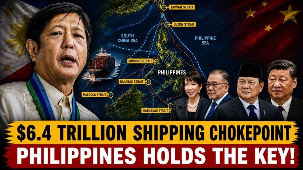
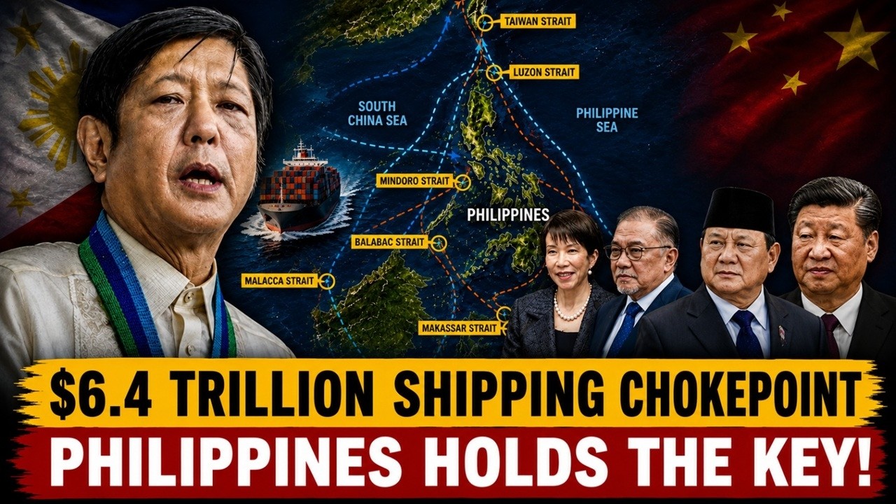
The Philippines’ potential impact on global trade comes from the combination of location, maritime connectivity and geopolitical risk. The country sits near the Luzon Strait in the north and the Balabac Strait in the south, while its surrounding waters connect the South China Sea with the Philippine Sea, Pacific Ocean and Sulu Sea. The surrounding maritime network carried enormous quantities of trade and energy before any conflict occurred. In 2024, the eight major South China Sea-related straits examined by CSIS handled approximately $6.4 trillion in goods, while the economies surrounding the South China Sea represented roughly $24 trillion in GDP, or about 22 percent of global GDP.
The most important point is therefore not that the Philippines could independently stop $6.4 trillion of trade. It cannot. The significance is that a war involving the Philippines—or a war around Taiwan that made Philippine-adjacent waters dangerous—could force shipping companies to reconsider routes through a maritime network carrying trillions of dollars of commerce. The economic consequences would depend on how many routes were affected, how long the disruption lasted and how effectively shipping companies could reroute vessels.
About Indo-Pacific Report
For more geopolitical analysis, strategy coverage, and Indo-Pacific security reporting, visit Indo-Pacific Report:
Website
Facebook
YouTube
Can the Philippines DISRUPT $6.4 TRILLION in Global Trade in South China Sea!