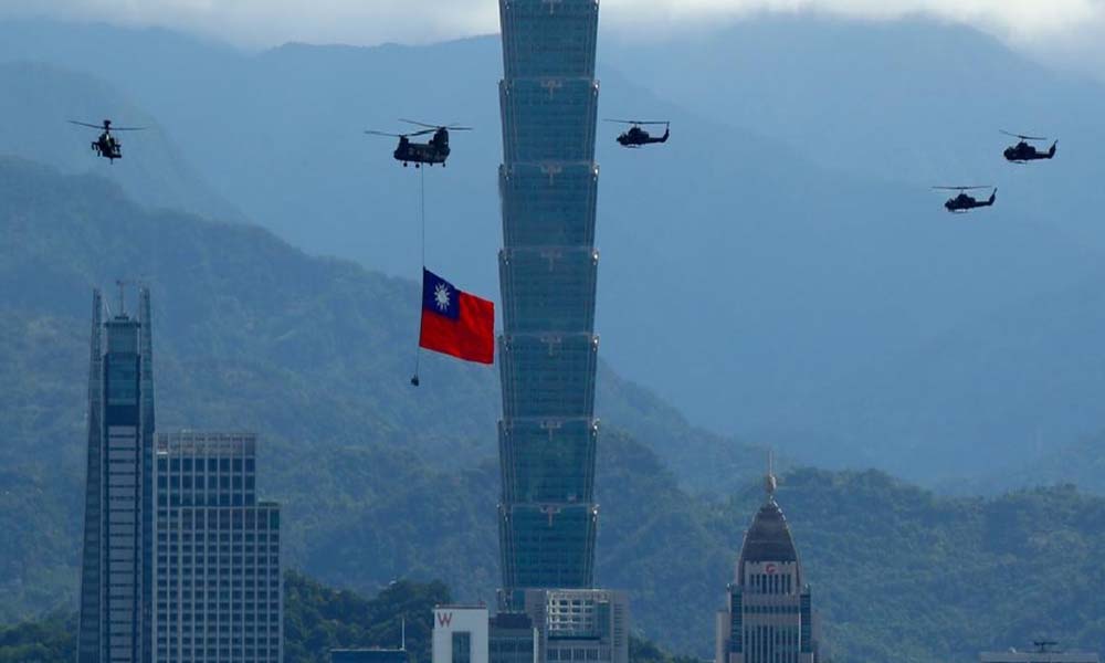
The Paracel Islands, also known as the Xisha Islands in Chinese and the Hoàng Sa Archipelago in Vietnamese, are a disputed archipelago in the South China Sea. This group of around 130 tiny coral islands and reefs, categorized into the Crescent Group and the Amphitrite Group, covers a land area of approximately 7.75 square kilometers and a maritime area of about 15,000 square kilometers. Located roughly 400 kilometers from Vietnam and 330 kilometers from Hainan, the islands are currently under the control of the People’s Republic of China, despite overlapping claims from Taiwan and Vietnam. Historically, the French Indochina colonial government established weather and telecommunication stations on Woody Island and Pattle Island in the 1930s, which were maintained until 1945. During the Second Sino-Japanese War, Japan occupied the islands, incorporating them into Japanese Taiwan in 1941. Post-war, the Republic of China reasserted its presence in 1946. The PRC has maintained de facto control since the 1974 Battle of the Paracel Islands. In 2012, China established Sansha City in Hainan Province to administer the area, and by 2017, had built 20 outposts on reclaimed land, including three harbors. The sovereignty of the Paracel Islands remains a contentious issue among the PRC, Taiwan, and Vietnam.
Resource Potential
The Paracel Islands, located in the South China Sea, are indeed a region of significant strategic and resource potential. The waters surrounding the Paracel Islands are rich in marine biodiversity, making them highly productive fishing grounds. These waters are crucial for the fishing industries of the surrounding nations, providing a significant source of food and economic activity. The seabed around the Paracel Islands is believed to contain substantial, yet largely unexplored, reserves of oil and natural gas. These potential energy resources make the area highly valuable and strategically important, as control over these resources could significantly enhance the energy security and economic power of the controlling nation.
Geography
The Paracel Islands, encompass 518 kilometers (322 miles) of coastline and feature a tropical climate. The archipelago’s extremes in elevation range from sea level to the highest point on an unnamed Rocky Island site at 14 meters (46 feet). The islands are rich in natural resources, including fish, coral reefs, and potentially significant quantities of oil and gas. However, they are also susceptible to natural disasters such as typhoons. Geographically, the Paracel Islands are divided into two main clusters: the northeastern Amphitrite Group and the western Crescent Group.
Amphitrites Group
The Amphitrite Group, named after the French ship Amphitrite which explored the islands between 1698 and 1700 while escorting a Jesuit mission to Canton, is located in the northeastern part of the Paracel Islands. This group consists of low, narrow islands with sand cays and enclosed shallow lagoons connected by rock reefs, forming an oval shape with a north-south axis of approximately 22 kilometers (14 miles). It lies roughly 37 kilometers (23 miles) northwest of Lincoln Island. The northern portion of the group includes the Qilian Yu sub-group, also known as the “Seven Sisters,” which comprises North Island, Middle Island, South Island, North Sand, Middle Sand, South Sand, and two smaller “sands,” along with West Sand and Tree Island.
Crescent group
The Crescent Group, located about 70 km (43 miles) southwest of the Amphitrite Group, consists of reefs and islands that form a crescent shape from west to east around a central deep lagoon. Spanning 31 by 15 kilometers, this group features vegetation on every island except for the small cays. The islands are named after former British East India Company (EIC) executives, including John William Roberts, Thomas Pattle, and James Drummond.
At the southwestern tip of the group lies Money Island, known in Chinese as Jin Yin Dao. Just 2.4 kilometers east of Money Island is Antelope Reef, which features a central lagoon that submerges at high tide. Northeast of this are Pattle Island and Robert Island (also known as Round Island), separated by a 3.5-kilometer strait. Pattle Island is notable for its French-built weather station and radio station, constructed in 1932 and 1937, respectively. Further northeast is Quanfu Dao, meaning “All Wealth Island,” along with Silver Islet (Observation Bank) and a smaller cay.
Directly south of these locations are Xianshe Yu (Salty Hut) and Yagong Dao (He Duck). The eastern edge of the group features a 12 kilometer long boomerang shaped reef with Stone Islet at the northern end and Drummond Island at the southern end. Close to the center of this reef lies Dragon Hole, the world’s deepest known sinkhole. The Duncan Islands, composed of Duncan Island and Palm Island, are located roughly 3 kilometers west of Drummond Island and 8 kilometers east of Antelope Reef. Midway between Antelope Reef and Palm Island lies Little Basket, also known as Kuangzai Shazhou.
Ownership Claims
China’s claim of sovereignty over the Xisha (Paracel) archipelagos is rooted in historical assertions. Chinese records of activities and statements, dating back centuries, are presented as evidence supporting these claims. Notably, China asserts that its sovereignty over the South China Sea Islands predates the development of modern international law by Hugo Grotius in the seventeenth century.
As international law evolved, specific criteria for asserting state authority over regions were established, and China’s historical claims must be evaluated within this legal framework. International law recognizes four primary methods of acquiring sovereign territory: conquest, occupation, prescription, and discovery. China bases its claims primarily on the discovery and subsequent occupation of these islands.
China argues that its historical actions and continuous presence in the South China Sea Islands constitute a valid basis for sovereignty. These historical facts, combined with the principles of international law, form the foundation of China’s claim to the Nansha and Xisha archipelagos.
Ownership via Discovery
China’s claim to the Nansha and Xisha Islands originates from the Han Dynasty over 2,100 years ago. During this period, Emperor Han dispatched Admiral Yang Pu and his subordinates to discover these islands. At that time, both tradition and international law maintained that “he who discovers the territory, holds its sovereignty,” establishing China’s rightful ownership of the Nansha and Xisha Islands through discovery. Prior to the eighteenth century, discovery and symbolic occupation were sufficient to assert sovereignty. However, since the seventeenth century, international law has required occupation and actions of authority to accompany claims of sovereignty based on discovery.
China’s Take
China’s claim to the Nansha and Xisha Islands is rooted not only in their discovery but also in continuous occupation and the exercise of jurisdiction. After discovering these islands during the Han Dynasty, the Chinese government maintained effective possession, reinforcing their sovereignty claim through continuous administration and symbolic occupation. Historical legal cases, such as the Palmas Island arbitration by Max Huber and the Eastern Greenland Case before the Permanent Court of International Justice, emphasize the importance of effective occupation and the exercise of state authority in establishing sovereignty.
For a claim of sovereignty through peaceful occupation under international law, two primary conditions must be met: the territory must be terra nullius (belonging to no one), and it must be occupied visibly and effectively. This doesn’t necessitate occupation of the entire territory but requires the establishment of control and administration. China has met these criteria through continuous and peaceful occupation since Admiral Cheng Ho’s expedition to the South China Sea in 1405. Emperor Cheng Zu of the Ming Dynasty sent Cheng Ho as a special envoy, integrating the Nansha Islands into China’s official maps as “Wanlishitang” (Ten Thousand Li Rocky Reefs).
Several pieces of historical evidence support China’s claim. For centuries, Chinese settlers from Hainan periodically relocated to the Nansha and Xisha Islands, constructing homes, temples, and cemeteries. Artifacts like coins, door frames, and Chinaware found on these islands confirm long-term Chinese habitation. Additionally, the Qing Dynasty published several maps in the eighteenth and nineteenth centuries, all depicting the Nansha Islands as part of China. These maps include titles such as the “China and Foreign World Map of the Great Qing Empire” (1724) and “Map of the Unified Territory of the Great Qing Empire” (1767).
The Qing Dynasty also protested against Germany’s survey attempts in 1883, leading Germany to halt its activities in recognition of Chinese sovereignty. In 1909, Admiral Li Zhun led a naval inspection and renaming expedition to the islands. During the French colonial period in Vietnam, the French acknowledged the presence of Chinese residents on the Nansha Islands, along with their temples and other cultural artifacts, during their brief occupation attempts in 1933. Japan occupied the Nansha and Xisha Islands during World War II, and after Japan’s surrender, China reasserted control, establishing administrative governance over these islands.
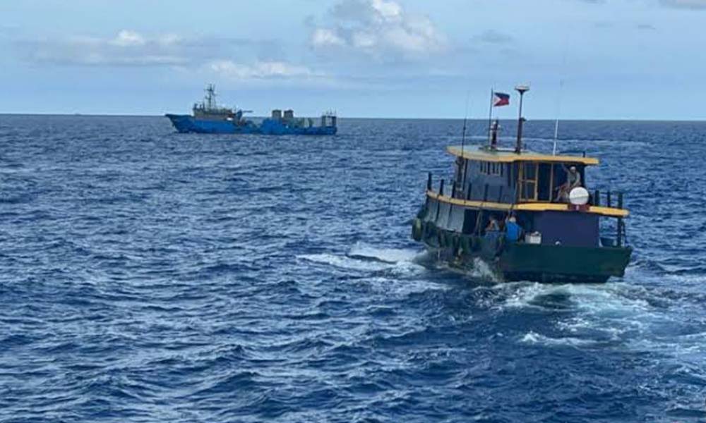
Further reinforcement of China’s sovereignty includes Japan’s renunciation of claims to the islands in the 1951 San Francisco Peace Treaty and the 1952 Sino-Japanese Peace Treaty. China’s Ministry of Foreign Affairs has repeatedly protested against the occupation of the islands by Vietnam and the Philippines, asserting sovereignty over the Nansha and Xisha Islands.
Vietnam
Vietnam was divided into North and South Vietnam before 1975. South Vietnam was called the Republic of Vietnam, which existed from 1954 to 1975. North Vietnam defeats South Vietnam in 1975. The unified Vietnam is called the Democratic Republic of Vietnam. The Vietnamese attitude toward China’s claim of sole sovereignty over the Paracel Islands is different.
The Republic of Vietnam’s Take
The Republic of Vietnam initiated both legal and military actions to challenge China’s sovereignty claims in the South China Sea by deploying troops to some of the Paracel and Spratly Islands. On July 30, 1971, the Republic of Vietnam issued a “Declaration on the Sovereignty of the Republic of Vietnam over the Archipelagos of Paracels and Spratly,” presenting five points to support its claim. First, in 1802, Emperor Gia Long established a “Dio Hoang Sa” (Company of the Paracels) to oversee the exploitation of these islands. Second, in 1830, under Emperor Minh Mang, the “Truong Sa” (Spratly) Islands were included as part of Vietnamese territory on the kingdom’s first maps. Third, the French government, representing the Vietnamese empire, officially took possession of the Spratly Islands in 1930 and 1933, notifying foreign powers of this by a letter dated September 29, 1933. Fourth, during the 1951 San Francisco Peace Conference, Japan renounced all territories seized during World War II, including the Spratly and Paracel Islands, and the Vietnamese delegate’s statement of sovereignty over these islands went unchallenged. Fifth, on October 22, 1956, the president of the Republic of Vietnam placed the Spratly Islands under the administration of Ba Ria Province, asserting that the Republic of Vietnam fulfilled the conditions required by the 1885 convention on territorial competency.
In a significant move, on January 19 and 20, 1974, the Republic of Vietnam deployed troops to six of the fifteen major Paracel Islands. In response, the PRC sent warships to defend the Xisha Islands, forcing the South Vietnamese to retreat. Despite this military conflict, no resolution was reached before the collapse of the Republic of Vietnam in 1975. The position of the Democratic Republic of Vietnam on the sovereignty of the South China Sea islands has been inconsistent. Before the unification of North and South Vietnam, the Democratic Republic of Vietnam recognized Chinese sovereignty over the Xisha and Nansha Islands, avoiding conflict. On June 15, 1956, Vice-Foreign Minister Un Van Khiem acknowledged to Li Zhimin, Charge d’Affaires of the Chinese Embassy in Vietnam, that according to Vietnamese data, the Xisha and Nansha Islands were historically part of Chinese territory, citing their inclusion in Chinese records dating back to the Song dynasty. This acknowledgment was reiterated on September 4, 1958, when the PRC declared a twelve-nautical-mile territorial sea, including these islands. The Vietnamese government, led by Premier Pham Van Dong, expressed support for this declaration, further affirming Chinese sovereignty over these islands.
However, since 1974, the Democratic Republic of Vietnam has reverted to its earlier stance, asserting Vietnamese sovereignty over these islands in its White Book. This document references the Dai Nam Thuo Ching Bien (Official Chronicles of Dai Nam), which records the occupation of the Hoang Sa Islands by King Gia Long in 1816. The White Book claims that the Truong Sa Archipelago, historically called Sai Truong Sa, refers to the Nansha Islands. However, historical records suggest that Sai Truong Sa was along the Vietnamese coast, not where China’s Nansha Islands are located. This legal dispute escalated into military conflict when the PRC ousted Vietnamese forces from the islands. One of the most distinctive features of the Paracel Islands is Dragon Hole, the world’s deepest underwater sinkhole. The islands are home to seabirds and sea turtles and experience a hot, humid climate with substantial rainfall and the potential for annual typhoons. The seafloor around the archipelago contains untapped oil and gas reserves, surrounded by rich fishing grounds. The tropical weather in the region is significantly influenced by monsoonal winds, which blow from the southwest in summer and from the northeast in winter. The southern basin receives annual rainfall ranging from about 80 inches (2,000 mm) to over 120 inches (3,000 mm), with frequent summer typhoons.
End Note
As of 2024, the ownership of the Paracel Islands remains a contentious issue. China maintains de facto control over the islands, having established a strong military and civilian presence. Vietnam, however, asserts its claim based on historical and legal grounds, challenging China’s control. Meanwhile, Taiwan also maintains a smaller but significant presence in the area, further complicating the dispute. The ongoing tensions over the Paracel Islands reflect the broader geopolitical struggles in the South China Sea, where access to valuable resources and strategic maritime routes are at stake.