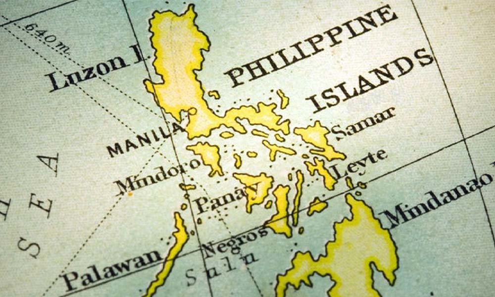
The Panatag Shoal dispute is a microcosm of the larger geopolitical contest for the South China Sea. Known locally as Bajo de Masinloc and in China as Huangyan Island, this triangle-shaped coral atoll is not just a fishing ground, it is a test case for sovereignty, international law, and great-power rivalry. At the heart of the latest controversy is China’s “new map” and freshly declared maritime baselines. For years Beijing has relied on its nine-dash line to justify sweeping claims, but the unveiling of new baselines around Scarborough Shoal marks an escalation, an effort to turn maps into “facts on the water.”
Behind these moves lie powerful economic and strategic drivers. The South China Sea carries over $3 trillion in annual trade, holds rich oil and gas reserves, and supports vital fisheries, making it a lifeline for regional economies and a cornerstone of China’s naval ambitions. To achieve its goals, China employs a dual-track strategy: hard power through coast guard deployments, maritime militia, and artificial islands and soft power through ASEAN diplomacy and claims of peaceful intent. This mix of muscle and rhetoric allows Beijing to advance without triggering outright war.
All of this explains why Panatag Shoal has once again become a flashpoint in the South China Sea, a high-stakes test of whether international law, freedom of navigation, and regional sovereignty can stand firm against a determined bid for maritime dominance.
Points of Contention
At the heart of the latest South China Sea tensions are multiple overlapping disputes that China’s new maritime baselines have only inflamed. The Spratly Islands, claimed by China, the Philippines, Vietnam, Malaysia, Brunei, and Taiwan, have seen extensive Chinese land reclamation and militarization, with radar, runways, and missile systems turning reefs into forward operating bases. Farther north, the Paracel Islands, claimed by China, Taiwan, and Vietnam, remain a flashpoint after the 2014 oil-rig crisis showed how quickly economic moves can spiral into maritime standoffs.
The danger is clearest at Panatag Shoal (Scarborough Shoal), where 2025 has brought a series of sharp skirmishes. By mid-September, Chinese and Philippine ships had collided, with Beijing accusing a Philippine vessel of “deliberately ramming” a coast guard ship, a charge Manila flatly denies. Philippine officials countered that Chinese water cannons damaged a government vessel and injured a crew member. Then, in September 2025, China declared part of Panatag Shoal a “national nature reserve,” a move condemned by Manila and allies such as the United States, where Secretary of State Marco Rubio called it “destabilizing”. At the same time, China’s maritime militia, ostensibly fishing trawlers but trained to assist its navy and coast guard has swarmed the area, blurring the line between civilian and military action.
These clashes all unfold against the backdrop of China’s updated “new map,” which draws fresh maritime baselines around contested reefs and effectively extends its ten-dash line claim across almost the entire South China Sea. International legal experts and governments from Malaysia, Vietnam, and the Philippines view the map as a direct violation of UNCLOS and the 2016 Hague arbitral ruling that rejected China’s historic claims. The result is mounting diplomatic backlash and rising risk of miscalculation, as each side accuses the other of trespassing and provocation.
Taken together, the militarized Spratlys and Paracels, the violent encounters near Panatag Shoal, and China’s cartographic expansion form one continuous flashpoint, a high-stakes contest over whether international law or raw power will decide the future of the South China Sea.
Points of Contention
The South China Sea remains one of the world’s most dangerous geopolitical flashpoints, and the release of China’s new maritime baselines has further intensified disputes that stretch from the Spratly Islands to Panatag (Scarborough) Shoal and the Paracel Islands.
Spratly and Paracel Islands
The Spratly Islands, a scattered group of reefs and atolls claimed by China, the Philippines, Vietnam, Malaysia, Brunei, and Taiwan, lie at the heart of overlapping maritime claims. Over the past decade, China has transformed at least seven Spratly features through massive land reclamation, building radar stations, runways capable of hosting fighter jets, deep-water harbors, and missile systems. These fortified outposts give Beijing the ability to monitor or disrupt international shipping and military movements across key trade corridors. Further north, the Paracel Islands, claimed by China, Taiwan, and Vietnam, present their own risks. In 2014, China’s sudden decision to install a giant oil rig in waters claimed by Vietnam sparked weeks of ramming incidents, anti-China protests, and a near-military confrontation, showing how an economic move can rapidly escalate into a broader crisis.
Recent Skirmishes and Escalations around Panatag Shoal
The danger is currently most acute at Panatag Shoal, where 2025 has seen a pattern of escalating confrontations. By mid-September, Chinese and Philippine ships had collided near the shoal, with Beijing alleging that a Philippine vessel “deliberately rammed” one of its coast guard ships, a charge that Manila strongly denies. Philippine officials countered that two Chinese coast guard ships fired high-pressure water cannons for nearly half an hour, damaging the BRP Datu Gumbay Piang and injuring a crew member. These are not isolated acts of harassment; they are high-risk encounters that endanger lives and test the resolve of both nations.
The tension escalated further when China announced in September 2025 that it would designate parts of Panatag Shoal as a “national nature reserve.” While presented as an environmental initiative, Manila and its allies, including the United States, immediately denounced the plan as a coercive maneuver aimed at legitimizing permanent Chinese control. U.S. Secretary of State Marco Rubio called the move “destabilizing,” warning that it undermines freedom of navigation and the global rules-based order. On the water, China’s People’s Armed Forces Maritime Militia (PAFMM), civilian fishing vessels trained and equipped to support the Chinese navy and coast guard has swarmed the area, allowing Beijing to project force while maintaining plausible deniability.
Controversy of the New Map and Maritime Baselines
All of these incidents are magnified by China’s controversial new map and its freshly declared maritime baselines. This updated map extends the infamous nine-dash line into a “ten-dash line”, enclosing almost the entire South China Sea and now including a dash east of Taiwan. More significantly, Beijing in late 2024 published precise geographical coordinates, “new baselines” around Scarborough Shoal, which China calls Huangyan Dao. International maritime law experts see this as a direct violation of the United Nations Convention on the Law of the Sea (UNCLOS), which defines maritime entitlements and served as the basis for the 2016 Hague arbitral ruling that invalidated China’s historic claims.
The diplomatic backlash has been swift. Malaysia, Vietnam, and the Philippines have formally rejected the new map and baselines, arguing that they ignore international law and escalate regional tensions. Manila has filed fresh protests and rallied international partners, while Hanoi and Kuala Lumpur have warned that such unilateral steps increase the risk of accidental clashes and destabilize Southeast Asia’s security environment. Each new Chinese patrol or enforcement action invites accusations of trespassing and provocation, heightening the chance of a miscalculation at sea.
A Broader Struggle Over Maritime Order
Viewed together, the militarized Spratlys and Paracels, the violent encounters near Panatag Shoal, and China’s cartographic expansion form a single, interconnected pattern. It is a contest over who sets the rules of maritime conduct: internationally recognized law or the raw application of power. Every Chinese baseline announcement, every coast guard ramming, and every militia swarm forces regional states and the global community to confront a fundamental choice between defending UNCLOS or allowing unilateral claims to stand.
In this way, the Points of Contention in the South China Sea are not simply regional disputes; they represent a decisive global test of international law, freedom of navigation, and collective security in one of the world’s busiest and most strategically vital waterways.
1 Philippine Navy Vessel Against 22 Chinese Ships at Scarborough Shoal
Geopolitical Stakes and Future Implications
The latest Chinese push at Panatag (Scarborough) Shoal is more than a sovereignty quarrel between Manila and Beijing. It is a high-stakes geopolitical confrontation whose ripple effects stretch across the Indo-Pacific and the global maritime order.
A. Philippines’ Response
The Philippines has doubled down on a strategy of legal protest and on-the-ground action. President Ferdinand Marcos Jr. has vowed that the nation will not “lose an inch” of its territory, underscoring Manila’s red-line commitment to defend its Exclusive Economic Zone (EEZ). Within hours of China’s September 2025 plan to designate parts of Panatag Shoal as a “national nature reserve,” the Philippine Department of Foreign Affairs lodged a formal diplomatic protest, branding the move “illegitimate and unlawful.” These filings add to the nearly 200 protests submitted since mid-2022, each one meant to document violations and reinforce the Philippines’ legal position under UNCLOS and the 2016 Hague arbitral ruling.
Diplomacy is backed by hard security measures. The 1951 U.S.–Philippines Mutual Defense Treaty, reaffirmed and clarified in 2024 and 2025, now explicitly covers attacks on Philippine forces, aircraft, and public vessels “anywhere in the South China Sea.” This update serves as a powerful deterrence, signaling that any armed assault could bring an American military response. Manila has also expanded joint naval patrols, intelligence sharing, and military exercises with the United States, Japan, and Australia, strengthening its ability to monitor and respond to Chinese incursions.
B. Broader Geopolitical Stakes
The South China Sea is a maritime artery for roughly one-third of all global shipping and over $3 trillion in annual trade. For Washington and its partners, the stakes are immense: if China’s new map and maritime baselines go unchallenged, freedom of navigation could erode, weakening the U.S. strategic presence in the western Pacific. To keep sea lanes open, the U.S. Navy and allied navies conduct regular “freedom of navigation operations” (FONOPs), deliberately sailing near contested features to assert international rights.
This volatile environment is accelerating military modernization across Asia. Countries such as Japan, Australia, Vietnam, and India are buying advanced submarines, long-range missiles, and surveillance systems at a record pace. Defense analysts warn that this arms buildup, driven partly by Chinese actions, could trigger a full-blown regional arms race, raising the risk of accidental clashes and miscalculations.
The standoff is also testing the cohesion of the Association of Southeast Asian Nations (ASEAN). Some members, notably Vietnam and the Philippines, are tightening security ties with the U.S. and its allies, while others, such as Cambodia and Laos, are leaning closer to China due to economic dependence. This strategic divergence undermines ASEAN’s long-standing principle of neutrality and consensus, making it harder for the bloc to speak with one voice on South China Sea issues.
$35B War Machine: How the Philippines is Reshaping Its Military!
Future Implications
While most confrontations have remained below the threshold of armed combat, the risk of miscalculation is constant and growing. A minor collision or accidental injury, like the September 2025 water-cannon attack that damaged the BRP Datu Gumbay Piang and injured a Filipino crew member, could serve as the “red line” that neither Beijing nor Manila intends to cross but may find unavoidable. Given the U.S. defense commitment, such an incident could rapidly draw in major powers, escalating into a regional or even global crisis.
China’s decision to label parts of Panatag Shoal a “national nature reserve” introduces a new tactic with far-reaching implications. By cloaking territorial expansion in environmental language, Beijing could set a dangerous precedent for using conservation claims to legitimize sovereignty grabs. Analysts warn that similar tactics might later be applied to other disputed areas, from the Spratlys to the Senkaku/Diaoyu Islands, effectively turning ecological protection into a geopolitical weapon.
Perhaps the most subtle but consequential risk is the gradual normalization of China’s presence. By repeatedly dispatching coast guard vessels, maritime militia, and naval escorts, and by issuing new maps and baselines, Beijing aims to make its control appear routine and inevitable. Over time, these “gray-zone” tactics could create a new status quo in which China exercises de facto authority, even if international law continues to reject its claims.
In sum, the confrontation over Panatag Shoal is a global test of maritime order. It combines legal disputes, military maneuvering, and environmental pretexts into a challenge that threatens freedom of navigation, regional stability, and the credibility of international law. The choices made in the coming months, by the Philippines, China, the United States, and ASEAN will shape the strategic landscape of the Indo-Pacific for decades to come.
Philippines on HIGH ALERT as 3 Chinese Warships Enter Disputed Waters
Conclusion
The Panatag Shoal dispute encapsulates the broader geopolitical contest over the South China Sea, where economic resources, maritime rights, and strategic sea lanes converge. China’s release of a new map with expanded maritime baselines and its “nature reserve” declaration are the latest moves in a long-term strategy to cement control, using a mix of legal claims, coast guard deployments, and maritime militia to create facts on the water.
The Philippines, backed by allies such as the United States, Japan, and Australia, has responded with strong diplomacy and an increasingly capable defense posture, vowing not to yield “an inch of territory.” Yet the region’s future will depend on a delicate balance between persistent diplomacy and the ever-present risk of armed conflict, where a single miscalculation at sea could trigger a wider confrontation.
Ultimately, the outcome of this dispute will set powerful precedents. It will determine not only the sovereignty and economic rights of nations bordering the South China Sea, but also the strength of international law and the trajectory of power dynamics across the Indo-Pacific. Whether rules or raw power prevail at Panatag Shoal will echo far beyond these contested waters, shaping the maritime order of the 21st century.