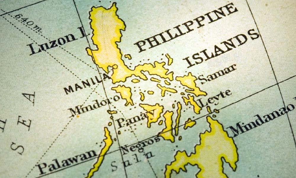
Recently, the Philippines has taken a decisive step to assert its territorial rights in the South China Sea by preparing to release an updated map that reflects its maritime entitlements in line with the 2016 arbitral ruling and the United Nations Convention on the Law of the Sea (UNCLOS). This new map is a clear response to China’s controversial “10-dash line” map, which claims nearly the entire South China Sea. The updated map will delineate areas such as the Kalayaan Island Group, Scarborough Shoal, Macclesfield Bank, and the Benham Rise—territories that the Philippines has long claimed as its own. Furthermore, the map will define the West Philippine Sea as the country’s 200-nautical-mile Exclusive Economic Zone (EEZ), separating it from the broader South China Sea, and thereby strengthening the Philippines’ sovereignty over these regions.
This move was prompted by the release of China’s updated “10-dash line” map in 2023, which extended China’s territorial claims even further, overlapping with the EEZs of several Southeast Asian nations, including the Philippines. The Philippine government responded swiftly, formally rejecting this new map, which contradicts the 2016 arbitral tribunal ruling that invalidated China’s sweeping claims in the South China Sea. The tribunal had affirmed that certain features in the Spratly Islands fall within the Philippine EEZ. Despite this legal victory, China continues its claims in defiance of international law, leading the Philippines to take a firm stance in defense of its sovereignty. The creation of the updated map is part of a broader diplomatic effort to assert the Philippines’ rights, and it will undergo rigorous vetting to ensure it aligns with international law and the arbitral ruling.
An intriguing aspect of the updated map is the inclusion of Sabah, a territory currently under Malaysia’s control but historically linked to the Philippines through the Sultanate of Sulu. This issue dates back to the 15th century when the Sultanate of Sulu came into possession of the region after assisting Brunei in a civil conflict. In 1878, the Sultan of Sulu leased Sabah to the British North Borneo Chartered Company, a lease that the Philippines argues never amounted to a transfer of sovereignty. After the formation of Malaysia in 1963, which included Sabah, the Philippines formally asserted its claim. Although Malaysia considers the issue settled, interpreting the 1878 agreement as a cession, the Philippines continues to lay claim to the region, albeit without actively pursuing it in recent years.
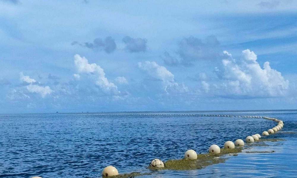
The maritime confrontation in the South China sea is part of a broader pattern of ongoing tension between China and the Philippines over sovereignty in the South China Sea. Scarborough Shoal has long been a flashpoint, and despite the 2016 arbitral ruling, China has maintained a heavy presence in the area, effectively blocking Philippine vessels from accessing this traditional fishing ground. The Philippines has responded by asserting its territorial claims more forcefully, and in recent months, it has enacted two significant pieces of maritime legislation—the Maritime Zones Act and the Archipelagic Sea Lanes Act—aimed at further strengthening its territorial integrity. In response, China has issued threats of “necessary measures” to protect its sovereignty.
The South China Sea dispute remains a complex and multifaceted issue, involving overlapping claims from multiple nations, including China, the Philippines, Malaysia, Brunei, Vietnam, and Indonesia. The region is of immense strategic importance, with vital trade routes that handle over $3 trillion in annual commerce. The United States, a longstanding ally of the Philippines, has warned China against aggressive actions, reaffirming its commitment to the Mutual Defense Treaty with the Philippines. Meanwhile, ASEAN nations find themselves caught between maintaining ties with China, an economic powerhouse, and upholding international law in the face of Beijing’s expanding maritime claims. As tensions escalate, the risk of miscalculation grows, and the future of peace and stability in the region remains uncertain. The Philippines, undeterred, is resolutely moving forward in asserting its sovereignty, with its own new map and standing firm in its diplomatic protests against China’s actions.
Historical Philippine Maps
The 1734 Velarde map, one of the earliest representations of the Philippines, offers significant historical insights into the territorial boundaries during the Spanish Empire. This map is a valuable artifact that reveals the territorial scope claimed by the Spanish colonial authorities, providing a snapshot of the Philippines during that period. The map is particularly noteworthy for its depiction of the islands, which showcases the colonial boundaries in a way that highlights the era’s geopolitical landscape. In 2024, the National Historical Commission of the Philippines (NHCP) initiated the “Landas ng Pagkabansa” (Path of Nationhood) project to honor the nation’s history. As part of this initiative, NHCP will install 43 new historical markers across Luzon, intended to commemorate key events and milestones in the journey to Philippine independence. This project is part of the broader 125th Anniversary of Philippine Independence, celebrated from 2023 to 2026.
The “Landas ng Pagkabansa” project is a pivotal effort to highlight the heroism and sacrifices of Filipinos in the fight for independence, tracing the history from the 1898 declaration of independence in Kawit, Cavite, to the end of the First Philippine Republic in 1901 in Palanan, Isabela. The 43 markers will be installed in key provinces such as Bulacan, Nueva Ecija, Tarlac, Pangasinan, La Union, Ilocos Sur, Mountain Province, and Ifugao. These markers are not only educational but also serve as reminders of the heroism and sacrifices of local communities and individuals who contributed to the independence movement. Dr. Emmanuel Calairo, NHCP chairperson, emphasized that these markers aim to remind Filipinos of the historical events that shaped their nation and the enduring spirit of their ancestors.
In parallel to this commemoration, the Philippine government is set to release a new map that will reflect the country’s territorial claims, including the West Philippine Sea and Benham Rise, which is now referred to as “Talampas ng Pilipinas.” This updated map, developed by the National Mapping and Resource Information Authority (NAMRIA), will incorporate the maritime zones and features recognized under the United Nations Convention on the Law of the Sea (UNCLOS), along with the 2016 arbitral award. According to NAMRIA Director Peter Tiangco, this map will clearly delineate areas where the Philippines has sovereignty and sovereign rights, providing legal clarity and standing up to international scrutiny. The map will also include the exact coordinates of key maritime features and will be published once the rules for the Philippine Maritime Zones Act are finalized.
The release of this updated map coincides with the ongoing tensions in the South China Sea, particularly in the West Philippine Sea, where the Philippines has faced increasing aggression from China. The Philippine government has filed multiple diplomatic protests against China’s actions, including the incidents of Chinese vessels firing of water cannons at Philippine vessels. As of December 2024, the Philippine government has filed 60 protests against China’s aggressive maritime actions this year alone, bringing the total to 193 protests since the administration of President Ferdinand Marcos Jr. These protests highlight the Philippines’ strong opposition to China’s expansive claims in the South China Sea, which are largely based on the controversial “New ten-dash line.”
The diplomatic disputes with China have intensified, with China defending its actions as necessary to protect its perceived territorial rights, particularly in the disputed areas such as Scarborough Shoal. In response, the Philippine government has repeatedly condemned these actions, emphasizing that they are illegal under international law, particularly the 1982 UNCLOS. Despite these tensions, the Philippines remains resolute in defending its sovereignty and maritime rights, using both diplomatic channels and legal instruments to assert its position in the ongoing territorial dispute.
Updated Philippine Map to Counter China’s Claims
In 2024, the National Mapping and Resource Information Authority (NAMRIA) announced plans to release a new and updated official map of the Philippines. This initiative aligns with the 2016 arbitral ruling and the United Nations Convention on the Law of the Sea (UNCLOS), aiming to assert the Philippines’ maritime entitlements and counter China’s controversial “10-dash line” claim. The updated map will reflect the provisions of the newly enacted Philippine Maritime Zones Act, which clearly defines the country’s maritime zones, including the West Philippine Sea. NAMRIA Administrator Undersecretary Peter Tiangco emphasized that this new map will align with international standards and Philippine constitutional mandates, marking a significant step forward in the nation’s defense of its sovereignty.
The updated map will accurately delineate the Philippines’ exclusive economic zone (EEZ) and continental shelf, ensuring compliance with UNCLOS and highlighting maritime boundaries with precision. This delineation is crucial for promoting environmental protection by identifying and preserving marine ecosystems and biodiversity. Additionally, the map will enhance navigation safety for both commercial and military vessels in the South China Sea by providing clear and reliable maritime charts. Administrator Tiangco noted that the previous map was based on historical agreements like the Treaty of Paris, but the new version reflects modern legal frameworks, particularly UNCLOS and national legislation.
Strategically, the updated map serves as a powerful diplomatic tool to counter China’s expansive claims over the South China Sea, now outlined in its “10-dash line” map. These claims overlap with the exclusive economic zones of the Philippines and other Southeast Asian nations, which have led to tensions in the region. By asserting its maritime rights through an internationally compliant map, the Philippines seeks to strengthen its position in upholding the 2016 arbitral ruling that invalidated China’s excessive territorial claims. Furthermore, the updated map reaffirms the Philippines’ sovereignty over the West Philippine Sea and provides a legal basis for protecting its maritime resources and enforcing territorial boundaries.
The release of the updated map is expected to garner significant international support, reinforcing the Philippines’ stance in global forums and promoting a rules-based maritime order in the Indo-Pacific region. NAMRIA is currently in the final stages of the vetting process, involving consultations with various government agencies to ensure accuracy and consistency with existing laws. While awaiting the Implementing Rules and Regulations (IRR) of the Philippine Maritime Zones Act, NAMRIA has prepared the delineation of maritime zones and archipelagic sea lanes in compliance with constitutional and international provisions.
Legal Basis and Regional Implications
The National Mapping and Resource Information Authority (NAMRIA) announced the forthcoming release of an updated Philippine map that aligns with the United Nations Convention on the Law of the Sea (UNCLOS) and the newly enacted Philippine Maritime Zones Act (Republic Act No. 12064). Signed into law by President Ferdinand Marcos Jr., this act defines the geographical extent of the country’s maritime zones, including its exclusive economic zone (EEZ) and continental shelf. The new map aims to reinforce the Philippines’ sovereign rights, particularly in disputed areas such as the Kalayaan Island Group, Scarborough Shoal, and the West Philippine Sea, while promoting compliance with international maritime standards.
The updated map is part of a broader strategy to counter China’s contentious “10-dash line” claim, which extends its territorial assertions over most of the South China Sea, overlapping with the EEZs of the Philippines and other neighboring nations. NAMRIA Administrator Peter Tiangco highlighted the “big difference” between the Philippine map, which is rooted in legal frameworks such as UNCLOS, and China’s maps, which lack international legal support. This updated map, once published, will pinpoint the Philippines’ lawful claims and strengthen its position in international discussions regarding maritime disputes.
A key focus of the new map is the promotion of sustainable maritime practices. It highlights areas of environmental importance, reaffirming the Philippines’ commitment to marine biodiversity conservation and the responsible use of marine resources. Additionally, the map provides a clear delineation of maritime boundaries, which is critical for ensuring navigation safety for commercial and military vessels operating in the South China Sea. By establishing precise territorial markers, the map enhances maritime security and supports safe passage for international shipping lanes.
Complementing this initiative, President Marcos also signed the Philippine Archipelagic Sea Lanes Act (Republic Act No. 12065), which outlines designated routes for foreign vessels and aircraft passing through Philippine waters, in accordance with UNCLOS and the Chicago Convention on International Civil Aviation. Together, these legislative measures support the Philippines’ sovereignty, protect its maritime domain, and establish a rules-based framework for managing its territorial waters.
Significance of the Map
The release of the new Philippine map will mark a historic moment, being the first update since the landmark 2016 arbitral ruling by The Hague, which invalidated China’s sweeping claims in the South China Sea. The map will highlight the Philippines’ sovereign rights and maritime entitlements recognized under international law, particularly the United Nations Convention on the Law of the Sea (UNCLOS). Anchored in the Philippine Maritime Zones Act, this legal framework clarifies the country’s maritime domain and provides a basis for asserting its rights in contested waters. Unlike China’s recently revised 10-dash line map, the Philippines’ updated map stands firmly on legal grounds, reinforcing its territorial and maritime claims through globally recognized norms.
A key feature of the updated map is the incorporation of the Philippine Rise (formerly Benham Rise), a 13-million-hectare undersea plateau located 250 kilometers east of northern Luzon. Approved by the United Nations in 2012 as part of the Philippines’ extended continental shelf, the Philippine Rise is rich in marine biodiversity, including coral reefs, algae, and sponges that sustain various fish species. Its potential goes beyond ecology, with vast deposits of methane hydrates and other valuable seabed resources such as cobalt-rich ferromanganese crusts. These minerals hold promise for the aerospace industry and global energy needs, further emphasizing the region’s strategic and economic significance.
The Philippine government has undertaken extensive scientific initiatives in the Philippine Rise, highlighted by marine expeditions like the 2017 Coordinated National Marine Scientific Research Initiatives and Related Activities (CONMIRA). Research efforts have uncovered its role as the country’s most productive tuna fishing ground and explored opportunities for renewable energy and marine biotechnology. Oceanographers are also studying currents and physical processes to better understand typhoon patterns, benefiting not just the Philippines but the entire region. Amidst maritime disputes in the West Philippine Sea, the Philippine Rise offers a secure area for continued research, illustrating the balance between scientific pursuits and national sovereignty.
The new map also integrates the West Philippine Sea, reflecting the Philippines’ ongoing efforts to counter China’s aggressive actions and reinforce its sovereign rights. President Ferdinand Marcos Jr.’s administration has prioritized these updates as part of broader maritime legislation, including the Philippine Archipelagic Sea Lanes Act. This law establishes regulated routes for foreign military and civilian vessels, ensuring compliance with UNCLOS and the Chicago Convention. By updating its map and implementing robust legal measures, the Philippines not only asserts its territorial integrity but also enhances regional stability in the face of growing tensions in the South China Sea.
https://indopacificreport.com/2024/02/07/why-brp-sierra-madre-is-important-for-the-philippines/
Regional Tensions Over China’s New Map
In 2024, tensions surrounding China’s updated 10-dash line map remain high, with strong protests from India, the Philippines, Malaysia, Vietnam, and Taiwan. Released in August 2023, the map asserts expansive territorial claims, including disputed areas in the South China Sea and the Indian state of Arunachal Pradesh, as well as the Aksai Chin plateau. India, which considers Arunachal Pradesh its territory, was the first to issue a formal protest, with External Affairs Minister S. Jaishankar denouncing China’s claims as “absurd.” Other nations have followed suit, rejecting the map’s validity under international law. The Philippines has declared the map “illegal” and cited a 2016 Hague tribunal ruling that invalidated China’s claims. Vietnam and Malaysia have issued similar statements, emphasizing violations of their sovereignty and exclusive economic zones (EEZs). Taiwan, claimed by China as a province, has also reiterated its independent status.
China’s map introduces a tenth dash east of Taiwan, intensifying regional disputes. It reaffirms its territorial claims over nearly all of the South China Sea, encroaching on areas claimed by Brunei, Indonesia, Malaysia, the Philippines, and Vietnam. The map has also raised concerns about China’s intentions regarding Taiwan. The dispute further extends to historical contentions, such as the inclusion of Russia’s Bolshoy Ussuriysky Island, despite a 2008 treaty resolving the matter. Analysts view this move as China’s attempt to assert dominance and revive irredentist territorial ambitions.
Military maneuvers and diplomatic posturing have escalated as nations push back against China’s assertions. China’s Coast Guard has intensified patrols in contested waters, leading to confrontations with Philippine vessels and sparking fears of potential conflict. In response, countries like Malaysia and Vietnam have sought clarity and pressed for adherence to international law, particularly the United Nations Convention on the Law of the Sea (UNCLOS). These actions are compounded by the involvement of external powers like the United States, which has criticized China’s claims and pledged support for its regional allies. The Philippines and Vietnam have emphasized the importance of UNCLOS as the basis for resolving disputes and rejected China’s narrative of historical sovereignty.
Critics argue that the map’s timing reflects a calculated move by China to stir debate, ensuring its claims dominate diplomatic discussions. Analysts like James Chin of the University of Tasmania suggest that Beijing’s intent is to maintain its territorial claims at the forefront of regional politics while signaling defiance of the 2016 Hague ruling. This strategy reinforces China’s nationalist rhetoric under President Xi Jinping and highlights its willingness to assert dominance despite international criticism. However, countries like India and the Philippines have countered with public rallies, cultural events, and strong diplomatic protests, while others, such as Vietnam, prefer quieter opposition through Communist Party channels.
Despite widespread criticism, China remains resolute in enforcing its territorial claims. Beijing defends the map as a routine administrative publication, urging other nations to view it “objectively.” However, experts warn that the map risks escalating regional tensions, particularly in the South China Sea, a vital trade route with an estimated $5 trillion in annual trade passing through it. Analysts foresee heightened military encounters and closer interactions between China and U.S.-allied forces operating in the region. While countries like Malaysia, Vietnam, and the Philippines continue to voice opposition, their ability to compel China to alter its stance remains limited. The 10-dash line thus symbolizes China’s broader strategy of territorial assertion and its unyielding approach to regional disputes.
https://indopacificreport.com/2024/01/09/what-are-the-most-pressing-challenges-for-the-philippines-in-2024/