Philippines Is Turning Pag-asa Island Into a Military Stronghold Against China!
A small island in the middle of the South China Sea is gradually becoming one of the most important locations in the Philippines’ maritime security strategy. Pag-asa Island, located within the disputed Spratly Islands, is receiving new infrastructure investments that could significantly improve Manila’s ability to maintain its presence in the West Philippine Sea. Runway improvements, the development of a sheltered harbor, new Philippine Air Force facilities and an expanded Coast Guard presence are changing the island’s strategic importance For years, the Philippines has faced serious challenges in maintaining its presence on remote features in the Spratly Islands. Long supply routes, difficult weather conditions and China’s expanding military infrastructure have limited the country’s ability to operate effectively in the area. Pag-asa has remained an important symbol of Philippine sovereignty, but its geographical isolation has made it difficult to transform that presence into a sustainable security position. The latest infrastructure projects suggest that Manila is beginning to address some of these long-standing weaknesses.
The development raises an important strategic question: Could Pag-asa eventually become a frontline military support hub capable of supporting surveillance, maritime security, logistical operations and regular military activities? The answer depends on whether the Philippines can turn its infrastructure investments into long-term operational capabilities. Building a runway or harbor is only the beginning. A reliable forward security position also requires trained personnel, continuous supplies, modern communications, maintenance facilities and the ability to operate under pressure The island’s future also has wider implications for the regional balance of power. As competition between China and the Philippines continues in the South China Sea, stronger facilities on Pag-asa could help Manila protect its maritime interests and improve its ability to respond to developments around nearby reefs and islands. However, the Philippines must also consider the financial, logistical and diplomatic challenges involved in strengthening such an exposed position.
Why Does Pag-asa Island Matter to the Philippines?
Pag-asa Island is the largest Philippine-occupied feature in the Kalayaan Island Group and serves as the administrative centre of the Municipality of Kalayaan. Covering approximately 37.2 hectares, it is located around 508 kilometres northwest of Puerto Princesa in Palawan. Unlike many other features in the Spratly Islands, Pag-asa has a permanent civilian community, making it important not only for national security but also for the Philippines’ continuing administrative and civilian presence in the area. Its importance extends beyond its physical size because of its location near several strategically significant maritime features Geography is one of the main reasons Pag-asa holds such importance in Philippine security planning. The island is situated near other Philippine-occupied features, including Lawak, Kota, Likas and Parola, while China’s major installation at Subi Reef is also located nearby. This geographical position gives Pag-asa considerable value for monitoring maritime activity and supporting government operations across the surrounding waters. It provides Manila with a permanent foothold in an area where several countries maintain competing territorial and maritime claims.
US Expands Basa Air Base to Strengthen Philippines Defense Against China
The island also helps demonstrate that the Philippines maintains an active civilian and administrative presence in the Spratlys. Sovereignty and maritime rights disputes are not determined simply by the presence of infrastructure, but maintaining communities, government services and regular official activities can reinforce a country’s practical presence in a contested region. For the Philippines, Pag-asa represents more than a remote settlement. It is an important part of its national position in the West Philippine Sea and a location from which government agencies can continue their activities. Its proximity to important maritime routes adds another dimension to its strategic value. The waters surrounding the Spratly Islands are connected to major regional shipping routes that support international trade and energy transportation. Any significant disruption in this maritime environment could affect regional economic stability. Although Pag-asa cannot independently control these routes, stronger facilities could help Philippine authorities improve monitoring, coordinate maritime patrols and respond more effectively to incidents involving foreign vessels.
Another important factor is the island’s potential role as a logistical centre. At present, maintaining a permanent presence in such a remote location requires considerable effort. Supplies, construction materials, fuel, medical equipment and personnel must travel long distances from the Philippine mainland. Better airport and harbor facilities could make these movements more reliable and reduce the difficulties associated with supporting government personnel and residents. This would allow the Philippines to maintain its presence with greater consistency rather than depending entirely on occasional supply missions. Pag-asa’s strategic value should therefore be understood through three connected factors: geography, permanent national presence and logistical potential. Its location provides an important observation and support position, its civilian community strengthens the country’s administrative presence, and improved infrastructure could make long-term operations more sustainable. These factors explain why Manila is investing in the island despite the significant costs and challenges involved.
The Military Imbalance Around the Spratly Islands
The Philippines is developing Pag-asa in a strategic environment where China already possesses a substantial military and surveillance advantage. Over the past decade, Beijing has transformed several occupied features in the Spratly Islands into major artificial-island installations. Subi Reef, Mischief Reef and Fiery Cross Reef are particularly important because they contain extensive infrastructure designed to support sustained military and maritime operations far from mainland China. These installations have changed the regional security environment and created additional challenges for smaller countries with limited resources. China’s facilities include long runways, aircraft hangars, port infrastructure, radar systems, communications equipment and other logistical support facilities. These capabilities allow Chinese aircraft and maritime vessels to operate more effectively across the South China Sea. They also support intelligence, surveillance and reconnaissance activities, helping Beijing monitor the movement of foreign aircraft and vessels. A December 2025 assessment by the Asia Maritime Transparency Initiative identified additional intelligence, surveillance and electronic warfare-related infrastructure at China’s three major Spratly outposts, highlighting the growing sophistication of its regional presence.
The advantage is not limited to the physical infrastructure on these reefs. China can connect its forward installations to a much larger network involving the People’s Liberation Army Navy, China Coast Guard and maritime militia. This combination allows Beijing to maintain a continuous presence, monitor important locations and respond to developments across several parts of the South China Sea. Its ability to coordinate different maritime and military organizations gives it greater operational flexibility than the Philippines currently possesses in the region. The Philippines faces a very different situation. Its occupied features are generally smaller, its supply routes are longer and its available maritime and aerialresources are more limited. Maintaining personnel, equipment and regular patrols in the Spratly Islands requires significant financial and logistical support. Even when Philippine authorities identify unusual activity, responding effectively can be difficult because of the distances involved and the presence of larger Chinese vessels and surveillance platforms.
The pressure surrounding Philippine operations became particularly visible in September 2026, when the Philippine Coast Guard reported that Chinese forces had fired flares toward an unarmed Philippine Coast Guard aircraft conducting a maritime awareness flight near Subi and Mischief reefs. Such incidents demonstrate the difficulties faced by Philippine authorities when carrying out routine surveillance activities in contested waters. They also show that even non-combat operations can become sensitive security encounters when multiple countries are attempting to maintain their presence in the same maritime area. This military imbalance explains why the development of Pag-asa has become increasingly important for Manila. The Philippines cannot immediately reproduce the extensive infrastructure China has established across the Spratly Islands. However, it can improve its own position by investing in reliable transportation, surveillance facilities, communications and logistical support. A better-equipped Pag-asa could help reduce some of the operational disadvantages faced by Philippine agencies and provide a more dependable location for coordinating activities around nearby features.
The Runway: Turning Pag-asa Into an Important Air Support Position
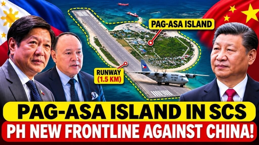
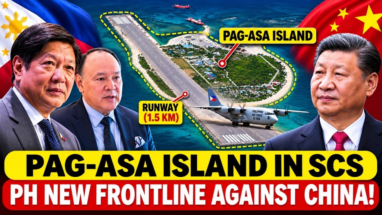
One of the most significant parts of Pag-asa’s development is the improvement of its airfield. For many years, the island’s approximately 1.3-kilometre runway restricted the types of aircraft that could operate there and limited the frequency of air movements. These restrictions created practical problems for transporting personnel, delivering urgent supplies and supporting government activities. In a remote location surrounded by contested waters, dependable air access is particularly important because maritime transportation can become difficult during periods of rough weather or heightened tensions. The Philippine government allocated PHP1.65 billion for airport development in its 2025 national budget, with plans to extend the runway towards approximately 1.5 kilometres. The investment reflects Manila’s intention to improve access to the island and strengthen its ability to support activities in the West Philippine Sea. An improved runway could make it easier to transport personnel and equipment, support emergency medical evacuations and provide more reliable access for government and military aircraft.
A major development occurred on April 23, 2026, when the Philippine Air Force inaugurated its completed Basing Support System on Pag-asa Island. The project included a new hangar and runway improvements intended to strengthen the Air Force’s ability to support operations in the area. This development is important because it moves the island beyond basic airfield access and provides additional infrastructure for maintaining an official military aviation presence. Further progress was indicated by satellite imagery reported by Janes in November 2026. According to the report, imagery captured on August 14 showed substantial progress on runway extension works, alongside a largely completed sheltered harbor. These developments suggest that the Philippines is gradually improving the island’s ability to receive aircraft and vessels. However, the completion of construction work should not automatically be interpreted as the establishment of a fully operational military airbase.
There is an important difference between having a runway capable of receiving aircraft and possessing the infrastructure required to support regular military aviation operations. Aircraft need aviation fuel, ground-handling equipment, maintenance facilities, trained technicians, spare parts and secure communications. Emergency services and reliable electricity are also necessary. Without these supporting capabilities, even a substantially improved runway may remain limited in the number and types of missions it can support. For the Philippine Air Force, the immediate value of the improved airfield may lie in transportation, surveillance support, logistical missions and selected military aviation activities. These functions could improve the movement of personnel, help government agencies respond to emergencies and strengthen the country’s ability to monitor developments around the Spratly Islands. The runway could also provide additional flexibility during situations when maritime access becomes difficult.
The Sheltered Harbor: Solving Pag-asa Island’s Supply Problem
One of the biggest challenges facing the Philippines in the Spratly Islands is the difficulty of maintaining reliable supply routes. Pag-asa is located hundreds of kilometres from the Philippine mainland, making the transportation of fuel, food, construction materials, military equipment and essential supplies a demanding task. Unlike major military bases with established ports and transportation networks, the island has historically faced limitations in receiving vessels, particularly during periods of rough weather. These difficulties affect not only military activities but also the daily lives of the civilian population living on the island. Without dependable maritime access, even well-developed facilities can become difficult to maintain over time. The development of a sheltered harbor is therefore one of the most strategically important infrastructure projects on Pag-asa. The Philippine government identified PHP300 million for the project, which is intended to provide a protected harbor basin where vessels can approach the island and unload supplies with greater reliability. According to satellite imagery reported by Janes in November 2026, imagery captured in August showed a fully enclosed harbor basin along the island’s northwestern coast. The project appeared operational or close to becoming operational, representing an important improvement in the island’s maritime infrastructure.
The harbor could significantly improve the movement of essential supplies. Philippine government vessels, Coast Guard ships and other authorized vessels could benefit from better access when delivering fuel, food, medical equipment and construction materials. This would make it easier to support civilian services while also improving the logistical capacity of government agencies operating in the surrounding waters. A more reliable harbor could also reduce the difficulties associated with unloading supplies during unfavourable sea conditions, although weather and maritime security risks would continue to affect operations.From a military perspective, the combination of an improved runway and a sheltered harbor could make Pag-asa a more effective forward support location. Air transportation can move personnel, urgent equipment and smaller supplies relatively quickly, while maritime transportation is more suitable for carrying heavier materials and larger quantities of provisions. Together, these facilities could create a more flexible transportation system and reduce the island’s dependence on a limited number of supply methods. This flexibility would be particularly important during emergencies or periods of increased regional tension.
Strengthening Philippine Control Around Pag-asa
Infrastructure becomes strategically meaningful only when the government has the personnel and organizational capacity to use it effectively. A runway, harbor and support building cannot independently maintain national presence or respond to maritime incidents. They require trained personnel, clear command arrangements, reliable communications and continuous operational coordination. This is why the growing presence of the Philippine Air Force and Coast Guard on Pag-asa is an important part of the island’s transformation. Their activities could help Manila move from maintaining a symbolic presence towards developing a more organized and sustainable security position. The Philippine Air Force’s new Basing Support System provides an important foundation for supporting aviation-related activities. The facility can help improve the organization’s ability to maintain personnel and coordinate operations on the island. Better aviation infrastructure could support transportation, surveillance-related missions, emergency responses and the movement of essential equipment. However, the effectiveness of these facilities will depend on regular staffing, maintenance arrangements and the availability of the resources required to keep them operational.
The Philippine Coast Guard has also taken steps to strengthen its organizational presence in the Kalayaan Island Group. On April 9, 2026, the Coast Guard District Kalayaan Island Group was launched, upgrading the local organizational structure into a full-fledged district. This development is significant because it provides a stronger institutional framework for maritime law enforcement, search and rescue, maritime monitoring and coordination. A more organized Coast Guard presence can help Philippine authorities respond to incidents more consistently rather than relying entirely on occasional patrols from distant locations.mThe importance of this development became visible on October 25, 2026, when Philippine Coast Guard personnel detected a foreign fishing vessel approximately 2.7 nautical miles west of Pag-asa, near Sandy Cay. A response boat challenged the vessel and escorted it outside the island’s territorial sea. The Coast Guard also reported that a China Coast Guard vessel and two rigid-hull inflatable boats monitored the operation. The incident demonstrated how a permanent local presence can help Philippine authorities identify maritime activity and respond directly when foreign vessels approach the island.
What Would Make Pag-asa a Genuine Frontline Military Stronghold?
Transforming Pag-asa into a genuine frontline security position will require much more than improving its runway and building a sheltered harbor. These facilities provide important foundations, but a sustainable military support hub needs several capabilities working together. The Philippines must develop a system that can monitor surrounding waters, support personnel, maintain communications, protect essential infrastructure and continue operations even when access becomes difficult. The island’s strategic value will depend on how effectively Manila connects its local facilities to the country’s wider defense and maritime security network. The first major requirement is reliable surveillance and early warning. Philippine authorities need the ability to identify approaching vessels, monitor aircraft movements and understand what is happening around nearby reefs and maritime features. Radar systems, maritime patrol aircraft, unmanned aerial vehicles and secure communication networks could contribute to this objective. However, collecting information is only one part of the process. Surveillance data must also reach the relevant command authorities quickly so that officials can assess developments and decide how to respond. Better maritime domain awareness would allow the Philippines to identify unusual activity earlier and improve coordination between the Coast Guard, Navy and Air Force.
The second requirement is sustainable aviation support. The improved runway will have limited value if aircraft cannot be maintained or supplied regularly. Aviation operations require fuel storage, ground-handling equipment, spare parts, trained technicians and appropriate maintenance facilities. The Philippines must also ensure that emergency services and communication systems are available whenever aircraft operate from the island. These requirements become even more important if Manila intends to increase the frequency of military and government flights. A dependable airfield should be capable of supporting regular operations rather than serving only as an occasional landing location. Maritime security is another essential requirement. The sheltered harbor could improve access for Philippine vessels, but the country must maintain enough ships and trained personnel to use the facility effectively. Coast Guard vessels could support maritime law enforcement and monitoring, while the Navy could contribute to broader defense activities. Coordination between these services would help improve patrol planning, information-sharing and emergency responses. Without sufficient vessels and logistical resources, the harbor may improve physical access without producing a major change in the Philippines’ operational presence.
Command and control capabilities will also determine whether Pag-asa can function as a reliable forward security position. Personnel stationed on the island must remain connected to national defense authorities and relevant operational commands. Secure communications, dependable electricity and reliable information-sharing systems are essential for coordinating activities over long distances. If communications are interrupted or information cannot be shared quickly, the island’s ability to respond to unexpected developments could be seriously reduced. Strong command arrangements are therefore just as important as physical infrastructure. Another major requirement is logistical resilience. The Philippines must establish dependable systems for storing fuel, food, medical supplies, spare parts and other essential equipment. Backup electricity, water supplies, emergency medical support and maintenance facilities would help reduce the island’s dependence on immediate resupply from the mainland. These requirements may appear less visible than military aircraft or advanced surveillance equipment, but they often determine whether remote facilities can remain operational for extended periods. A forward position that cannot support its personnel during difficult conditions cannot provide lasting strategic value.
About Indo-Pacific Report
For more geopolitical analysis, strategy coverage, and Indo-Pacific security reporting, visit Indo-Pacific Report:
Website
Facebook
YouTube
Philippines Is Turning Pag-asa Island Into a Military Stronghold Against China!