Philippines Maps Thitu Island in the South China Sea — China Is Watching
The Philippines is putting increasing attention on the geography, infrastructure and government presence surrounding Thitu Island, also known as Pag-asa Island, in the disputed South China Sea. At first glance, a more detailed maritime map may appear to be a technical development involving coordinates, water depths, coastlines and navigational features. But the significance of Thitu goes far beyond cartography. The island has become an important part of the Philippines’ wider strategy to maintain its presence in the Kalayaan Island Group while using international law, maritime documentation, civilian administration and Coast Guard operations to support its position.
Why Thitu Island Is So Important to the Philippines
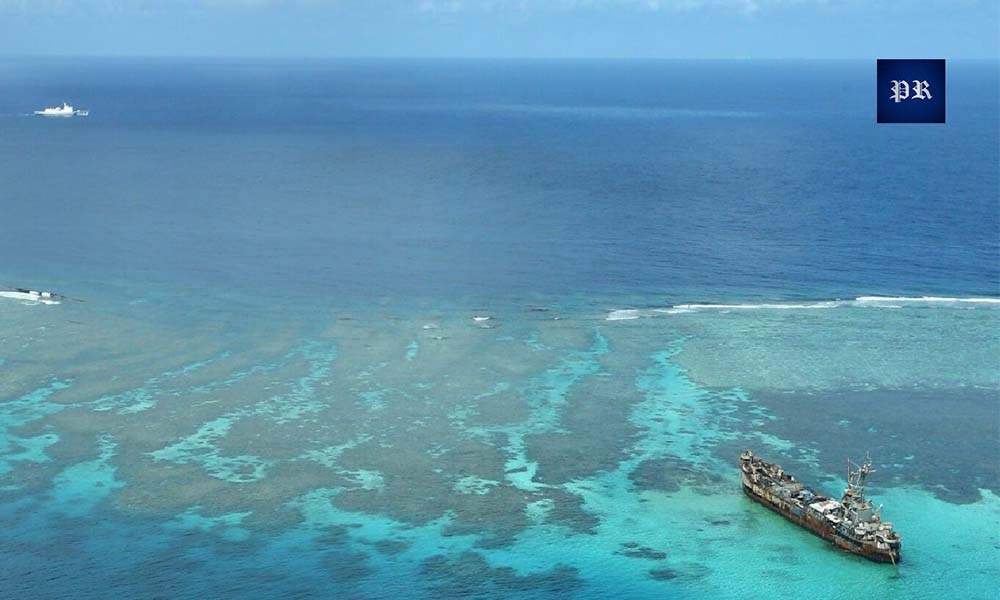
Thitu Island, known as Pag-asa Island in the Philippines and Zhongye Dao in China, is one of the most important Philippine-held features in the Spratly Islands. It is administered by the Philippines as part of Kalayaan municipality in Palawan and is particularly significant because it is not merely an unoccupied maritime feature. A permanent civilian community lives there, while Philippine government agencies maintain facilities and conduct activities in and around the island.
That civilian presence gives Thitu a different character from many other contested features in the South China Sea. People live on the island, receive government services and depend on regular supplies and transportation. The Philippines has therefore had to think about Thitu not only as a territorial and maritime issue but also as a functioning community that requires electricity, water, communications, transportation, emergency services, security and other forms of public support.
The geographical position of Thitu also contributes to its importance. The island is located within the Spratly Islands, an area where several governments maintain competing territorial and maritime claims. Chinese-controlled Subi Reef is relatively close, while Vietnam and Taiwan also maintain claims involving features in the Spratlys. This means that Philippine activities on Thitu take place in an environment where other governments are closely watching developments.
For Manila, maintaining Thitu is therefore about more than simply demonstrating that a Philippine flag is present. It involves ensuring that Philippine personnel and civilians can remain there, that the island can be supplied, that government agencies can operate effectively and that the surrounding maritime area can be monitored.
This is where mapping becomes important. A government cannot effectively manage or document a maritime position without knowing precisely where geographical features are located and how they relate to surrounding waters. Nautical charts provide information that can support navigation, maritime safety, government operations and legal documentation. They do not automatically determine sovereignty, but they can make a country’s position more precise and easier to communicate.
Why a More Precise Maritime Map Matters
Maritime disputes are often discussed in political language, but many of their underlying questions are highly geographical. The exact location of a feature, whether it is above water at high tide, whether it is a low-tide elevation or another type of maritime feature, and how it relates to surrounding waters can have major legal consequences under the United Nations Convention on the Law of the Sea. UNCLOS establishes different maritime zones, including territorial seas, contiguous zones, exclusive economic zones and continental shelves. The legal character of geographical features is important because not every feature generates the same maritime entitlements. This is one reason why precise hydrographic information matters in the South China Sea. For the Philippines, detailed mapping can provide a more consistent geographical foundation for government statements and maritime operations. Instead of referring generally to a large disputed area, authorities can identify specific coordinates, features and maritime spaces. This becomes particularly useful when governments exchange diplomatic protests or when an incident occurs involving coast guard, fishing or other vessels. The important point is that a map supports a legal position; it does not automatically create that legal position. A chart cannot simply transform a disputed island into undisputed territory. Likewise, submitting a chart to the United Nations does not mean that the UN has awarded sovereignty to the country that submitted it.
The United Nations’ system for depositing charts under UNCLOS is primarily about giving publicity to official maritime information. The Philippines’ August 2026 deposit of the Bajo de Masinloc and Approach chart is an example of this process. The UN record states that the chart concerns normal baselines as well as the outer limits of the territorial sea and contiguous zone. That distinction is important when discussing Thitu. The strategic value of Philippine mapping should not be exaggerated into a claim that a new chart alone will settle the South China Sea dispute. Its value is more practical. It gives Manila a clearer documentary foundation for explaining its geographical position and can become one element of a larger legal and diplomatic record. The United Nations element of the story deserves particular attention because international filings can easily be misunderstood. When a government deposits a maritime chart with the UN, the action creates an official international record of what that government has submitted. It does not mean that the UN has examined every underlying territorial dispute and issued a ruling accepting the submitting country’s sovereignty claims. The Philippines has used international legal mechanisms and maritime documentation for many years. The country has made previous deposits relating to its archipelagic baselines, continental shelf and other maritime information. The UN’s current deposit database records the Philippines’ August 2026 Bajo de Masinloc filing under Article 16(2) of UNCLOS.
What the 2016 South China Sea Arbitration Means for Thitu
The 2016 South China Sea arbitration remains one of the most important legal developments behind the Philippines’ approach to maritime disputes with China. The case was initiated by the Philippines under UNCLOS and examined questions involving historic rights, maritime entitlements, the legal status of certain features and the lawfulness of certain Chinese actions in the South China Sea. The tribunal concluded that China’s claims to historic rights in areas of the South China Sea beyond the maritime entitlements allowed by UNCLOS had no legal effect. It also addressed the legal status of several South China Sea features and concluded that none of the high-tide features of the Spratly Islands considered in the proceedings generated an exclusive economic zone or continental shelf. However, the arbitration award has to be understood correctly. It did not decide sovereignty over individual islands and did not draw a maritime boundary between China and the Philippines. This is one of the most important distinctions in the entire South China Sea debate. In other words, the arbitration ruling did not simply declare every disputed feature to be Philippine territory. Instead, it dealt with questions under UNCLOS, including the legal limits of maritime entitlements and the effect of historic-rights claims. For Manila, the ruling remains an important legal reference. The Philippines continues to describe UNCLOS and the 2016 award as central elements of its approach to the West Philippine Sea, while China continues to reject the arbitration award. This disagreement means the South China Sea remains an active geopolitical and legal dispute. Better mapping around Thitu can therefore matter without being described as a solution to the dispute. Accurate geography allows the Philippines to explain its position within the legal framework it relies upon, while the continuing dispute shows that legal documentation and physical presence must operate alongside diplomacy.
This makes the wording around Thitu especially important. It would be inaccurate to say that the United Nations has already accepted a new Philippine Thitu map as proof of sovereignty unless a separate official filing is confirmed. A more accurate interpretation is that Manila is continuing a wider effort to use maritime charts, coordinates, legislation and international procedures to make its maritime position more clearly documented. That distinction also makes the story more credible for readers. South China Sea disputes are complicated enough without turning every map, filing or infrastructure project into an automatic legal victory. The Philippines itself continues to rely on UNCLOS and the 2016 arbitration award as important parts of its legal position, but those instruments do not eliminate every territorial dispute in the region. The value of international documentation is therefore cumulative. Each official filing, chart or government statement can contribute to a longer documentary record. Over time, that record can make it easier for Manila to explain what it claims, where it claims it and which legal framework it believes applies.
Thitu Is Becoming More Than a Remote Philippine Outpost
The most significant part of the Thitu story may not be the map itself. It may be the fact that the Philippines is simultaneously developing the island’s physical and administrative capacity. Thitu has received infrastructure improvements designed to make the island more accessible and sustainable. Development of the runway, port and other facilities has been connected to the Philippines’ wider effort to improve access to its remote outposts in the West Philippine Sea. These projects are relevant not only to security but also to civilian life because a remote island requires dependable transportation and logistics.
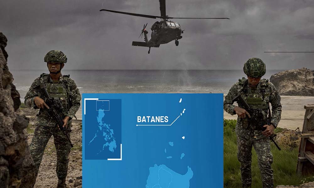
The Philippine Coast Guard has also expanded its presence on Thitu. The establishment of a dedicated Coast Guard command on the island in 2026 added another layer of Philippine government activity in the area. The Coast Guard’s role includes maritime law enforcement, monitoring, environmental protection and search-and-rescue responsibilities, giving its presence a broader function than conventional military deployment. This distinction matters. Coast guard activity is increasingly important across the South China Sea because many encounters occur below the level of direct military confrontation. Government vessels, fishing boats and maritime law-enforcement agencies frequently operate in the same contested waters. The presence of a permanent Philippine Coast Guard command can therefore improve Manila’s ability to monitor activity and respond to incidents around Thitu. Infrastructure also changes the practical meaning of presence. A government can claim an island, but maintaining people and institutions there requires supplies, transportation, communications, electricity, water and emergency support. The more developed the island becomes, the easier it can be for Manila to sustain its civilian and administrative presence. That does not mean infrastructure changes the legal status of Thitu automatically. It does not. But it does mean that the Philippines is increasing the practical sustainability of its presence.
France Joins the Philippines’ Luzon Corridor China Is Watching!
China Is Watching What Happens Around Thitu
The civilian population on Thitu is one of the most important aspects of the island’s story because it creates a continuous human presence in a remote and contested environment. Residents of Pag-asa depend on the Philippine government for basic services and access. Schools, communications, transportation, medical assistance, food supplies and other public services all become more complicated when the community is located far from the Philippine mainland. This is why infrastructure projects on Thitu cannot be viewed exclusively through a military lens. A better runway can support civilian transportation. A better harbour can make deliveries safer and more reliable. Improved communications can help residents communicate with authorities. Better power and water systems can improve everyday life. At the same time, the civilian presence has political and administrative significance. It demonstrates that Thitu is not simply an empty reef identified on a government map. There is a functioning community connected to Philippine institutions. But this point also needs to be treated carefully. Civilian residence does not automatically settle sovereignty under international law. The existence of a population can contribute to the practical administration of a territory, but territorial disputes are determined through the relevant legal and historical frameworks rather than by population alone. The strongest interpretation is therefore that the civilian community reinforces the practical reality of Philippine administration without independently resolving the underlying territorial dispute.
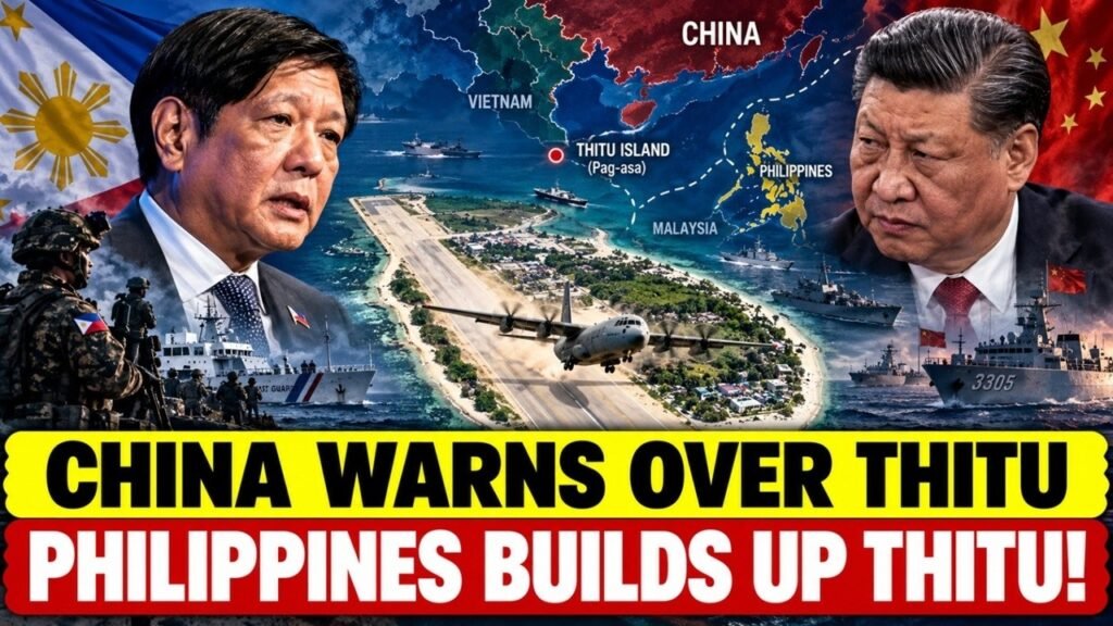
The reason Thitu attracts so much attention is that Philippine activity does not occur in isolation. China maintains a competing claim to the feature and has significant military and maritime infrastructure elsewhere in the Spratly Islands. Chinese vessels have been observed around Philippine-held features, including Thitu. This means Manila’s infrastructure projects and government activities are taking place in an environment of continuous maritime observation. China’s presence in the Spratly Islands has also changed the strategic environment over the past decade. Several reefs have been transformed through reclamation and construction, creating large artificial-island facilities with runways, ports and other infrastructure. For the Philippines, this creates a difficult strategic environment. Manila wants to maintain its presence and improve the living conditions and security of its personnel and civilians, but it also has to manage the possibility that increased activity could produce more encounters with Chinese vessels. That is why the Thitu story should not be described simply as a military confrontation. Much of the competition takes place through coast guard activity, maritime surveillance, infrastructure development, fishing access, diplomatic statements and legal documentation. These actions are often described as part of a gray-zone environment because they can influence control and presence without necessarily crossing the threshold into direct armed conflict.
Thitu Shows How Maritime Competition Is Changing
The South China Sea is increasingly becoming an environment where physical infrastructure and legal documentation work together. A harbour can make an island easier to supply. A runway can make it easier to reach. A Coast Guard command can provide permanent government presence. A civilian population can create continuity. A maritime chart can provide precise geographical information. A diplomatic filing can put a government’s position into an international record. None of these actions alone determines sovereignty. Their importance comes from their cumulative effect. This is particularly relevant for a country like the Philippines, which does not possess the same overall military resources as China. Manila therefore has increasingly relied on a combination of legal arguments, diplomacy, coast guard operations, transparency, alliances and infrastructure. The strategy is less about one dramatic action and more about maintaining a consistent presence over time. That is why the phrase “the map is only the beginning” captures an important part of the broader story. The map matters because it is connected to everything happening around it. Without physical presence, the map would remain largely documentary. Without legal documentation, physical activity could be harder to place within Manila’s stated legal framework.
One of the biggest advantages of detailed maritime mapping is that it allows governments to move away from vague geographical language. A broad statement about “the South China Sea” can cover an enormous area and may leave readers unclear about the precise location involved. A nautical chart can identify individual islands, reefs, shoals, coastlines, baselines and navigational features. This matters whenever a maritime incident occurs. If a Philippine Coast Guard vessel encounters another vessel near a particular feature, precise geographical information can help authorities explain where the incident happened. If Manila issues a diplomatic protest, the government can identify the relevant coordinates. If a legal question arises, officials can refer to specific geographical evidence rather than relying entirely on broad political language. This is one reason official charts can have long-term strategic value even when they do not immediately change the situation at sea. The Philippines’ verified 2026 UN filing involving Bajo de Masinloc demonstrates that Manila is continuing to use the international deposit system to publicize official maritime information. The UN record specifically identifies the chart as relating to normal baselines and the outer limits of the territorial sea and contiguous zone. The lesson for Thitu is not that a new map will settle sovereignty. The lesson is that geographical precision can become an important part of how a country documents and communicates its maritime position.
The Philippines Is Building Four Connected Forms of Presence Around Thitu
The developments around Thitu can be understood through four connected forms of presence: physical, civilian, administrative and legal. Physical presence comes from infrastructure. Roads, buildings, communications systems, port facilities, runway improvements and other projects make the island more accessible and sustainable. Without this infrastructure, maintaining a permanent community and government presence would be significantly more difficult. Civilian presence comes from the people who live on Pag-asa. Their daily lives create a continuing human connection between the island and the Philippine state. They require government services, transportation, communications and basic infrastructure, which in turn encourages Manila to maintain regular administrative attention. Administrative presence comes from Philippine government institutions, including the Coast Guard. These agencies give Manila the ability to perform practical functions such as maritime monitoring, law enforcement, search and rescue and environmental protection.
Legal and diplomatic presence comes from charts, coordinates, legislation, official statements, international filings and references to UNCLOS and the 2016 arbitration award. These mechanisms allow the Philippines to explain its position beyond the immediate physical environment of the island. The significance lies in the connection between these layers. Infrastructure supports civilians. Civilians require administration. Administration requires maritime access. Legal documentation helps explain the geographical and legal basis of the state’s position. This makes Thitu an important case study in modern maritime competition. A Philippine map cannot force China to recognize Philippine sovereignty. It cannot automatically settle competing claims by Vietnam or Taiwan. It cannot alter the military balance in the South China Sea. It cannot prevent vessels from entering disputed waters. It cannot eliminate the possibility of diplomatic confrontation. Likewise, infrastructure does not automatically create sovereignty. A harbour is an infrastructure project. A runway is an infrastructure project. A Coast Guard facility is a government installation. None of these, by itself, constitutes a final legal determination of territorial ownership. The same caution applies to international filings. A United Nations deposit creates an official record of information submitted by a state, but it does not mean that the UN has adjudicated the entire territorial dispute. This is why the most rational way to understand Manila’s approach is as a long-term process of documentation and presence rather than a single decisive action. The Philippines is trying to make its position clear, sustainable and continuously documented. That is different from claiming that a map will settle the dispute overnight.
Why the Strategy Could Also Increase Tensions
Strengthening Thitu has advantages, but it also carries risks. The more infrastructure Manila develops, the more important the island may become to the broader strategic environment. More Philippine Coast Guard activity can result in more encounters with Chinese vessels. Better maritime access can lead to increased Philippine operations. Greater civilian and government activity can generate additional surveillance. This creates a delicate balance. Manila wants to maintain its presence and protect its interests without turning every routine maritime encounter into a crisis. China, meanwhile, has its own claims and strategic interests in the Spratly Islands. The result is an environment in which relatively small incidents can acquire much greater political significance. That is why coast guard communication, maritime safety procedures and diplomatic channels remain important. The objective is not simply to increase presence but to maintain that presence without allowing routine competition to escalate into a military confrontation. A more detailed map can actually be useful in this environment because it is one of the least kinetic tools available to a government. It provides information and documentation without placing another armed platform into a disputed waterway.
When all of these developments are considered together, Manila’s objectives become easier to understand. The first objective is greater geographical clarity. The Philippines wants its official maritime information to be precise enough that government agencies, diplomats and international observers understand exactly what geographical areas are being discussed. The second objective is documentation. International maritime disputes can last for decades, and governments need records showing how their positions have developed over time. Official charts and international filings can become part of that documentary history. The third objective is administrative continuity. Maintaining civilians, public services and government institutions on Thitu demonstrates that the island remains an active part of Philippine administration in practical terms. The fourth objective is sustainability. Infrastructure allows the Philippines to maintain activity on a remote island that would otherwise be extremely difficult and expensive to support. The fifth objective is maritime presence. A Coast Guard command provides a regular government presence in surrounding waters and gives Manila additional capacity for monitoring, enforcement and emergency response. None of these objectives independently settles sovereignty. Their combined effect, however, can make the Philippine position more organized, visible and sustainable.
The Real Test Comes After the Map
The most important question is therefore not whether the Philippines can produce a more detailed chart. The more important question is what happens after the chart, mapping work or maritime documentation becomes part of a wider national strategy. Will infrastructure on Thitu continue to improve? Will the harbour become more useful for civilian and government access? Will runway improvements make transportation more reliable? Will the Coast Guard maintain a sustainable presence? Will the civilian community receive better public services? Will Manila continue to use UNCLOS and international mechanisms to document its maritime position? And perhaps most importantly, how will China respond? These questions will tell observers much more about the future significance of Thitu than any single map. The South China Sea dispute is unlikely to be transformed by one document. It is shaped by repeated actions over many years. Ships patrol. Coast guards monitor. Civilians live on islands. Governments build infrastructure. Officials issue diplomatic protests. Countries submit maritime documents. International courts and tribunals interpret legal rules.Thitu sits directly inside this larger process.
 The real story behind the Philippines’ mapping efforts around Thitu is therefore more complicated and more interesting than the idea of a new map changing the South China Sea overnight. A map can provide geographical precision. A UN filing can create an international documentary record. Infrastructure can make an island more accessible. A harbour can improve logistics. A runway can improve transportation. A Coast Guard command can strengthen government maritime presence. A civilian population can provide continuity. But none of these developments automatically settles sovereignty. The Philippines is instead building a long-term position through multiple connected actions. Its approach combines international law, maritime documentation, civilian administration, infrastructure, Coast Guard activity and diplomacy. The 2016 South China Sea arbitration remains an important legal reference for Manila, while UNCLOS continues to provide the broader legal framework for maritime rights and responsibilities. The most accurate way to describe the Thitu strategy is therefore one of persistence. Manila is trying to document its position, maintain its civilian community, improve the infrastructure that supports the island, strengthen government activity and keep its maritime claims visible internationally.
About Indo-Pacific Report
For more geopolitical analysis, strategy coverage, and Indo-Pacific security reporting, visit Indo-Pacific Report:
Website
Facebook
YouTube
Philippines Maps Thitu Island in the South China Sea — China Is Watching