U.S. Turning the Philippines Into a FRONTLINE Base Against China
Explore how the U.S.-Philippines alliance, EDCA, and the First Island Chain are reshaping Indo-Pacific security and strategic competition with China. The Indo-Pacific has become the center of global strategic competition. One question increasingly asked is whether the United States is transforming the Philippines into a frontline state against China. This article examines the geography, history, EDCA, the First Island Chain, and the strategic calculations of Washington, Manila, and Beijing in a balanced, reader-friendly way.
Is the United States turning the Philippines into a frontline base against China?
At first glance, the answer appears obvious. American troops are returning to the Philippines. New military facilities are being built. Advanced missile systems are appearing across the Western Pacific. Joint military exercises are growing larger and more frequent. And Chinese military analysts increasingly describe the Philippines as a critical component of America’s strategy to contain China’s rise. But the real story is more complicated.
The United States is not rebuilding the massive military bases that once dominated Subic Bay and Clark Air Base during the Cold War. Instead, Washington is constructing something far more flexible—and potentially far more consequential: a dispersed network of military access, logistics hubs, missile deployments, and allied partnerships stretching across the First Island Chain.
The Philippines sits at the centre of this emerging strategic architecture.
Positioned between the South China Sea and the Pacific Ocean, lying just south of Taiwan, and occupying one of the world’s most important maritime crossroads, the Philippines has become increasingly important to American strategy, increasingly concerning to Chinese planners, and increasingly exposed to the risks of great-power competition.
The question, therefore, is no longer whether the Philippines matters.
The question is whether geography is transforming the Philippines into the new frontline of the twenty-first century’s most important geopolitical rivalry.
There are moments in history when a country does not choose to become strategically important.
History chooses it.
Imagine waking up in a small island province in the northern Philippines and discovering that your hometown has suddenly become important to military planners in Washington, Beijing, Tokyo, and Canberra.
Nobody declared war
No shots were fired.
Yet American military aircraft begin appearing more frequently overhead. Joint military exercises expand across nearby provinces. Anti ship missile systems arrive on neighboring islands. Chinese military analysts publish reports discussing the strategic importance of your region. And thousands of miles away, officials in Washington quietly describe your homeland as one of the most critical pieces of the Indo-Pacific security architecture.
For decades after the Cold War, many believed that the Philippines had escaped the frontlines of great-power competition. The American flag had been lowered at Subic Bay. Clark Air Base had fallen silent. Globalization, trade, and economic growth appeared to have replaced the geopolitics of military confrontation.
But geography never disappears.
Stretching between the South China Sea and the Pacific Ocean, positioned along the First Island Chain, and lying just a few hundred kilometers from Taiwan, the Philippines was never merely another Southeast Asian nation. It was, and remains, one of the world’s most important strategic crossroads.
Today, as rivalry between the United States and China intensifies, that geography is once again shaping history.
The question, therefore, is no longer whether the United States is returning to the Philippines.
The real question is what kind of return this actually is.
The United States has been here before.
Long before the phrase “Indo-Pacific strategy” entered the vocabulary of diplomats and military planners, American strategists understood a simple geopolitical reality: whoever wished to project power across the Western Pacific could not afford to ignore the Philippines.
Following the Spanish-American War of 1898, the United States acquired the Philippine Islands and quickly recognized their strategic value. Over the following decades, America built one of its most important overseas military networks there. Subic Bay became one of the largest naval facilities outside the continental United States. Clark Air Base evolved into one of America’s most critical air power hubs in Asia. During World War II, during the Korean War, during the Vietnam War, and throughout the Cold War, the Philippines served as a central pillar of American
strategy in the Pacific
For nearly half a century, this military architecture formed part of Washington’s broader strategy of containing rival powers across Eurasia. The Philippines was not merely an ally. It was a geographic anchor of American power.
The collapse of the Soviet Union transformed the strategic landscape. In 1991, the Philippine Senate rejected the extension of American military basing rights. By 1992, the American flag had been lowered at Subic Bay and Clark Air Base. To many observers, it appeared that an entire chapter of history had come to an end.
The assumption seemed reasonable.
The Cold War was over. Great-power rivalry appeared to be fading. Globalization, trade, and economic integration were supposed to replace geopolitics as the dominant force shaping international relations.
But history has a habit of returning through geography.
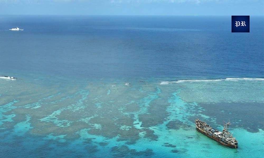
As China’s economic and military power expanded in the early twenty-first century, the strategic map of Asia began to change. Chinese coast guard vessels pushed deeper into waters in the South China Sea. Chinese naval forces expanded into the Western Pacific at an unprecedented pace. Taiwan once again emerged as one of the world’s most dangerous geopolitical flashpoints. And suddenly, military planners in Washington found themselves staring at a map they had never truly forgotten.
Because the geography had never changed.
The Philippines still sat astride the South China Sea. It still occupied a critical section of the First Island Chain. It still controlled some of the most important maritime approaches between East Asia and the Pacific Ocean. And it still lay only a few hundred kilometers from Taiwan.
By the early 2020s, Washington rediscovered something it had always known, but had briefly convinced itself it no longer needed to remember:
The Philippines occupies one of the most strategically valuable positions on Earth.
To understand why the United States is returning to the Philippines, one must first understand a geographical concept that has shaped Asian geopolitics for generations: the First Island Chain.
Stretching from Japan through Okinawa, across Taiwan, through the northern Philippines, and into the South China Sea, this chain of islands forms one of the most important strategic barriers on Earth.
For military planners in Washington, it represents a defensive perimeter.
For military planners in Beijing, it represents a strategic constraint.
And for the Philippines, it represents destiny.
This geography shapes almost every major security question in the Indo-Pacific. It influences access to the Pacific Ocean. It affects the defense of Taiwan. It shapes maritime trade routes carrying trillions of dollars in commerce. And in any future conflict, it could determine whether Chinese naval forces remain confined to regional waters or break into the wider Pacific.
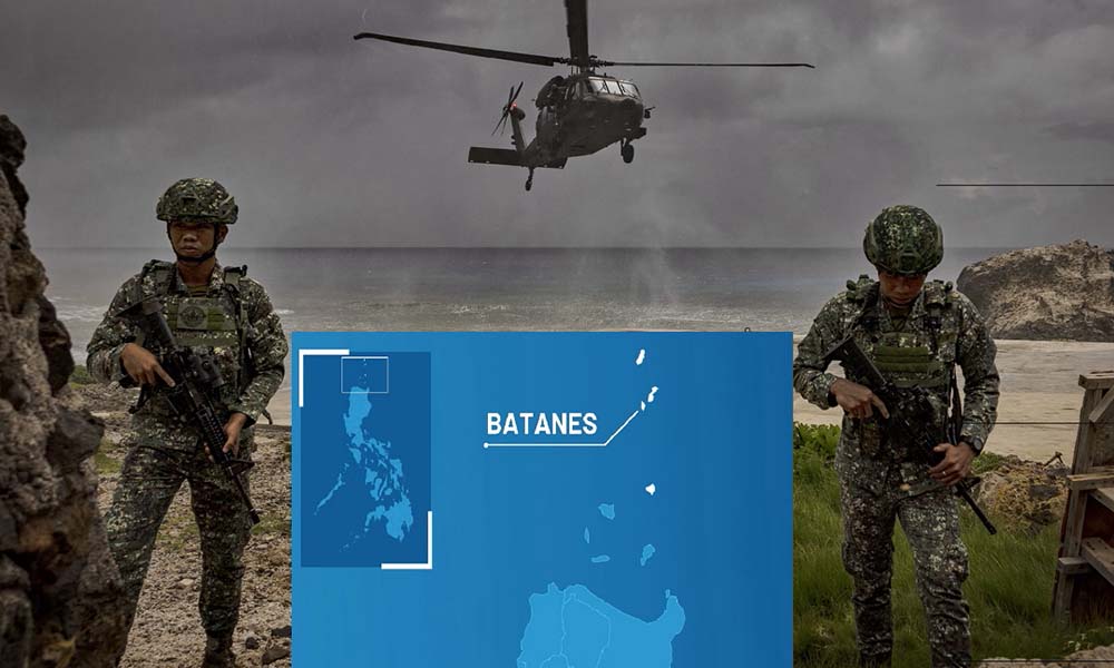
Nowhere is this more apparent than in the waters between Taiwan and the northern Philippines. The Bashi Channel, a narrow passage separating Taiwan from the Philippine province of Batanes, has become one of the most important strategic waterways in the world. Recent American and Philippine military exercises, including deployments of anti-ship missile systems to northern Philippine islands, reflect a growing recognition that control of these waters could prove decisive in any Taiwan contingency. As one former Philippine military chief bluntly told Reuters: “You can’t invade Taiwan if you don’t control the northern Philippines.”
This is why the Philippines matters.
If War Breaks Out Between China and the Philippines, Who Would Support Manila?
Geography simply waits
And the geography of the Philippines has waited for more than a century.
If geography explains why the Philippines matters, then the next question becomes unavoidable:
What exactly is the United States building there?
The official answer is straightforward.
In 2014, Washington and Manila signed the Enhanced Defense Cooperation Agreement, or EDCA. The agreement was never designed to recreate the giant American bases of the Cold War. Instead, it created something far more flexible: a framework allowing U.S. forces to rotate through Philippine military facilities, preposition equipment, construct infrastructure, and conduct joint operations with their Filipino counterparts. Crucially, the agreement explicitly prohibits permanent American military bases on Philippine territory.
For years, EDCA remained limited in scope.
Then geopolitics intervened.
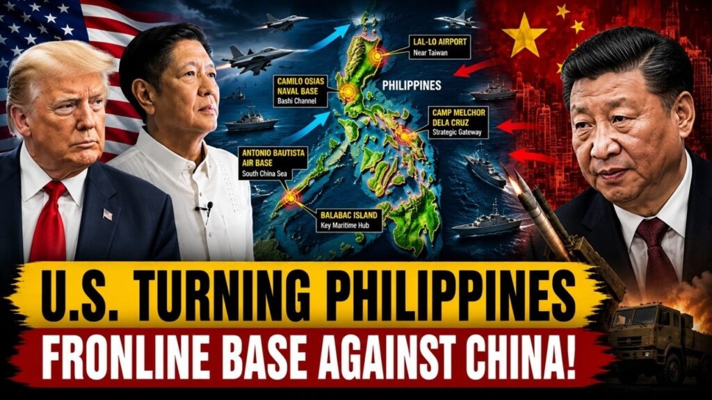
As tensions in both the South China Sea and the Taiwan Strait intensified, the agreement was dramatically expanded in 2023. Today, the United States has access to nine military facilities spread across the Philippine archipelago, creating a strategic network stretching from the South China Sea to the approaches of Taiwan.
Three of these sites occupy positions of enormous importance for any potential Taiwan contingency: Naval Base Camilo Osias in Cagayan, Lal-lo Airport in northern Luzon, and Camp Melchor Dela Cruz in Isabela. All lie within the northern gateway connecting the Philippines to Taiwan and the Western Pacific.
Further south, Balabac Island and Antonio Bautista Air Base sit astride the maritime approaches to the South China Sea, placing them near some of the region’s most contested waters.
Officially, these are not American bases.
remain Philippine military facilities
Strategically, however, they function as something else entirely: nodes in a dispersed American-led military network designed to operate across the First Island Chain, complicate Chinese military planning, and strengthen deterrence across both the South China Sea and the Taiwan Strait.
In other words, Washington is not rebuilding Subic Bay.
It is building a twenty-first century version of strategic presence.
If Washington sees the Philippines as a crucial ally, Beijing increasingly sees it as something else entirely:
A forward operating hub in an emerging American containment network.
Over the past several years, Chinese strategic analysts have increasingly described the expansion of the U.S.-Philippines alliance not as an isolated bilateral relationship, but as part of a broader American strategy of “Integrated Deterrence” — a military and political framework designed to link together the capabilities of the United States, Japan, Australia, and the Philippines into a single strategic architecture.
From Beijing’s perspective, the logic of this network is straightforward.
In the north, American access to bases in northern Luzon strengthens the ability to monitor and potentially constrain Chinese military movements through the Bashi Channel and toward Taiwan. In the south, facilities in Palawan expand surveillance, logistics, and operational reach across the South China Sea. Chinese analysts have increasingly described this emerging posture with a striking phrase:
“Lock Taiwan from the north and control the South China Sea from the south.”
But China’s own strategic assessments also reveal an important paradox.
Chinese analysts recognize that the United States has not rebuilt the permanent military architecture of the Cold War. American forces in the Philippines remain rotational. Investments in EDCA facilities have been more limited than many expected. Several sites continue to face infrastructure and land acquisition challenges. And perhaps most importantly, Washington’s strategy depends heavily on the cooperation and political will of its allies.
This creates a strategic dilemma that even Chinese analysts acknowledge.
The United States appears stronger precisely because it has fewer permanent bases.
Instead of concentrating forces in a handful of vulnerable installations, Washington is constructing a dispersed network of access agreements, rotational deployments, missile systems, logistics hubs, and allied partnerships stretching across the First Island Chain.
In other words, America is not returning to the Philippines to recreate Subic Bay.
It is returning to ensure that, in any future crisis, no single battlefield exists at all.
If the Cold War was defined by massive military bases, then the twenty-first century may be defined by something very different:
Networks.

The United States is no longer attempting to recreate the giant overseas military infrastructure that characterized its global posture during the Cold War. Instead, Washington is building a dispersed system of access agreements, logistics hubs, rotational deployments, missile positions, and allied interoperability designed to complicate an adversary’s military planning before a conflict ever begins.
American strategists call this approach “integrated deterrence.”
Its logic is straightforward. Rather than relying exclusively on American military power, the United States increasingly seeks to combine the capabilities, geography, and political commitments of its allies into a single strategic architecture. In the Indo-Pacific, this network stretches across the United States, Japan, the Philippines, Australia, South Korea, and, increasingly, European partners seeking a greater regional presence.
The military systems accompanying this strategy reflect the same philosophy.
NMESIS anti-ship missile systems, Typhon launchers, HIMARS rocket artillery, unmanned platforms, and distributed maritime denial capabilities are all designed around one central principle: dispersal. Instead of concentrating forces in a few large and vulnerable bases, military power is spread across multiple locations, making it more difficult for an adversary to target and neutralize. In this emerging strategic environment, geography itself becomes a weapon.
As Robert Kaplan might observe, empires once expanded by planting flags.
Twenty-first century powers expand by building networks.
But this strategy creates a profound dilemma for the countries that occupy these networks.
For the Philippines, the benefits are substantial. Closer cooperation with the United States brings enhanced deterrence, accelerated military modernization, access to advanced technologies, stronger alliance guarantees, and greater strategic leverage in dealing with a far more powerful China.
Yet these advantages come with equally significant risks.
The more strategically valuable the Philippines becomes to the United States and its allies, the more exposed it becomes to geopolitical competition. Military facilities may become targets during crises. Economic pressure and gray-zone coercion may intensify. And in the event of a conflict over Taiwan, the Philippines could find itself drawn into a confrontation that it neither initiated nor desired.
This has always been the dilemma facing states located at the intersection of great powers.
Great powers seek strategic depth.
Smaller powers often become that depth.
There is a recurring pattern in the history of great-power competition.
Certain countries do not seek to become frontlines.
They become frontlines because of where they are.
During the Cold War, West Germany found itself positioned at the fault line between the American and Soviet spheres of influence. South Korea became the frontline of ideological and military competition in Northeast Asia. Today, Taiwan occupies perhaps the most dangerous geopolitical position in the world, sitting at the intersection of American maritime power and Chinese national ambition.
And increasingly, the Philippines appears to be joining that list.
This phenomenon is hardly new. More than a century ago, the British geographer Halford Mackinder argued that geography imposes enduring constraints on international politics. Decades later, Nicholas Spykman refined this idea, arguing that control over the maritime rimlands of Eurasia would determine the global balance of power. George Kennan’s strategy of containment during the Cold War was built upon similar assumptions: that geography, alliances, and strategic positioning ultimately shape the international order.
In recent years, Robert D. Kaplan has revived this argument with a simple observation: geography never disappears.
And nowhere is that observation more relevant than in the Philippines.
For decades after the Cold War, the country appeared to occupy the geopolitical periphery. But as strategic competition between the United States and China intensifies, the Philippines is once again becoming what geography always suggested it would become: a frontier state positioned at the edge of competing spheres of power.
Throughout history, maps have repeatedly transformed peripheral states into strategic frontiers.
The Philippines may simply be the latest example.
Because in geopolitics, countries do not always choose their role in history.
Sometimes, geography chooses it for them.
So, is the United States turning the Philippines into a frontline base against China?
The answer depends on how we define a military base.
If a military base means permanent garrisons, sprawling compounds, and the return of Cold War-era installations like Subic Bay, then the answer is no.
But if a military base means a country whose geography, infrastructure, alliances, logistics networks, missile deployments, and strategic calculations have become deeply integrated into the competition between great powers, then the answer becomes far more complicated.
The United States is not recreating Subic Bay.
It is building something far more modern: a flexible network of alliances designed to deter war by shaping geography itself.
The irony, however, is one that history repeatedly teaches us.
The places chosen to prevent great-power wars often become the places where those wars are first fought.
And that may be the greatest geopolitical challenge facing the Philippines in the twenty-first century.
Final Thoughts
The future of the Philippines will depend not only on its alliances but also on how it balances national security, sovereignty, and regional stability. Geography has placed the country at the heart of Indo-Pacific competition, but policy decisions will shape how that role evolves
U.S. Turning the Philippines Into a FRONTLINE Base Against China